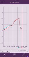
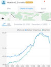
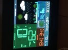
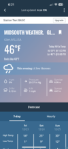
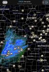
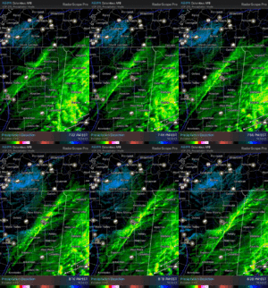
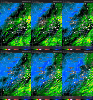
Yep has warmed to 61 here
-
Hello, please take a minute to check out our awesome content, contributed by the wonderful members of our community. We hope you'll add your own thoughts and opinions by making a free account!
You are using an out of date browser. It may not display this or other websites correctly.
You should upgrade or use an alternative browser.
You should upgrade or use an alternative browser.
Wintry December 23-26 2022 Winter Weather and Cold
- Thread starter SD
- Start date
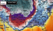
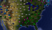
These wind chills are far more impressive than the actual cold itself. Subzero wind chills taking over half the country.


Hourly forecast says you’re leveling off right here but that feels like temp is in the -30’s ?Currently. -10
Coldest real temp I’ve experienced is -17 twice in 3 winters here. Hopefully we can beat that ! View attachment 128233
JLL1973
Member
Fountainguy97
Member
Just got the crawlspace sealed up. Battened down for nearly a 36hr period at or below 0! Strange because it's a balmy 43 right now. doesnt feel like an impending snowstorm is on the way.
Yeah this first little front pushing back through was more impressive than I thought it was gonna be, down to 47 just like that.
Fridays High will be at 12:01 am here tonight. Sitting in upper 30s all day at best with wind wept showers. Fog is entrenching itself now. Finally lost showers and breeze past hour or so.It’s going to be a pretty high RH night and it is very damp outside. Beginning to wonder about a flash freeze, which is absurd to even consider in most of NC but is applicable here.
ChattaVOL
Member
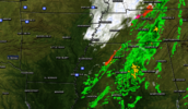
Interesting rain band about to come through Chattanooga… Might be a sign of a little more precip than modeled.
Flotown
Member
keep me updated over here on any snow u see cause ill get what u get a little afterFront about to roll through here in next few minutes. Let’s see how gas the temps drop. 46 now
W
WSW
Guest
Seems like a low amount to issue a WSW....WINTER STORM WARNING IN EFFECT FROM 6 PM THIS EVENING TO 6 AM CST FRIDAY... ...WIND CHILL WARNING REMAINS IN EFFECT FROM 10 PM THIS EVENING TO NOON CST FRIDAY...
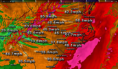
* WHAT...For the Winter Storm Warning, heavy snow expected. Total snow accumulations of up to two inches, with pockets of up to 4 inches. Winds gusting as high as 40 mph. For the Wind Chill Warning, dangerously cold wind chills expected. Wind chills as low as 25 below zero.
DadOfJax
Member
Fits the criteria to issue it, good call by them.Seems like a low amount to issue a WSW.
W
WSW
Guest
Yeah different criteria for different parts of the county I suppose. I think I'm just used to 6+ inches for WSWFits the criteria to issue it, good call by them.
DobsonCityWx
Member
Kinda excited to see a heavy CAD get destroyed by Arctic air. This will be a first for me. Not many things can do that quickly. The fog and light rain is intense tonight.
ChattaVOL
Member
HRRR has underdone the precip v.s. Current radar. Interesting to see how that plays out.
NCHighCountryWX
Member
- Joined
- Dec 28, 2016
- Messages
- 699
- Reaction score
- 1,918
D
Deleted member 609
Guest
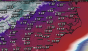
It's a different kind of cold. Snot freezes instantly in your nose when you walk outside. Think I got down to 8 degrees in 2014. Kind of looking forward to it.For those of us east of the apps HRRR has Saturday morning as our coldest which makes sense. Ive only seen single digits with no snow cover once that I can remember
View attachment 128252
I'll be honest I am looking forward to it. Will reassess this about 24 hours from nowIt's a different kind of cold. Snot freezes instantly in your nose when you walk outside. Think I got down to 8 degrees in 2014. Kind of looking forward to it.
D
Deleted member 609
Guest
Yea. It's cool for a few minutes and then you just want to go inside.I'll be honest I am looking forward to it. Will reassess this about 24 hours from now
- Joined
- Jan 23, 2021
- Messages
- 4,602
- Reaction score
- 15,196
- Location
- Lebanon Township, Durham County NC
Looks like real time obs and the HRRR match up pretty good on front timing
StormStalker
Member
My uncle says it’s snowing in Corinth, MS.
Those greens flip so fast on radar along that front. Seems like cold chasing moisture can work out with such a rare airmass. Still no match for the mountains later but pretty gnarly
JLL1973
Member
I lost power 30 seconds into the frontal passage. Been snowing pretty good here last half hour or so
keep me updated over here on any snow u see cause ill get what u get a little after
ChattaVOL
Member
Roads in Memphis are horrible per reports on twitter
D
Deleted member 609
Guest
It's still drizzling outside. Ground is completely wet. Everything should be completely frozen tomorrow unless it dries up overnight.
JLL1973
Member
Yes it is
How was your wind? I’m concerned about losing power here tooI lost power 30 seconds into the frontal passage. Been snowing pretty good here last half hour or so

