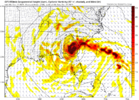
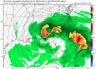
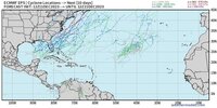
I’ve actually been looking at this one for a couple days now and it’s slightly peaked my interest. If anything came out of this, it would be from about the most marginal set up possible.Little tweaking and we can sneak some fun in between next Sun-Tues. Euro is a little to far off coast and both need some HP help, better timing. The canadian is the quickest with the storm ( starts up Sunday ) and looks like it has some misfit ULL energy trying to get involved. Long shot but it's something to watch. Ill give it a 5% chance for NC right now.


-
Hello, please take a minute to check out our awesome content, contributed by the wonderful members of our community. We hope you'll add your own thoughts and opinions by making a free account!
You are using an out of date browser. It may not display this or other websites correctly.
You should upgrade or use an alternative browser.
You should upgrade or use an alternative browser.
Pattern December 2023
- Thread starter whatalife
- Start date
Did end up with .94 totalWhopping .11 of rain thus far
It might be time to issue a mega frost alert ? ?
? ?
weatherfide
Member
- Joined
- Jan 5, 2017
- Messages
- 3,242
- Reaction score
- 4,821
This one could be a decent rain maker for me. I've been hoping it trends back to the NW for this reason.I’ve actually been looking at this one for a couple days now and it’s slightly peaked my interest. If anything came out of this, it would be from about the most marginal set up possible.
Yeah I think that it would be a good rain maker and would put another series dent in the drought after the rainfall this past weekend. It does look to be quite a dynamic system that could produce its own pocket of cold air to see a small area get some wet snow… especially in the mountains or foothills. The 18z GFS is actually about the perfect track for the corridor from ATL to RDU, but there just isn’t any cold air source close by.This one could be a decent rain maker for me. I've been hoping it trends back to the NW for this reason.
NCSNOW
Member
- Joined
- Dec 2, 2016
- Messages
- 9,582
- Reaction score
- 19,103
Not only is 18z gfs perfect track, it has a 1035mb damming hp sitting over PA to boot. And still turns into a nada burger. Cant draw it any better surface map for frozen. Oh well, good ole super el nino pac flood air.Yeah I think that it would be a good rain maker and would put another series dent in the drought after the rainfall this past weekend. It does look to be quite a dynamic system that could produce its own pocket of cold air to see a small area get some wet snow… especially in the mountains or foothills. The 18z GFS is actually about the perfect track for the corridor from ATL to RDU, but there just isn’t any cold air source close by.
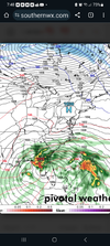
Agreed. If you were going to draw up a perfect surface map for a solid NE GA, SC Upstate, and NC Piedmont snowstorm, that would be it. Honestly it wouldn’t need to be an arctic airmass either to make it work. It just goes to show how much Pacific origin air is coming in this week.Not only is 18z gfs perfect track, it has a 1035mb damming hp sitting over PA to boot. And still turns into a nada burger. Cant draw it any better surface map for frozen. Oh well, good ole super el nino pac flood air.
View attachment 138523
ATLwxfan
Member
Yeah I think that it would be a good rain maker and would put another series dent in the drought after the rainfall this past weekend. It does look to be quite a dynamic system that could produce its own pocket of cold air to see a small area get some wet snow… especially in the mountains or foothills. The 18z GFS is actually about the perfect track for the corridor from ATL to RDU, but there just isn’t any cold air source close by.
Yep. The low track is textbook. There is no cold air to be found. At the end of December the warmth stretches to the northernmost parts of Canada. By the looks of the MJO forecast the Euro’s fantasy of dreamy January is toast.
Sent from my iPhone using Tapatalk
At least we'll get some rain. Hopefully, it'll be a dynamic rainstorm.Yep. The low track is textbook. There is no cold air to be found. At the end of December the warmth stretches to the northernmost parts of Canada. By the looks of the MJO forecast the Euro’s fantasy of dreamy January is toast.
Sent from my iPhone using Tapatalk
We'll eventually get a 2 week period of favorable MJO forcing that will give us a 10 day window to cash in. Probably late Jan or Feb.
The MJO is actually not in the worse position once we get through the next 10 days. It’s low amped now and is headed towards COD and looks like it wants to loop around on the left side of the circle which isn’t worst thing. If we were looking at a high amp phase 5 and 6 that would legitimately give you a reason to punt through the first 3 weeks of January. Other indicies certainly look to be lining up to begin to shuffle the pattern just after Christmas, but like I said earlier, like January 2016 and 2022, it might take a couple weeks to bear some fruit so that some cold air can get built back up in the north.Yep. The low track is textbook. There is no cold air to be found. At the end of December the warmth stretches to the northernmost parts of Canada. By the looks of the MJO forecast the Euro’s fantasy of dreamy January is toast.
Sent from my iPhone using Tapatalk
griteater
Member
The mod/strong/super ninos give us the best chance at seeing good gulf lows like this. I like gulf lows and big -NAOs, but neither guarantee anything of course. Always a balancing act. Need a strong enough Pac jet / STJ jet to get the waves in the southern stream, but if it's too strong, you don't have enough cold air. La Nina gives you a better chance at Arctic blasts, but you still have to time those up with fruitful storm waves...and more SE ridging with La Nina. There's a reason why the wintry climo is so low down here. I tend to think of a normal winter as one accumulating snow (light to heavy) and one mixed event (snow and ice....or ice). Hopefully we can at least have a normal winter this year.Not only is 18z gfs perfect track, it has a 1035mb damming hp sitting over PA to boot. And still turns into a nada burger. Cant draw it any better surface map for frozen. Oh well, good ole super el nino pac flood air.
View attachment 138523
Brent
Member
NCSNOW
Member
- Joined
- Dec 2, 2016
- Messages
- 9,582
- Reaction score
- 19,103
Models catch onto storms well in advance during el ninos. Euro had this past weekend pegged from 9 days out. All 3 onto this one. Its a slow mover ull hangs out in Tx panhandle mid week. Then gets in gulf weekend and deepens. I-10 gonna flood
GoDuke
Member
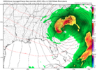
dang that’s beautiful and won’t have a damn thing to show for it. What a waste.View attachment 138527
966 on the CMC
accu35
Member
- Joined
- Jan 5, 2017
- Messages
- 8,431
- Reaction score
- 9,932
Not really a waste for folks who need the rain.dang that’s beautiful and won’t have a damn thing to show for it. What a waste.

