WXinCanton
Member
I was around 2.5. I'll take it.3.1" in the gauge from this event.
I was around 2.5. I'll take it.3.1" in the gauge from this event.
No shut-out for you this year.any idea what this white stuff is? Never seen it before View attachment 138508
Yeah. Good frost …any idea what this white stuff is? Never seen it before View attachment 138508
Awesome. Looks like Wintergreen got over 6 inches.any idea what this white stuff is? Never seen it before View attachment 138508
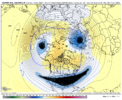
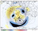
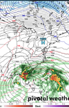
People forget it's the opposite of La Nina. We're not trying to make our winter before the king holiday.When the big GOAK trough shuffles back to the Aleutians and we raise heights in AK, that’s when I’m sure winter storm prospects will appear. Just gotta wait, gotta have patience, we’re following a typical strong Nino progression, there not known for being good early on View attachment 138512View attachment 138513View attachment 138511
Yep you can already see the wheels in motion at the end of the gefs run. Hopefully the eps has this as wellWhen the big GOAK trough shuffles back to the Aleutians and we raise heights in AK, that’s when I’m sure winter storm prospects will appear. Just gotta wait, gotta have patience, we’re following a typical strong Nino progression, there not known for being good early on View attachment 138512View attachment 138513View attachment 138511
When the big GOAK trough shuffles back to the Aleutians and we raise heights in AK, that’s when I’m sure winter storm prospects will appear. Just gotta wait, gotta have patience, we’re following a typical strong Nino progression, there not known for being good early on View attachment 138512View attachment 138513View attachment 138511
 on the maps.
Agreed, going to be some happy people soon!When the big GOAK trough shuffles back to the Aleutians and we raise heights in AK, that’s when I’m sure winter storm prospects will appear. Just gotta wait, gotta have patience, we’re following a typical strong Nino progression, there not known for being good early on View attachment 138512View attachment 138513View attachment 138511


Now you have to do one for right now. I would have to assume it involves a middle finger in some regard.
Even though it was a La Niña, It’s very similar to December 2021 when things were so warm especially the last 10 days of the month… I don’t think Charlotte fell below 60 for four or five days leading into New Year’s. However, you could see the signs fairly evident that a good pattern was coming.When the big GOAK trough shuffles back to the Aleutians and we raise heights in AK, that’s when I’m sure winter storm prospects will appear. Just gotta wait, gotta have patience, we’re following a typical strong Nino progression, there not known for being good early on View attachment 138512View attachment 138513View attachment 138511


