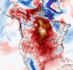
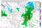
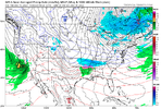
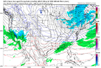
Nitetorch ftw!6th straight morning in the 20s much different than seeing my Bermuda greening back up before Christmas the last few years
-
Hello, please take a minute to check out our awesome content, contributed by the wonderful members of our community. We hope you'll add your own thoughts and opinions by making a free account!
You are using an out of date browser. It may not display this or other websites correctly.
You should upgrade or use an alternative browser.
You should upgrade or use an alternative browser.
Pattern December 2023
- Thread starter whatalife
- Start date
I’ll take this weather. Constant freezes and 50s for highs. Perfect for working around the house.6th straight morning in the 20s much different than seeing my Bermuda greening back up before Christmas the last few years
Didn’t Concord see snow on Christmas Day in 2010? Not arguing but I remember snow on the ground Christmas Day!Most recent White Christmas spatial map for NC.
Some areas along the US HWY 1 corridor and towards the Triangle area have been waiting nearly a century for one.
2010 was close but no cigar for most areas SE of I-85
View attachment 138658
I don't get this map. It snowed here on Christmas night in 2010. Wouldn't that be considered a white Christmas?Most recent White Christmas spatial map for NC.
Some areas along the US HWY 1 corridor and towards the Triangle area have been waiting nearly a century for one.
2010 was close but no cigar for most areas SE of I-85
View attachment 138658
I'll take it.Hoping for crumbs:
RAH:
A cold front will push SE through the area Monday evening. At the
same time, a potent clipper like upper PV anomaly diving SE thru the
region may provide it`s own sufficient fleeting saturation by means
of strong dynamical lifting to support some scattered rain showers,
and perhaps even some flurries or a quick passing snow shower if the
snowflake can overcome a dry sub cloud layer. Lows 25-30.
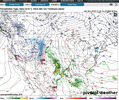
6z NAM:
View attachment 138669
Stormsfury
Member
If it stuck to 1", yes that would qualify.I don't get this map. It snowed here on Christmas night in 2010. Wouldn't that be considered a white Christmas?
Drizzle Snizzle
Member
I don't see anyone west of I-75 getting 1" of rain out of this in GA.
dsaur
Member
Well, I don't see this very often. Rain coming toward me from the Atlantic. Rain coming up from Fla and a front coming in from the west. All at the same time. Now all I need is a clipper.
Webberweather53
Meteorologist
I don't get this map. It snowed here on Christmas night in 2010. Wouldn't that be considered a white Christmas?
Snow occurred after local midnight on December 26th over the Triangle area. Closer to Charlotte, I think there's reason to believe the NWS RAH analysis that I based this on is incorrect.
Jrips2710
Member
The weather in this App State-Miami OH bowl game in Orlando is hilarious. Absolutely monsooning. 7 fumbles in the first half
App State should have went for the two field goals...The weather in this App State-Miami OH bowl game in Orlando is hilarious. Absolutely monsooning. 7 fumbles in the first half
If you wonder how they have 4 losses this season, all on the last play of the game. There you have it!App State should have went for the two field goals...
Yeah I think it is. I was in Concord on Christmas Day 2010 until about 7:30 at my parent’s house, only a couple miles from Concord Regional Airport. When we left, there was already about 1” on the ground and it was really starting to pick up. At my house in Wingate, we basically watched the changeover happen as we were pulling into the driveway about 8:30… it snowed light but steady the rest of the evening enough to have a little over .5” before midnight. I ended getting dumped on for a few hours later that night into the early morning from the deformation band as the coastal low started cranking up.Snow occurred after local midnight on December 26th over the Triangle area. Closer to Charlotte, I think there's reason to believe the NWS RAH analysis that I based this on is incorrect.
gawxnative
Member
Just from the "quick look" of this and not delving into it, I have a bit on concern as to the look of "training cells" on here. May need to look at hints of severe in Dixie.Shetley with back to back flood storms to help his desert ? View attachment 138686
That’s a strong high, very cold look, low bombing in NE acting as a 50/50 low , almost a Jan 88 look, details to be ironed out, if it doesn’t go poof at 0zHappy New Year from the GFS! And it’s not even 400 hours out! View attachment 138688
Has the looks of something that will fizzle out in the next frame.Happy New Year from the GFS! And it’s not even 400 hours out! View attachment 138688
Last edited:
I’m just not smart enough to know why it fizzles out. Someone please tell me why.Dang Stevo you have this figured out now
View attachment 138692
If I had to take a guess that big low along the Maine and Canada border is just sitting there and it kinda squashes things to the south. Move that about 200-300 miles NE and let that 1041 high move in tandem with that shortwave and you have a really good Southern Slider overrunning set up.I’m just not smart enough to know why it fizzles out. Someone please tell me why.
Right where we want it at day 12!I’m just not smart enough to know why it fizzles out. Someone please tell me why.
Dry subcloud layer, lack of forcing, no moisture fluxI’m just not smart enough to know why it fizzles out. Someone please tell me why.
Let's gooooo!!! Lol


Brent
Member
I'm dreaming of a wet Christmas. Oh well we're still way behind on rainfall it's not the worst thing ever
NoSnowATL
Member
Enjoy your 67 and sunny weather.I'm dreaming of a wet Christmas. Oh well we're still way behind on rainfall it's not the worst thing ever
Cary_Snow95
Member
Week of Christmas looking warm and rainy. Hopefully we can get a more consolidated piece of energy and push it all thru at once rather than a whole week of clouds
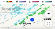
Nice thump of snow this afternoon in NW NC. Boone, ski slope areas etc.
SWVAwxfan
Member
Had a pretty good snow squall lay a quick coating here.
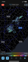
Its more than a sprinkle. Melting flake into a sprinkle i can confirm. Think my face had 4 hits in 60 seconds out with dog. So few between, floodlight cant give me a register
SWVAwxfan
Member
Just got a special weather statement for a line of snow and 40 mph winds fixing to move through
Power is out spots in my county. Wind is ripping.
Iceland volcano finally erupted
Iceland volcano finally erupted
Lowest temp in the calendar year imby is 20.3 I think tonight can beat it.
SWVAwxfan
Member
The snow aspect of this storm certainly overperformed in this area. Roads were very slick and icy this am. Numerous calls for wrecks. Montgomery county closed all schools today. And we didn't even have a winter weather advisory.
J1C1111
Member
That was a big win in your area. It's usually the other way around these days when you get a winter weather advisory and get close to nada. I miss those days when you wouldn't be under a advisory and still get a dusting to a 1/2 at times like you got last night.The snow aspect of this storm certainly overperformed in this area. Roads were very slick and icy this am. Numerous calls for wrecks. Montgomery county closed all schools today. And we didn't even have a winter weather advisory.

