Jinx
-
Hello, please take a minute to check out our awesome content, contributed by the wonderful members of our community. We hope you'll add your own thoughts and opinions by making a free account!
You are using an out of date browser. It may not display this or other websites correctly.
You should upgrade or use an alternative browser.
You should upgrade or use an alternative browser.
Wintry Dec 21-22 street light 18z nam fantasy probably not happening but starting the thread anyway storm
- Thread starter SD
- Start date
Probably will be the thread ever. ???
The most whacked up thread title I ever seen
Greatest thread title ever!!!!
Oconeexman
Member
- Joined
- Jan 2, 2017
- Messages
- 895
- Reaction score
- 2,304
B
W
A
Could we have one of those patented SE creeper storms?
W
A
Could we have one of those patented SE creeper storms?
Attachments
Darklordsuperstorm
Member
I had to look it up, but if you remember the 2/6-2/7 2021 event kinda started showing up in the short range models like this. Not really any signs of it, until the NAM and especially the HRRR started picking up on it.
Oconeexman
Member
- Joined
- Jan 2, 2017
- Messages
- 895
- Reaction score
- 2,304
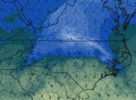
Credit to burrel..he mentioned this one a week ago...it may be our best shotIt's showing on Hrrr already...View attachment 127478
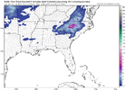
From the NAM(s), it looks like either rain or snow. Tracking model trends for surface temps / dew points will be important but the most important item will be the upper air temps.
Here's the 3K NAM 850 temps at hour 60:

Lets see if we can trend the freezing line south a little the next few runs. **Maybe get a small (in-situ) high to pop up just north of us...
Here's the 3K NAM 850 temps at hour 60:

Lets see if we can trend the freezing line south a little the next few runs. **Maybe get a small (in-situ) high to pop up just north of us...
Well well what’s this a Christmas miracle or a Christmas illusion.Credit to burrel..he mentioned this one a week ago...it may be our best shot
Correct me if I’m wrong but isn’t the NAM usually right in this range?
Oconeexman
Member
- Joined
- Jan 2, 2017
- Messages
- 895
- Reaction score
- 2,304
It does well in theses situations inside 60hrs..so yea it has a decent track record with light moisture fetch over running and picking up on the cold air advection. If it's still showing tomorrow at 12z we in bisiness...fingers crossedCorrect me if I’m wrong but isn’t the NAM usually right in this range?
What time does 12z come out tomorrow?It does well in theses situations inside 60hrs..so yea it has a decent track record with light moisture fetch over running and picking up on the cold air advection. If it's still showing tomorrow at 12z we in bisiness...fingers crossed
Cad Wedge NC
Member
10:30 am for GFS earlier for the NAMWhat time does 12z come out tomorrow?
I've seen little systems overperform in these situations. Got a good 3in snow from one in 2014 I believe. Nam was the only one bringing precip NW into the foothills. GSP didn't bite till two inches were on the ground. So fingers crossed this is an overperformer.
0z HRRRRRRR is now running. It goes out to 48 hours. Lets see if it matches with the 6z NAM. **man this is depressing putting my hopes in this low odds (small) event. But it is what it is...
According to most on this page, they are all low odds lol.0z HRRRRRRR is now running. It goes out to 48 hours. Lets see if it matches with the 6z NAM. **man this is depressing putting my hopes in this low odds (small) event. But it is what it is...
Banter useless posting still applies in this thread as well, just fyi


