BULLETIN
Tropical Storm Bertha Advisory Number 13
NWS National Hurricane Center Miami FL AL022026
1000 AM CDT Wed Jul 22 2026
...CENTER OF BERTHA WOBBLING SOUTH OF THE MISSISSIPPI COAST...
...TROPICAL STORM CONDITIONS EXPECTED WITHIN THE WARNING AREA
THROUGH TONIGHT...
SUMMARY OF 1000 AM CDT...1500 UTC...INFORMATION
-----------------------------------------------
LOCATION...29.8N 88.6W
ABOUT 40 MI...65 KM S OF PASCAGOULA MISSISSIPPI
ABOUT 55 MI...90 KM NNE OF THE MOUTH OF THE MISSISSIPPI RIVER
MAXIMUM SUSTAINED WINDS...50 MPH...85 KM/H
PRESENT MOVEMENT...WNW OR 290 DEGREES AT 6 MPH...9 KM/H
MINIMUM CENTRAL PRESSURE...998 MB...29.47 INCHES
Tropical Storm Bertha Discussion Number 13
NWS National Hurricane Center Miami FL AL022026
1000 AM CDT Wed Jul 22 2026
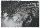
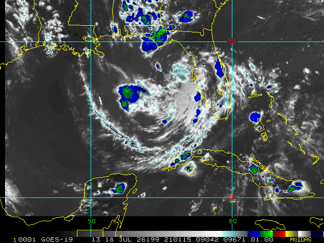
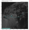
Bertha's satellite presentation has continued to degrade this
morning, with all of the associated deep convection having been
pushed well to the southwest of the exposed surface center due to
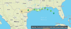
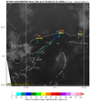
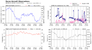
strong deep-layer shear. That said, dropsonde data from NOAA and
Air Force Reserve Hurricane Hunter aircraft indicate that the
central pressure has changed very little from the previous
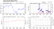
advisory. The NOAA aircraft measured a peak 750-mb flight-level
wind of 55 kt several hours ago, which equates to an initial
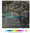
intensity of 45 kt. More recent aircraft data suggest those winds
may have decreased, but for now we'll continue to hold 45 kt in
anticipation of additional aircraft and scatterometer data over the
next few hours.
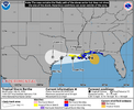
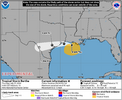
Bertha's center has been deviating a bit north of the forecast
track, and the current motion estimate is now 290/5 kt. Track model
guidance insists that Bertha should resume a westward motion today,
but wobbles and deviations like the current one are normal behavior
for such a highly sheared tropical cyclone. Once a westward motion
resumes, Bertha's center is likely to straddle the coast of
Louisiana through Thursday and then reach the upper Texas coast by
Thursday evening or night. The NHC track forecast lies along the
northern edge of the guidance suite, partially to account for the
recent northward jog and partially to closely follow the typically
reliable HCCA and GDMI guidance.
The expected weakening appears to be on the verge of starting, and
the main question for the forecast is how quickly will Bertha lose
intensity. Part of that equation is how much time the center will
spend over land, while the system also continues to contend with
strong northeasterly shear. The NHC intensity forecast maintains
Bertha as a minimal tropical storm through 36 hours (around the
time of a potential Texas landfall), but it's also possible that
the cyclone could weaken to a depression or remnant low by that
time. Like the track forecast, the intensity forecast is largely a
blend of the latest HCCA and GDMI guidance. A remnant low forecast
point is shown over Texas at 48 hours for continuity's sake, but
Bertha could have dissipated by that time.
FORECAST POSITIONS AND MAX WINDS
INIT 22/1500Z 29.8N 88.6W 45 KT 50 MPH
12H 23/0000Z 29.6N 90.3W 40 KT 45 MPH...INLAND
24H 23/1200Z 29.5N 92.7W 35 KT 40 MPH...OVER WATER
36H 24/0000Z 29.4N 95.5W 35 KT 40 MPH...INLAND
48H 24/1200Z 29.0N 98.7W 25 KT 30 MPH...POST-TROP/REMNT LOW
60H 25/0000Z...DISSIPATED
$$
Forecaster Berg