• Hello, please take a minute to check out our awesome content, contributed by the wonderful members of our community. We hope you'll add your own thoughts and opinions by making a free account!

Tropical Bertha

BULLETIN
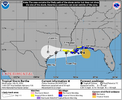
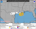
Tropical Storm Bertha Advisory Number 7
NWS National Hurricane Center Miami FL AL022026
1000 PM CDT Mon Jul 20 2026

...TROPICAL STORM WARNING ISSUED FOR A PORTION OF THE NORTHERN
GULF COAST...


SUMMARY OF 1000 PM CDT...0300 UTC...INFORMATION
-----------------------------------------------
LOCATION...28.2N 85.9W
ABOUT 140 MI...225 KM S OF PANAMA CITY FLORIDA
ABOUT 215 MI...350 KM SE OF MOBILE ALABAMA
MAXIMUM SUSTAINED WINDS...40 MPH...65 KM/H
PRESENT MOVEMENT...STATIONARY
MINIMUM CENTRAL PRESSURE...999 MB...29.50 INCHES


WATCHES AND WARNINGS
--------------------
CHANGES WITH THIS ADVISORY:

A Tropical Storm Warning has been issued for the Alabama/Florida
border to the Jefferson/Plaquemines Parish border in Louisiana

A Tropical Storm Watch has been issued for west of the
Jefferson/Plaquemines Parish border to Morgan City, Louisiana.

A Tropical Storm Watch has also been issued for Metropolitan New
Orleans, Lake Pontchartrain, and Lake Maurepas.

The Tropical Storm Watch east of the Bay/Gulf County Florida line
has been discontinued.


Tropical Storm Bertha Discussion Number 7
NWS National Hurricane Center Miami FL AL022026
1000 PM CDT Mon Jul 20 2026

The system has become a little better organized with an area of deep
convection over the southern semicircle showing slight curvature and
limited curved convective bands over the northwestern quadrant.
Flight-level winds from both NOAA and Air Force Hurricane Hunter
aircraft within the convection to the southwest and southeast of the
center indicate that the intensity is near 35 kt, so the system has
been upgraded to Tropical Storm Bertha. The aircraft also reported
that the central pressure has dropped about 6 mb since this
afternoon. The storm has well-defined upper-level outflow to the
south and southwest, but outflow is limited over the northern
semicircle.

There have been several center fixes from the aircraft which
indicate very slow, erratic motion. Since the storm has moved
very little overall this evening, the best estimate for the initial
motion is nearly stationary. Bertha remains sandwiched between two
mid-level subtropical high cells, in a region of weak steering
currents. The high to the northwest of the storm is forecast to
become the dominant steering influence which should induce a
west-northwestward or westward motion over the next few days. The
official track forecast is similar to the previous NHC prediction,
on the southern side of the guidance suite and close to the Google
DeepMind ensemble mean.

Bertha is being affected by significant north-northeasterly vertical
wind shear. Dynamical guidance indicates that this shear will
increase during the next couple of days. This should limit
intensification of the storm before the center reaches the coast.
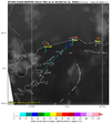
Simulated satellite imagery from the global models shows the deep
convection near or offshore of the coastline, likely due to the
shear. Unfavorable atmospheric conditions along with the
interaction of land should prevent strengthening late in the
forecast period. The official intensity forecast is on the high
side of the model guidance.

FORECAST POSITIONS AND MAX WINDS

INIT 21/0300Z 28.2N 85.9W 35 KT 40 MPH
12H 21/1200Z 28.8N 86.6W 40 KT 45 MPH
24H 22/0000Z 29.1N 87.3W 45 KT 50 MPH
36H 22/1200Z 29.3N 88.1W 45 KT 50 MPH
48H 23/0000Z 29.3N 89.4W 40 KT 45 MPH...INLAND
60H 23/1200Z 29.3N 90.7W 35 KT 40 MPH...INLAND
72H 24/0000Z 29.3N 92.1W 30 KT 35 MPH...OVER WATER
96H 25/0000Z 29.3N 94.6W 25 KT 30 MPH...OVER WATER
120H 26/0000Z 29.3N 97.0W 20 KT 25 MPH...POST-TROPICAL

$$
Forecaster Pasch
 
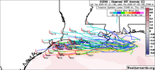
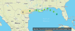
0Z UKMET: significantly stronger than last few runs and not as far N track allowing it to avoid LA for the most part and actually landfall just S of Galveston as TS, where Joe Bastardi said he may be hanging out:

GLOBAL MODEL DATA TIME 0000UTC 21.07.2026

TROPICAL STORM BERTHA ANALYSED POSITION : 28.5N 86.2W

ATCF IDENTIFIER : AL022026

LEAD CENTRAL MAXIMUM WIND
VERIFYING TIME TIME POSITION PRESSURE (MB) SPEED (KNOTS)
-------------- ---- -------- ------------- -------------
0000UTC 21.07.2026 0 28.5N 86.2W 1005 32
1200UTC 21.07.2026 12 28.7N 86.4W 1001 42
0000UTC 22.07.2026 24 29.3N 87.1W 1001 37
1200UTC 22.07.2026 36 29.4N 87.6W 1002 37
0000UTC 23.07.2026 48 28.9N 89.0W 1002 42
1200UTC 23.07.2026 60 29.0N 90.3W 1004 37
0000UTC 24.07.2026 72 28.5N 92.6W 1000 40
1200UTC 24.07.2026 84 29.1N 94.9W 1006 38
0000UTC 25.07.2026 96 CEASED TRACKING
 
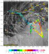
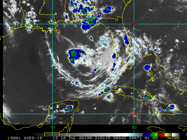
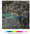
Look closely and the cursor is where center of circulation is. All the convection is being blown off omto its southernside still.


1784629858496.jpeg
 
Its actually strengthened overnight somehow but yeah the dry air and shear is definitely keeping most of it offshore

Pressure down to 997 MB at 7am

Indeed:

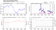
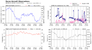
Peak Flight-Level Winds: 62kt at 11:55z

NHC 5AM EDT forecast had it at 50 knots as of 2PM EDT. It appears to already be about that strong at the approximated surface level.
 
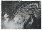
The windfield has tightened up substantially even in the face of dry air and northeast shear. Bertha is firing off some deep convection near and over the COC again. It'll be interesting to see if it can sustain this convection over the COC throughout the day. Doubtful given the shear and nearby dry air, but who knows?
1784641552603.png
 
12Z UKMET is, of course, stronger due to a stronger initialization. This, like the 0Z, only skirts LA and like that one comes in just SW of Galveston hours 57-60 while highest winds are 45 knots/solid TS:

MET OFFICE TROPICAL CYCLONE GUIDANCE FOR NORTH-EAST PACIFIC AND ATLANTIC

GLOBAL MODEL DATA TIME 1200UTC 21.07.2026

TROPICAL STORM BERTHA ANALYSED POSITION : 28.8N 85.9W

ATCF IDENTIFIER : AL022026

LEAD CENTRAL MAXIMUM WIND
VERIFYING TIME TIME POSITION PRESSURE (MB) SPEED (KNOTS)
-------------- ---- -------- ------------- -------------
1200UTC 21.07.2026 0 28.8N 85.9W 997 52
0000UTC 22.07.2026 12 29.3N 87.4W 996 43
1200UTC 22.07.2026 24 29.4N 88.3W 996 41
0000UTC 23.07.2026 36 29.2N 89.8W 995 40
1200UTC 23.07.2026 48 29.1N 92.1W 995 47
0000UTC 24.07.2026 60 29.0N 95.1W 997 45
1200UTC 24.07.2026 72 27.9N 98.2W 1003 29
0000UTC 25.07.2026 84 CEASED TRACKING
 
KMOB_loop.gif
 
6Z UKMET: weaker than 0Z’s 999 mb with 1005 mb when near GLV (hour 39). Most of rainfall S of GLV, where <1” falls, and Houston, where <0.5” falls. Peak of ~4” Matagorda Bay.
 
BULLETIN
Tropical Storm Bertha Advisory Number 13
NWS National Hurricane Center Miami FL AL022026
1000 AM CDT Wed Jul 22 2026

...CENTER OF BERTHA WOBBLING SOUTH OF THE MISSISSIPPI COAST...
...TROPICAL STORM CONDITIONS EXPECTED WITHIN THE WARNING AREA
THROUGH TONIGHT...


SUMMARY OF 1000 AM CDT...1500 UTC...INFORMATION
-----------------------------------------------
LOCATION...29.8N 88.6W
ABOUT 40 MI...65 KM S OF PASCAGOULA MISSISSIPPI
ABOUT 55 MI...90 KM NNE OF THE MOUTH OF THE MISSISSIPPI RIVER
MAXIMUM SUSTAINED WINDS...50 MPH...85 KM/H
PRESENT MOVEMENT...WNW OR 290 DEGREES AT 6 MPH...9 KM/H
MINIMUM CENTRAL PRESSURE...998 MB...29.47 INCHES


Tropical Storm Bertha Discussion Number 13
NWS National Hurricane Center Miami FL AL022026
1000 AM CDT Wed Jul 22 2026

Bertha's satellite presentation has continued to degrade this
morning, with all of the associated deep convection having been
pushed well to the southwest of the exposed surface center due to
strong deep-layer shear. That said, dropsonde data from NOAA and
Air Force Reserve Hurricane Hunter aircraft indicate that the
central pressure has changed very little from the previous
advisory. The NOAA aircraft measured a peak 750-mb flight-level
wind of 55 kt several hours ago, which equates to an initial
intensity of 45 kt. More recent aircraft data suggest those winds
may have decreased, but for now we'll continue to hold 45 kt in
anticipation of additional aircraft and scatterometer data over the
next few hours.

Bertha's center has been deviating a bit north of the forecast
track, and the current motion estimate is now 290/5 kt. Track model
guidance insists that Bertha should resume a westward motion today,
but wobbles and deviations like the current one are normal behavior
for such a highly sheared tropical cyclone. Once a westward motion
resumes, Bertha's center is likely to straddle the coast of
Louisiana through Thursday and then reach the upper Texas coast by
Thursday evening or night. The NHC track forecast lies along the
northern edge of the guidance suite, partially to account for the
recent northward jog and partially to closely follow the typically
reliable HCCA and GDMI guidance.

The expected weakening appears to be on the verge of starting, and
the main question for the forecast is how quickly will Bertha lose
intensity. Part of that equation is how much time the center will
spend over land, while the system also continues to contend with
strong northeasterly shear. The NHC intensity forecast maintains
Bertha as a minimal tropical storm through 36 hours (around the
time of a potential Texas landfall), but it's also possible that
the cyclone could weaken to a depression or remnant low by that
time. Like the track forecast, the intensity forecast is largely a
blend of the latest HCCA and GDMI guidance. A remnant low forecast
point is shown over Texas at 48 hours for continuity's sake, but
Bertha could have dissipated by that time.
FORECAST POSITIONS AND MAX WINDS

INIT 22/1500Z 29.8N 88.6W 45 KT 50 MPH
12H 23/0000Z 29.6N 90.3W 40 KT 45 MPH...INLAND
24H 23/1200Z 29.5N 92.7W 35 KT 40 MPH...OVER WATER
36H 24/0000Z 29.4N 95.5W 35 KT 40 MPH...INLAND
48H 24/1200Z 29.0N 98.7W 25 KT 30 MPH...POST-TROP/REMNT LOW
60H 25/0000Z...DISSIPATED

$$
Forecaster Berg
 
Got an official landfall at 45mph as of 3pm EST:

453
WTNT62 KNHC 221901
TCUAT2

Tropical Storm Bertha Tropical Cyclone Update
NWS National Hurricane Center Miami FL AL022026
200 PM CDT Wed Jul 22 2026

...TROPICAL STORM BERTHA MAKES LANDFALL IN ST. BERNARD PARISH,
LOUISIANA...

Satellite images indicate that the center of Tropical Storm Bertha
has made landfall near the Biloxi Wildlife Management Area in St.
Bernard Parish, Louisiana. The maximum sustained winds are estimated
to be 45 mph (75 km/h) with higher gusts.


SUMMARY OF 200 PM CDT...1900 UTC...INFORMATION
---------------------------------------------------
LOCATION...29.9N 89.4W
ABOUT 45 MI...70 KM SW OF BILOXI MISSISSIPPI
ABOUT 40 MI...65 KM E OF NEW ORLEANS LOUISIANA
MAXIMUM SUSTAINED WINDS...45 MPH...75 KM/H
PRESENT MOVEMENT...WNW OR 295 DEGREES AT 7 MPH...11 KM/H
MINIMUM CENTRAL PRESSURE...1000 MB...29.53 INCHES
 
Back
Top