• Hello, please take a minute to check out our awesome content, contributed by the wonderful members of our community. We hope you'll add your own thoughts and opinions by making a free account!

Pattern August is the worst month of the year and it's not even close thread

2 EQ @ 2.0 this past weekend: Saturday near Canton NC , Sun in Weaverville NC.

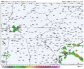
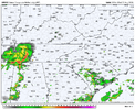
Big difference on Thurs and Fri wx . Am Models/Raleigh NWS say chance Thursday and out of picture Friday:

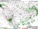
Euro and Ukmet at 0z Say Friday Football in trouble with storms in abundance 18z through 0z Sat.

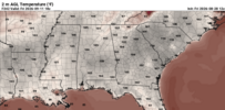
Labor day weekend Euro says the chicken aint gonna be the only thing frying. GFS says grab a sweater.
 
sub80 high temps in august at KGSP since 2017
2017 - 3
2018 - 0
2019 - 3
2020 - 1
2021 - 1
2022 - 3
2023 - 2
2024 - 2
2025 - 13 (including two days with a maxT<avg minT for the date)
2026 - 0 (with only 1 sub85 high, through 8/24)
 
sub80 high temps in august at KGSP since 2017
2017 - 3
2018 - 0
2019 - 3
2020 - 1
2021 - 1
2022 - 3
2023 - 2
2024 - 2
2025 - 13 (including two days with a maxT<avg minT for the date)
2026 - 0 (with only 1 sub85 high, through 8/24)

what about sub 80 high temps in September at KGSP since 2017?
2017 - 8
2018 - 3
2019 - 3 (with an incredible 23 90F+ highs, including 12 straight from the 2nd to the 13th)
2020 - 15
2021 - 7
2022 - 8
2023 - 8
2024 - 12
2025 - 12

Obviously the humidity decrease plays a big part in the comfort of September, but I am always a little disappointed at how warm of a month it can be
 
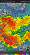
A severe thunderstorm went over my home ~3:10-25PM per radar. I’m out of town and thus couldn’t witness it.

I think this is the first sig. rain there in a good while.

Edit 8/25: Per Cocorahs and radar, I’m roughly estimating my home got 0.4” afternoon of 8/24.
 
Last edited:
Wasn't too bad outside overall today since the humidity had disappeared. Seems like there's a good shot the wet weather holds down the temps a bit later this week, but there doesn't seem like there's a real breakthrough switch to fall moment coming anytime soon.
 
Today was the 2nd afternoon in a row that my home had a severe thunderstorm warning. The heaviest was mainly 5-6 PM. Per radar my place likely got a really good dousing, but I’m out of town. I’ll check Cocorahs and other things later to get an estimate on the rainfall.

*Edit: After considering radar loops and 1.99” at Hunter, the best I can do is to very roughly estimate my home’s total at 1.5”.
 
Last edited:
I didn’t see the radar loop yesterday (8/26) for my area. However, based on radar based rainfall estimates shown by local TV websites and considering Hunter’s 1.27”, I’m roughly estimating my home got a 2nd day in a row of a good hit yesterday with 0.75” (for 8/26). I’m not there to see a measurement. I already very roughly estimated 1.5” the day before (for 8/25).

That puts my place at ~~7.25” MTD, a very beneficial wetter than normal being there’s still a moderate drought there lingering per the latest Drought Monitor.
 
Was at my parents those evening and it absolutely poured in eastern Harnett County. Saw some cool fast moving clouds in Aberdeen heading south towards Rockingham. Pretty steady rain from the race track/drag strip towards downtown Rockingham.
 

Attachments

  • IMG_1257.jpeg
    3.4 MB · Views: 22
  • IMG_1258.jpeg
    3.5 MB · Views: 18
  • IMG_1258.jpeg
    3.5 MB · Views: 16
  • IMG_1257.jpeg
    3.4 MB · Views: 21
Was at my parents those evening and it absolutely poured in eastern Harnett County. Saw some cool fast moving clouds in Aberdeen heading south towards Rockingham. Pretty steady rain from the race track/drag strip towards downtown Rockingham.
We picked up 10+inch per hour, totaling 3.24 inches of rain!
 
1. Based on Corcorahs and radar yesterday, I roughly estimate 0.1” fell at my home yesterday (8/27) thus bringing my location at 7.35” mtd through 8/27.

2. More rain has fallen and is still falling there today. I’ll have to roughly estimate later how much for 8/28.

Edit: my rough estimate for 8/28 at my home is 0.5” based largely on local TV radar estimates. That puts me at ~7.85” MTD.
 
Last edited:
Very intense thunderstorm here in Lenoir, the winds were insane. Luckily power still on but won’t be surprised if we see some outages.
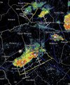
It skipped over me in Glen Alpine but they have gotten nasty just down the road in Morganton. Continuous thunder.
 
0.4” or so. Should get past a half inch looking at radar. Over 5” for the month, and down to 71F
 
Closing out the month here in Unionville which is in Union county - we just call it Monroe. Yes - we have had almost 20" of rain in the last 37 days (I know - I know). We are now short 4" for the year on average precip - which is quite the comeback.

7.17" for the month (so far)
12.41" since July 24th (the night where it all started to change)
 
Back
Top