Shaggy
Member
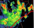
Seems my luck of just being outside the big rains will continue in August. Kinda glad this time. Lightning has been crazy

RadarScope's maps are like 15 years outdated. It's almost unusable where I am. They don't even have Charlottes outer loop.Seems my luck of just being outside the big rains will continue in August. Kinda glad this time. Lightning has been crazy
View attachment 149172
That looks a lot like the storm that came through here Tuesday evening. It had the worst lightning I have seen in several years, but thankfully most if it was about 1-2 miles away.Seems my luck of just being outside the big rains will continue in August. Kinda glad this time. Lightning has been crazy
View attachment 149172

That’s not bad at all for early August88.2/67.8 HI: 92
It could be worse here, still warm though.
Thunderstorms already popping up all around this area. This is much earlier than most days of recent weeks. Been hearing thunder the last 15 minutes or so. Will it rain? So far it has been hit and miss pop ups and so that remains to be seen. The NWS has only 20% chances.
Also, the dewpoints/HI are very high with upper 70s/108! Temps are in the low 90s. All conducive to the pop-ups.


.png")
Lol jinx
Rare tweet but tomorrow has that look. Don’t be shocked if there’s widespread wind damage tomorrow


That hole in harnett county is just right
Erwin, once again, is going to be slightly impacted.
And thats good. Cause I live there.That hole in harnett county is just right


Good. I'm sick of the rain.The GFS is dry after Debby goes through. If she takes the ICON track, drought will become the big story for most of us later on. There is not 1 drop of rain from St. Louis down to Montgomery AL and the surrounding area through 276 on the latest run and much of what is over GA and the Carolinas comes from the tropical system.
The GFS is dry after Debby goes through. If she takes the ICON track, drought will become the big story for most of us later on. There is not 1 drop of rain from St. Louis down to Montgomery AL and the surrounding area through 276 on the latest run and much of what is over GA and the Carolinas comes from the tropical system.

And so it beginsUpdate, Watch Likely for our neighbors... 80% chance of SVR watch to be issued by SPC.
Not for us, however.
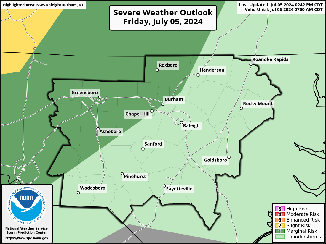
For friends in NC:
GFS deletes summer next weekend View attachment 149252