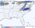
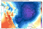
I bet it's snowing in Roxboro.View attachment 117058
We’ll see
-
Hello, please take a minute to check out our awesome content, contributed by the wonderful members of our community. We hope you'll add your own thoughts and opinions by making a free account!
You are using an out of date browser. It may not display this or other websites correctly.
You should upgrade or use an alternative browser.
You should upgrade or use an alternative browser.
Pattern April Thread
- Thread starter SD
- Start date
Rain
I don’t think it even rained here, LOL.Rain
GeorgiaGirl
Member
Didn't hit the predicted high temp of 57 today I believe, unless it was 57 in the wee hours of the morning, and now we may threaten to hit freezing. The low predicted is 34, so it'll be close.
Low 50s+wind+cloud cover=just nasty stuff.
Looking forward to it being in the 70s tomorrow.
Low 50s+wind+cloud cover=just nasty stuff.
Looking forward to it being in the 70s tomorrow.
Iceagewhereartthou
Member
Well never would have thought it fellas but had a healthy snow and graupel shower in Easley this afternoon around 5; came down pretty hard for a bit. Absolutely awesome! What a beautiful weather weekend!
BufordWX
Member
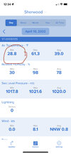
29.5 currently at the house. Darn impressive for April.
Frosty morning . Pretty decent one at that.
gawxnative
Member
Well got down to 28.6 here, and seems that has been below 32 for 6 hours.. Very heavy frost of course with no wind. so thinking a lot of possible freeze damage, as we were only under Frost Warning
bigstick10
Member
29.7 here in my burg,,,wow...
LickWx
Member
For once eastern NC escaped . 36 Roxboro 39 rdoo 36 louisburg .
BHS1975
Member
40 degree temp swing tomorrow.
Sent from my iPhone using Tapatalk
Sent from my iPhone using Tapatalk
Yeah I’m in ATL for the weekend… was at the Braves game last night and it was downright freezing in the stands. Going again today and 70 degrees is gonna feel glorious29.7 here in my burg,,,wow...
34 here. WhewFor once eastern NC escaped . 36 Roxboro 39 rdoo 36 louisburg .
NBAcentel
Member
Even Myrtle got down to 37. Lol
LickWx
Member
Yeah west of Raleigh really got screwed . 33 Sanford . Brrr . Thank god we avoided 20s . I would like to think we are in the clear though most likely for the growing season unless it’s 2020 and 2021 all over again. These nights suck but I’ll take an entire week of 36 degree lows over a night at 28.34 here. Whew
NBAcentel
Member
LickWx
Member
37 down to Savannah holy hell. Very bad news for ag in Georgia and sc. 38 Charleston . All of Atlanta froze pretty hard outside of the airport . I wonder if they are appreciating it ? We sure appreciated our freeze a week ago or so didn’t we ?
LickWx
Member
80s entire workweek here looks like. I’ll take it . I’m sure there’s another 2 freezes and glorious 50 degree weather to ruin our 6 months of heat and humidity just around the cornerIn other news, this week looks amazing all the way thru the weekendView attachment 117061
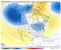
I think the next cold shot has a chance at a freeze but that cold shot seems to be trending still cold but more zonal.Yeah west of Raleigh really got screwed . 33 Sanford . Brrr . Thank god we avoided 20s . I would like to think we are in the clear though most likely for the growing season unless it’s 2020 and 2021 all over again. These nights suck but I’ll take an entire week of 36 degree lows over a night at 28.
NBAcentel
Member
Yeah EPS doesn’t fully get the trough In because the ridge out west collapses to quickI think the next cold shot has a chance at a freeze but that cold shot seems to be trending still cold but more zonal.
LickWx
Member
We don’t need a freeze especially not another severely late one .Yeah EPS doesn’t fully get the trough In because the ridge out west collapses to quick
With the higher sun angle, we are getting into that time of year where even 850mb temps of 0*C to 5*C can still yield daytime temps of 70*F+.
Still below average, but nothing too cold.
Still below average, but nothing too cold.
NBAcentel
Member
Yup and how many times over the past few years have we seen the models be too aggressive with western ridging only to flatten out.Yeah EPS doesn’t fully get the trough In because the ridge out west collapses to quick
HSVweather
Member
Down to 34.9 here this morning and looking forward to 75 this afternoon.
GeorgiaGirl
Member
The airport got to 32.
The low at the house was 37, but apparently the sun was already on the thermometer, so it was probably off by a few degrees.
The low at the house was 37, but apparently the sun was already on the thermometer, so it was probably off by a few degrees.
Only got down to 39 at RDU. Pathetic. Frost Warning for that?!?!
LickWx
Member
And thank god for that . We are past the last freeze date avg . Don’t want or need anymore freezes . Only damage if we freezeOnly got down to 39 at RDU. Pathetic. Frost Warning for that?!?!
A late freeze will happen eventually since it's all about averages and such.And thank god for that . We are past the last freeze date avg . Don’t want or need anymore freezes . Only damage if we freeze
LickWx
Member
It happened 2 years in a row here. So we paid our share. Latest in 18 years last yearA late freeze will happen eventually since it's all about averages and such.
whatalife
Moderator
olhausen
Member
31.8 this morning and probably the last freeze of the season. Also got snow / sleet showers Friday afternoon. That makes it 3 Aprils in a row and 4 out of the last 5 that snow has fallen here. Pretty crazy cause I only saw snow fall once in April between 2006-2017 and that was in April 2007.
gawxnative
Member
There are some pretty good hints of another threat of freeze/frost around the 19-20 time frame.. I would hold off on planting still
Yeah, I always heard April 15th down yalls way! Just a suggestion!There are some pretty good hints of another threat of freeze/frost around the 19-20 time frame.. I would hold off on planting still
NoSnowATL
Member
They always say never before Easter Weekend. Tends to be true.Yeah, I always heard April 15th down yalls way! Just a suggestion!
NBAcentel
Member
LickWx
Member
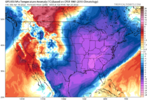
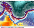
Freeze 4 weeks later than normal again ? Wow . That’s a solid 30 days of our growing season poof. Giving us a growing season equivalent to the average in a place like western pa or Michigan or something . We never get late first freezes on the other hand . Can count on us radiating down every yearThis is stupid ------- -------- Tom Brady Sucks ---- ---- for late April, this is the stupidest ---- I’ve ever seen this is a late February look, ---- ---- man I’m so done with days like yesterday and this morning View attachment 117072
BHS1975
Member
This is stupid ------- -------- Tom Brady Sucks ---- ---- for late April, this is the stupidest ---- I’ve ever seen this is a late February look, ---- ---- man I’m so done with days like yesterday and this morning View attachment 117072
And then another super late frost in Dec.
Sent from my iPhone using Tapatalk

