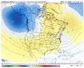
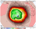
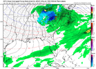
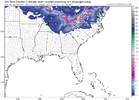
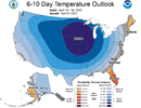
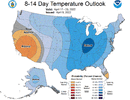
I'm a little concerned about SE severe weather in the 10-15 day range the closed block north of AK seems to have some linkage to SE severe in +5-10ish days. Still looking for enough analogs though to see if it is a true precursor
-
Hello, please take a minute to check out our awesome content, contributed by the wonderful members of our community. We hope you'll add your own thoughts and opinions by making a free account!
You are using an out of date browser. It may not display this or other websites correctly.
You should upgrade or use an alternative browser.
You should upgrade or use an alternative browser.
Pattern April Thread
- Thread starter SD
- Start date
NBAcentel
Member
NBAcentel
Member
LickWx
Member
I have 4 days over 80 forecast including a day at 85 this coming week . Where winter ? #savenicku
We just got to get through the next couple mornings and then hopefully we will be done with the 30s for the next 6 months. Easter weekend is looking absolutely gorgeousI have 4 days over 80 forecast including a day at 85 this coming week . Where winter ? #savenicku
D
Deleted member 609
Guest
Gfs clowns all year long ?
View attachment 117031
What an awful model.
Another beautiful cool dry weekend! It will be enjoyed by me at least! Hope all have a great weekend!
Unfortunately, the 70*F+ streak at DFW is broken with only a high of 69*F today. ?
Happy Easter from the GFSView attachment 116999
FWIW, the 00z GFS was definitely different (in a good way, IMO) with the evolution of the pattern beyond mid-next week.
Sleet in Athens Georgia just now
NoSnowATL
Member
Cloudy 46, this is Hell.
Pretty sure I just saw some snow falling
I was pretty sure I saw a few flurries earlier, then the tinkling of sleet on my car's windshield when I posted earlier.Pretty sure I just saw some snow falling
Mid 50s beautiful sky full of nice cumulus clouds .. no need for a jacket and no need for a swimsuit .. dry, making this one of the most pleasant days of the year imo .. jealous of those seeing flakes or pellets!
NBAcentel
Member
Mid 50s ------- suck man, we’re wasting away days that could be 70, gonna be amaze balls being at Myrtle and it being 55 later ?Mid 50s beautiful sky full of nice cumulus clouds .. no need for a jacket and no need for a swimsuit .. dry, making this one of the most pleasant days of the year imo .. jealous of those seeing flakes or pellets!
NoSnowATL
Member
Nick hates life. #PrayforNickMid 50s ------- suck man, we’re wasting away days that could be 70, gonna be amaze balls being at Myrtle and it being 55 later ?
Its garbage anyone that says otherwise is trolling or doesn't go outsideMid 50s ------- suck man, we’re wasting away days that could be 70, gonna be amaze balls being at Myrtle and it being 55 later ?
NBAcentel
Member
Seriously. Low 70s and the Colorado summer is better then thisIts garbage anyone that says otherwise is trolling or doesn't go outside
I don't think I've ever heard anyone say whew can't wait for 52 and mostly cloudy with a NW wind at 20 in mid April. I can't wait for the bitching about the heat in a few weeks the tears will be deliciousSeriously. Low 70s and the Colorado summer is better then this
NBAcentel
Member
In 3.5-5 weeks averages are closing in on 80I don't think I've ever heard anyone say whew can't wait for 52 and mostly cloudy with a NW wind at 20 in mid April. I can't wait for the bitching about the heat in a few weeks the tears will be delicious
gawxnative
Member
Same over here near Monroe GA.. and so far my max daytime temp has been 44.2There is currently some sleet and graupel here. Didn't expect that lol.
ForsythSnow
Moderator
All graupel for me. Weird we've had two light wintry precip events this spring.There is currently some sleet and graupel here. Didn't expect that lol.
I thought the oppressive heat should have started already? Wasn't that why we were cheering on freezing cold in late March into April?In 3.5-5 weeks averages are closing in on 80
NBAcentel
Member
Endless summer for 9-10 months of the year man !!!! I was told that by folks hereI thought the oppressive heat should have started already? Wasn't that why we were cheering on freezing cold in late March into April?
I just don't understand why people aren't ok with average post about 3/1 there's nothing "hot" until we get into June. If we were average today that would be roughly 70/45 oh the humanityEndless summer for 9-10 months of the year man !!!! I was told that by folks here
Its garbage anyone that says otherwise is trolling or doesn't go outside
It can be both...¯\_(ツ)_/¯
I've been doing yard work today, so 50s and cloudy has been nice.
Brent
Member
30 this morning but already up to 73 ?
Next shot of cold is mid to late week here, 70s and 80s til then
Next shot of cold is mid to late week here, 70s and 80s til then
BufordWX
Member
It was 32 here this morning and now it’s up to 78 and still rising.30 this morning but already up to 73 ?
Next shot of cold is mid to late week here, 70s and 80s til then
It’s cold today with the cloud cover and all the wind!!! ?
DFW is overachieving a bit today. Currently 88*F.
pcbjr
Member
norcarolinian
Member
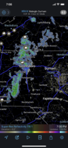
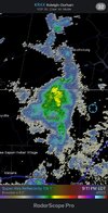
Sleet/ snow/ graupel falling in NW Guilford
norcarolinian
Member
Where is this weather in December? Low 40s, wind is howling and it’s spitting snow. Ah North Carolina how I love thee

