LickWx
Member
84/65 juicy baby
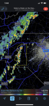
These could be the interesting cells of the day as they move into central and eastern NC and further north.. line behind looks outflow driven and meh .. still only few will get lucky with some hail cores or microbursts.. hoping Raleigh scores! View attachment 117709

Charlotte feeding the Raleigh storms . We like ! Charlotte uhi feeding storms for Raleigh ftw!


Too much pulse. You can see the up draft go up on the ILM radar then the lightning starts then it weakens/collapses and a new updraft gets going to the east with a new lightning cluster. Probably going to get a few hail reports where these updrafts really max out and a few wind reports where the collapse but mehHmmmm just as warnings are popping off, I honestly don't understand sometimes.
Concerning...Severe potential...Watch unlikely
Valid 261759Z - 262000Z
Probability of Watch Issuance...5 percent


Blowing dust is a problem here with this gustfront. Reduced visibility is real here. Got a couple of videos.
