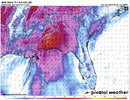
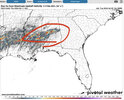
Probably 2 different threats in this window.
-
Hello, please take a minute to check out our awesome content, contributed by the wonderful members of our community. We hope you'll add your own thoughts and opinions by making a free account!
You are using an out of date browser. It may not display this or other websites correctly.
You should upgrade or use an alternative browser.
You should upgrade or use an alternative browser.
Severe April 8-12 2024
- Thread starter SD
- Start date
JHS
Member
Right now, both GSP and the Blacksburg VA NWS offices seem to think we get severe weather and heavy rain Wednesday into Thursday. The GFS and Euro have strong signals for severe weather now according to GSP and RNK mentions rotating storms in their area. If nothing else a 55-60 knot low level jet could be tapped in stronger storms Thursday cause some damage.
Edit: The Raleigh office is not as confident in severe yet, because of a possible timing issue for one thing and getting split to the north and south for another. They do say things might be a little rough though if everything lined up right.
Edit: The Raleigh office is not as confident in severe yet, because of a possible timing issue for one thing and getting split to the north and south for another. They do say things might be a little rough though if everything lined up right.
Last edited:
I'm a little surprised this thread isn't popping. I wouldn't be shocked to see the enh expanded and potentially upgraded in some areas of ms/al.
It'll be interesting to see the nature of this as time progresses alot of divergence and forcing may lead to a well developed mcs that chases cape and rides the theta e boundary cutting off the rain and severe threat in north ga and a part of SC/NC.
It'll be interesting to see the nature of this as time progresses alot of divergence and forcing may lead to a well developed mcs that chases cape and rides the theta e boundary cutting off the rain and severe threat in north ga and a part of SC/NC.
Brick Tamland
Member
Maybe folks are getting tired of the severe threats turning into duds. MS and AL are usually good for severe weather, but there's a lot of crying wolf in NC, SC and GA lately.I'm a little surprised this thread isn't popping. I wouldn't be shocked to see the enh expanded and potentially upgraded in some areas of ms/al.
It'll be interesting to see the nature of this as time progresses alot of divergence and forcing may lead to a well developed mcs that chases cape and rides the theta e boundary cutting off the rain and severe threat in north ga and a part of SC/NC.
We haven't had a legit threat here yet. We've had a couple of good kinematic days and a couple decent thermodynamic days but nothing that overlapped to 2 to really get hypedMaybe folks are getting tired of the severe threats turning into duds. MS and AL are usually good for severe weather, but there's a lot of crying wolf in NC, SC and GA lately.
We haven't had a legit threat here yet. We've had a couple of good kinematic days and a couple decent thermodynamic days but nothing that overlapped to 2 to really get hyped
Pretty much the same here. I keep waiting on the models to show a classic look, but no dice yet.
One thing about the threat tomorrow that is sticking out is that meal/secondary low some of the models are forming over southern MS. This is the type of setup where for most of us the storm mode is messy with the main threat being the QLCS. In southern MS however, this is the type of event where you get a few supercells to really show out, especially if you get enhanced helicity from that secondary low.
RoddyPiper
Member
I completely disagree with SPC's broad area of risk across the deep South, but that small area in southern MS is always juiced in this type of setup. You could go with a 6-8 county MOD risk bullseye, downgrading 1 level as you expand in 1 county rings.One thing about the threat tomorrow that is sticking out is that meal/secondary low some of the models are forming over southern MS. This is the type of setup where for most of us the storm mode is messy with the main threat being the QLCS. In southern MS however, this is the type of event where you get a few supercells to really show out, especially if you get enhanced helicity from that secondary low.
Brick Tamland
Member
You wouldn't know that by the way WRAL was acting with last week's "threat."We haven't had a legit threat here yet. We've had a couple of good kinematic days and a couple decent thermodynamic days but nothing that overlapped to 2 to really get hyped
I completely disagree with SPC's broad area of risk across the deep South, but that small area in southern MS is always juiced in this type of setup. You could go with a 6-8 county MOD risk bullseye, downgrading 1 level as you expand in 1 county rings.
I understand the larger risk area. There is a ton of wind shear associated with the system. Assuming instability gets far enough north, the QLCS could be quite strong. However in these setups the best instability normally doesn’t get as far north as models say.
Brick Tamland
Member
AL, MS and MO continue to be ground zero for severe weather.
Brick Tamland
Member
The SPC reduced the severe threat here to a level 1. I know, shocking.
Not really surprised. This setup is boom or bust for us and is so highly dependent on the evolution of convection to our SW. Given the amount of forcing, divergence and cape over us and to the south this setup on particular has a tendency to be self limiting since more often than not since deep convection and a mcs is likely which either #1 chokes out moisture transport or #2 sends a decaying mcs into the area early in the day leaving us too stable or with subsidence during peak heating. If we didn't have the organized area of storms or it was moving through later in the day the threat would be more substantial (see March 1984 for a similar but not perfect analog. When looking at the at days 2-5 I think it's much better to raise attention to it and back down versus waiting until day 2 to see the convective evolution to our SW then start sounding the alarm.The SPC reduced the severe threat here to a level 1. I know, shocking.
All of that said the severe risk isn't 0 for us and the area or rain incoming being early moving out would open the door for some scattered severe storms tomorrow afternoon with wind and some potentially higher than normal severe gusts being possible in the taller more mature storms.
On another note with the strong upper level system swinging through Friday with very cold air aloft any sustained updraft would have a chance to be a fairly prolific small hail producer. Dry air aloft though may limit the coverage and intensity
Last edited:
With that MCS riding the coast, our severe chance is about nil.
Snowlover87
Member
FFC says some areas could get up to 5” of rain !
It keeps shifting south though.FFC says some areas could get up to 5” of rain !
Snowlover87
Member
South of Macon and Columbus looks to be the bullseye.It keeps shifting south though.


