Probably 2 different threats in this window.
-
Hello, please take a minute to check out our awesome content, contributed by the wonderful members of our community. We hope you'll add your own thoughts and opinions by making a free account!
You are using an out of date browser. It may not display this or other websites correctly.
You should upgrade or use an alternative browser.
You should upgrade or use an alternative browser.
Severe April 8-12 2024
- Thread starter SD
- Start date
JHS
Member
Right now, both GSP and the Blacksburg VA NWS offices seem to think we get severe weather and heavy rain Wednesday into Thursday. The GFS and Euro have strong signals for severe weather now according to GSP and RNK mentions rotating storms in their area. If nothing else a 55-60 knot low level jet could be tapped in stronger storms Thursday cause some damage.
Edit: The Raleigh office is not as confident in severe yet, because of a possible timing issue for one thing and getting split to the north and south for another. They do say things might be a little rough though if everything lined up right.
Edit: The Raleigh office is not as confident in severe yet, because of a possible timing issue for one thing and getting split to the north and south for another. They do say things might be a little rough though if everything lined up right.
Last edited:
PV reversal that began 1st week of March was into the top six all time. To little to late,but thats been the trigger for our cool spring
I'm a little surprised this thread isn't popping. I wouldn't be shocked to see the enh expanded and potentially upgraded in some areas of ms/al.
It'll be interesting to see the nature of this as time progresses alot of divergence and forcing may lead to a well developed mcs that chases cape and rides the theta e boundary cutting off the rain and severe threat in north ga and a part of SC/NC.
It'll be interesting to see the nature of this as time progresses alot of divergence and forcing may lead to a well developed mcs that chases cape and rides the theta e boundary cutting off the rain and severe threat in north ga and a part of SC/NC.
Maybe folks are getting tired of the severe threats turning into duds. MS and AL are usually good for severe weather, but there's a lot of crying wolf in NC, SC and GA lately.I'm a little surprised this thread isn't popping. I wouldn't be shocked to see the enh expanded and potentially upgraded in some areas of ms/al.
It'll be interesting to see the nature of this as time progresses alot of divergence and forcing may lead to a well developed mcs that chases cape and rides the theta e boundary cutting off the rain and severe threat in north ga and a part of SC/NC.
Cool spring? Where?PV reversal that began 1st week of March was into the top six all time. To little to late,but thats been the trigger for our cool spring

We haven't had a legit threat here yet. We've had a couple of good kinematic days and a couple decent thermodynamic days but nothing that overlapped to 2 to really get hypedMaybe folks are getting tired of the severe threats turning into duds. MS and AL are usually good for severe weather, but there's a lot of crying wolf in NC, SC and GA lately.
We haven't had a legit threat here yet. We've had a couple of good kinematic days and a couple decent thermodynamic days but nothing that overlapped to 2 to really get hyped
Pretty much the same here. I keep waiting on the models to show a classic look, but no dice yet.
One thing about the threat tomorrow that is sticking out is that meal/secondary low some of the models are forming over southern MS. This is the type of setup where for most of us the storm mode is messy with the main threat being the QLCS. In southern MS however, this is the type of event where you get a few supercells to really show out, especially if you get enhanced helicity from that secondary low.
Mahomeless
Member
- Joined
- Oct 17, 2023
- Messages
- 900
- Reaction score
- 2,158
I completely disagree with SPC's broad area of risk across the deep South, but that small area in southern MS is always juiced in this type of setup. You could go with a 6-8 county MOD risk bullseye, downgrading 1 level as you expand in 1 county rings.One thing about the threat tomorrow that is sticking out is that meal/secondary low some of the models are forming over southern MS. This is the type of setup where for most of us the storm mode is messy with the main threat being the QLCS. In southern MS however, this is the type of event where you get a few supercells to really show out, especially if you get enhanced helicity from that secondary low.
You wouldn't know that by the way WRAL was acting with last week's "threat."We haven't had a legit threat here yet. We've had a couple of good kinematic days and a couple decent thermodynamic days but nothing that overlapped to 2 to really get hyped
I completely disagree with SPC's broad area of risk across the deep South, but that small area in southern MS is always juiced in this type of setup. You could go with a 6-8 county MOD risk bullseye, downgrading 1 level as you expand in 1 county rings.
I understand the larger risk area. There is a ton of wind shear associated with the system. Assuming instability gets far enough north, the QLCS could be quite strong. However in these setups the best instability normally doesn’t get as far north as models say.
Latest 12z HRRR for late tomorrow/early Thursday looks absolutely nasty for central AL with regards to the QLCS. Big time bookend vortex/bowing segment. Would be a much higher chance for wind and spin up tornadoes.


Last edited:
AL, MS and MO continue to be ground zero for severe weather.
The SPC reduced the severe threat here to a level 1. I know, shocking.
Not really surprised. This setup is boom or bust for us and is so highly dependent on the evolution of convection to our SW. Given the amount of forcing, divergence and cape over us and to the south this setup on particular has a tendency to be self limiting since more often than not since deep convection and a mcs is likely which either #1 chokes out moisture transport or #2 sends a decaying mcs into the area early in the day leaving us too stable or with subsidence during peak heating. If we didn't have the organized area of storms or it was moving through later in the day the threat would be more substantial (see March 1984 for a similar but not perfect analog. When looking at the at days 2-5 I think it's much better to raise attention to it and back down versus waiting until day 2 to see the convective evolution to our SW then start sounding the alarm.The SPC reduced the severe threat here to a level 1. I know, shocking.
All of that said the severe risk isn't 0 for us and the area or rain incoming being early moving out would open the door for some scattered severe storms tomorrow afternoon with wind and some potentially higher than normal severe gusts being possible in the taller more mature storms.
On another note with the strong upper level system swinging through Friday with very cold air aloft any sustained updraft would have a chance to be a fairly prolific small hail producer. Dry air aloft though may limit the coverage and intensity
Last edited:
With that MCS riding the coast, our severe chance is about nil.
Drizzle Snizzle
Member
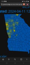
FFC says some areas could get up to 5” of rain !
It keeps shifting south though.FFC says some areas could get up to 5” of rain !
Drizzle Snizzle
Member
South of Macon and Columbus looks to be the bullseye.It keeps shifting south though.
Drizzle Snizzle
Member
Huge rainfall event possible for Georgia. I’m a little skeptical though. 
NAM 3k for around 10am tomorrow morning in my area


Last edited:
South Carolina mid day with dew points in the upper 60s

No change in text discussion from NWS earlier today:
.SHORT TERM...
(This afternoon through Thursday)
Issued at 232 PM EDT Wed Apr 10 2024
Primary forecast issue for the day will be the potential for
thunderstorms and severe weather, including flash flooding, across
southern portions of the CWA this evening and into the overnight
hours.
Strong/severe line of thunderstorms moving east along the Gulf Coast
this afternoon. The models have struggled with this system from run
to run, especially the track of the system. This initial system may
bypass much of the CWA to the south, but the SW corner of the outlook
area would have the best chances from seeing any convective impacts
from the line.
The hi-res models continue to fire shra/tsra on the backside of any
initial line that moves through during the evening in association
with strong mid level energy/trough. This secondary system may end up
evolving into another broken line of strong/potentially severe
thunderstorms overnight and into early Thursday morning. The primary
convective severe hazards will be damaging wind gusts and brief
tornadoes.
The secondary area of convection likely to develop with the
trough/strong shortwave energy will likely impact areas well north
of the Columbus to Macon line overnight. The convective mode may be
a bit more messy than down south, with widespread showers with
embedded thunder.
Another potential hazard will be heavy rainfall across portions of
the southern CWA. With repeated convective systems moving across,
each one producing locally heavy rainfall, have gone ahead and
issued a Flood Watch for the potential for flash flooding. For areas
mostly along and south of a line from Columbus to Macon and along
and west of I-75. Widespread 2 to 4 inches of rainfall is likely
with some locally higher amounts up to 5 inches possible.
Winds are expected to become gusty behind the front later Thursday
into Thursday night. The pressure gradient will tighten as a
deepening low pressure system moves from the Lower Mississippi River
Valley into the Ohio Valley tonight and early Thursday. Will hold
off issuing a Wind Advisory for now, but it may need to be
considered on later shifts.
NListemaa
Ron Burgundy
Member
Wake low blowing through NGA right now. Power out all over the place

Last edited:
SnowwxAtl
Member
How long does this suppose to last?
Wake lows are a cool weather feature. This particular one has already lasted longer than many I have experienced.
83k out in Georgia 
HRRR has some pretty legit gusts through tomorrow morning. Probably can knock 20% off these numbers but still high
Ron Burgundy
Member
Should be winding down soon per the SWSHow long does this suppose to last?
Crazy pressure reading from my Ambient station as the low moved through


Windergawx
Member
Pretty strong wind atm 40mph atleast
SnowwxAtl
Member
When does this wake low moves out?Pretty strong wind atm 40mph atleast
Windergawx
Member
NBAcentel
Member
Hrrr looks pretty impressive this morning, with semi-discreet convection and moderate instability ahead of the cold front. The big rain shield that looked to limit the threat a day or 2 ago didn’t really occur. Now we’re staring down a more interesting threat. Some of those Hodographs showing up are truly impressive for our area. If storms can overcome the mid level warmth, then a higher tornado threat is there


2 in of rain in Charleston so far this morning and another 1-2 in expected
HRRR been staying excited all morning, placement/existence of storms is gonna remain in question until game time
Makeitsnow
Member
At about 1am last night I had sustained east to southeast winds of 25 to 28mph with a top gust of 41. And about 30 seconds later the power got knocked out. Naturally few minutes later the winds dropped off quite fast. There were quite a few outages east of athens but fortunately it was only out for a few hours. Overall a short but impressive wind event.Pretty strong wind atm 40mph atleast
New hrrr is impressive. With the lack of rain this morning and the morning mcs getting out of the way quickly we have some time to recoverHRRR been staying excited all morning, placement/existence of storms is gonna remain in question until game time

definitely some support for a sneaky set up that flies under the SPC's radar. why they still have ohio as a 10% tor chance is a puzzling choice.
I think Asheboro-ish has a shot at a solid supercell right around sunset. Higher tor potential probably along a corridor NW of I-85