-
Hello, please take a minute to check out our awesome content, contributed by the wonderful members of our community. We hope you'll add your own thoughts and opinions by making a free account!
You are using an out of date browser. It may not display this or other websites correctly.
You should upgrade or use an alternative browser.
You should upgrade or use an alternative browser.
Pattern Another Angry August: Broiled, Baked, and Bone-Dry
- Thread starter SD
- Start date
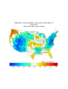
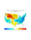
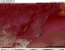
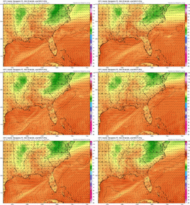
If a few things go right it could be cooler than thatThis is going to be amazing View attachment 173687
August will average BN on temps when all is said an done.
tennessee storm
Member
Believe that when I see that ….lolAugust will average BN on temps when all is said a done.
Id love it but i doubt it. We are back to the endless above normal pattern by the 6thAugust will average BN on temps when all is said an done.
Brent
Member
GlwtAugust will average BN on temps when all is said an done.
As much as I want that it's still August. Summer won't be over anytime soon
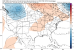
This weekend is the most interesting thing we've had in a while, minus tracking oppressive heat. Looks like a slow moving front crosses much of the southeast/midatlantic early in the weekend and our much advertised slug of dryer, cooler air is confined to VA+north on Saturday before the departing 500mb trough can swing down a bit more into Sunday and our surface HP settles in the northeast to setup a CAD structure with a little more traditional low lvl drying and cooling. Before it seemed like we were relying on the cooler air from the north to keep things down Saturday, now it seems that we may be more looking for widespread cloud cover/showers along the interaction between the front and more southerly flow in the mid-upper levels.
TLDR wudgeThis weekend is the most interesting thing we've had in a while, minus tracking oppressive heat. Looks like a slow moving front crosses much of the southeast/midatlantic early in the weekend and our much advertised slug of dryer, cooler air is confined to VA+north on Saturday before the departing 500mb trough can swing down a bit more into Sunday and our surface HP settles in the northeast to setup a CAD structure with a little more traditional low lvl drying and cooling. Before it seemed like we were relying on the cooler air from the north to keep things down Saturday, now it seems that we may be more looking for widespread cloud cover/showers along the interaction between the front and more southerly flow in the mid-upper levels.
GoDuke
Member
Thread title made me hungry. Got a hankering for T-bone steak, with broiled shrimp and a baked potato.
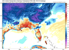
CFS Tanks us on 850's roughly 1st 10 days and last 10 days of August. Warm at the 850 level Aug10-20.Id love it but i doubt it. We are back to the endless above normal pattern by the 6th
However if you throw in a Bastardi curveball, which is a cloud induced 1-2 day event from Tropics to mute Aug10-20th. And we might have a winner.
Drizzle Snizzle
Member
JHS
Member
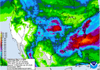
Not happening. Maybe .50 up to 1 inch and then only in certain areas. Most of us will get .25 or less over the next week.Looks awfully wet over the next week.View attachment 173698
JHS
Member
The 18z GFS is delaying the cooldown. Now not cooling down until Saturday for many of us.
We need to add busted to the thread title
iGRXY
Member
Says who?Not happening. Maybe .50 up to 1 inch and then only in certain areas. Most of us will get .25 or less over the next week.
90 Thursday, 84 here Friday, 70's weekend. This is what's been advertised timing wise I thought. with 80% storms Thurs evening into Friday as transition takes place.The 18z GFS is delaying the cooldown. Now not cooling down until Saturday for many of us.
JHS
Member
Well, the GFS has already cut these totals by 50-75% for many of us and it will probably cut them even more. Sat and Sun will not be nearly as cool as forecast either with much more sun. GSP's 90+ may just keep going.Says who?
- Joined
- Jan 5, 2017
- Messages
- 3,769
- Reaction score
- 5,966
Yeah, we gotta stop covering everything in concrete and asphalt. Move to the country, it's not getting warmer there, at least not the highs...lows however, they are inching up.Don’t get to excited just yet… seen several days early October get 90 degrees even… and daily averages keep on warming up as climate keeps getting warmer
iGRXY
Member
Well the GFS is not a good model so it holds zero weight. If you want to keep quoting it like it is, be my guest. But it's routinely off on temps and precip.Well, the GFS has already cut these totals by 50-75% for many of us and it will probably cut them even more. Sat and Sun will not be nearly as cool as forecast either with much more sun. GSP's 90+ may just keep going.
tennessee storm
Member
Euro has cut down on the rain totals also … so there s. ThatWell the GFS is not a good model so it holds zero weight. If you want to keep quoting it like it is, be my guest. But it's routinely off on temps and precip.
Euro and cmc trying to develop a wave over the lol wudge and really spike precip totals. Haven't done that in the summer months in such a long time I'd be all in on it
Last edited:
Brent
Member
Yeah, we gotta stop covering everything in concrete and asphalt. Move to the country, it's not getting warmer there, at least not the highs...lows however, they are inching up.
Except we still haven't beaten the 1930s here even with all the concrete
- Joined
- Jan 5, 2017
- Messages
- 3,769
- Reaction score
- 5,966
The 1930s were horrible.Except we still haven't beaten the 1930s here even with all the concrete
Definitely starting to zero in on easterly/SEly flow over the lol wudge for Sat bringing pretty widespread clouds. Looks like latest GFS is a little more aligned with sfc flow so doesn't get as much precip going.
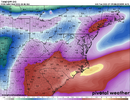
What’s the CMC showing?? It does best with wedges!It also brought the lower dews back Sunday PMView attachment 173727
I've been full bore on the August Below Normal for GSO. My call is we end up -3 BN for the month @ GSO. We also will end up AN for precip.
Normals are 4.36 qpf and 77.1 on the Mean
Normals are 4.36 qpf and 77.1 on the Mean
tennessee storm
Member
I say August and September will be like usual… above the norms with below precipitation least for the mid south region
Looks like general western ridging for the month. That would potentially shield us from tropical systems, assuming the Atlantic ever gets its act together.
Brent
Member
Looks like general western ridging for the month. That would potentially shield us from tropical systems, assuming the Atlantic ever gets its act together.
Is it bad I'm hoping it won't
Everyone on social media just acts like nothing bad has ever happened before
Drizzle Snizzle
Member
JHS
Member
We have 1 last chance tomorrow to do something about this before we get another 7+ days of dry weather.
 droughtmonitor.unl.edu
| U.S. Drought Monitor
JHS
Member
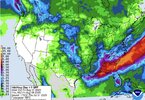
They have cut way back over the Carolinas, except right along the coast.Widespread 3-4” across much of the south over the next 7 days. View attachment 173770
Brent
Member

