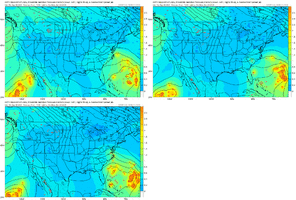
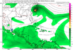
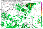
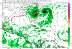
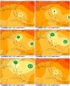
Probably not strong by any means but could bring some much needed rain depending!It has done a good job today maintaining convection but still don't see much in the way of westerlies on its south side yet.
-
Hello, please take a minute to check out our awesome content, contributed by the wonderful members of our community. We hope you'll add your own thoughts and opinions by making a free account!
You are using an out of date browser. It may not display this or other websites correctly.
You should upgrade or use an alternative browser.
You should upgrade or use an alternative browser.
Tropical 94L - PTC to be issued later today
- Thread starter SD
- Start date
Shaggy
Member
NoSnowATL
Member
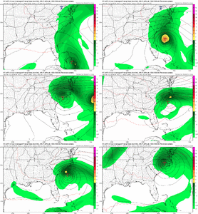
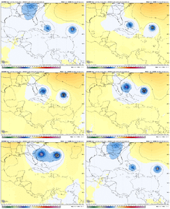
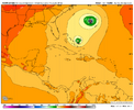
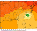
Lex just passed out with excitementAnyone see the Euro AI 18z run? This would be one for the booksView attachment 175063View attachment 175064
lexxnchloe
Member
GeorgiaGirl
Member
Anyone see the Euro AI 18z run? This would be one for the booksView attachment 175063View attachment 175064
Would be very strange, but we've seen the ICON depict this over the Bahamas and Larry told us that the UKMET apparently had a TD traveling SE too for 12z (well, ESE).
Seems like if the interaction with Humberto misses, that this may end up being a hit or a scraper if it develops. Probably not strong though, but flooding was already a problem in NC with Chantal.
That’s the most threatening GEFS run yet for the SE US going back a number of days.
Tropical Weather Outlook
NWS National Hurricane Center Miami FL
800 PM EDT Wed Sep 24 2025
For the North Atlantic...Caribbean Sea and the Gulf of America:
1. Eastern Caribbean Sea (AL94):
Showers and thunderstorms have become better organized since
yesterday in association with a tropical wave centered near Puerto
Rico. This wave is expected to move west-northwestward around 10
to 15 mph, spreading heavy rainfall and gusty winds across Puerto
Rico and the Dominican Republic through early tomorrow. The system
is then expected to slow down and turn northwestward when it
reaches the southwestern Atlantic. A tropical depression is likely
to form when the disturbance is in the vicinity of the Bahamas late
this week. Interests in Puerto Rico, the Dominican Republic, the
Turks and Caicos Islands, and the Bahamas should monitor the
progress of this system.
* Formation chance through 48 hours...medium...40 percent.
* Formation chance through 7 days...high...80 percent.
Public Advisories on Humberto are issued under WMO header
WTNT33 KNHC and under AWIPS header MIATCPAT3.
Forecast/Advisories on Humberto are issued under WMO header
WTNT23 KNHC and under AWIPS header MIATCMAT3.
Forecaster Blake
We need the rain but I'm not sure we need that much rainAnyone see the Euro AI 18z run? This would be one for the booksView attachment 175063View attachment 175064
Sent from my SM-S156V using Tapatalk
file this under yeah probably not but also there aren't many solutions you can fully assume will not happen in this situationAnyone see the Euro AI 18z run? This would be one for the booksView attachment 175063View attachment 175064
Shaggy
Member
Many still missed but it is threatening for sure. A missed exit would mean an even higher threat. New burst of convection after sun set. She's simmering but we will of course be looking at interactions with humberto.That’s the most threatening GEFS run yet for the SE US going back a number of days.
As far as that goes I've noticed that just before sunset the LLC tucked under the deeper convection off to the NE of the center. I wonder If we get a couple of center relocations off to the NE with humberto could that add enough separation. Seems the answer would be no imo.
Shaggy
Member
Dennis 99' did a loop but not as pronounced as the 18z AIfile this under yeah probably not but also there aren't many solutions you can fully assume will not happen in this situation
lexxnchloe
Member
We could probably absorb a lot of rain in this region but not sure we could absorb 12-20 like the AI.
18z op euro is a substantial PRE setup with the coastal front being west and tremendous divergence over the top. Its qpf would likely have verified too low imo.
This is really fascinating to watch there aren't massive differences run to run WRT to major features but we are getting large changes
18z op euro is a substantial PRE setup with the coastal front being west and tremendous divergence over the top. Its qpf would likely have verified too low imo.
This is really fascinating to watch there aren't massive differences run to run WRT to major features but we are getting large changes
Last edited:
Downeastnc
Member
We could probably absorb a lot of rain in this region but sure we could absorb 12-20 like the AI.
18z op euro is a substantial PRE setup with the coastal front being west and tremendous divergence over the top. Its qpf would likely have verified too low imo.
This is really fascinating to watch there aren't massive differences run to run WRT to major features but we are getting large changes
It's a insane setup really...like once in a few decades or more. I can't remember ever seeing anything quite like it maybe ever.
things are about to get weird
my stock is in the occam's razor solution so far, which is boring (humberto dominant, shears 94L, its a naked swirl, nobody misses any school). but the ensembles are buzzy and have piqued my interest
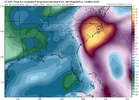
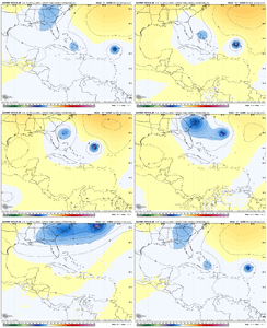
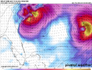
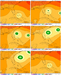
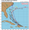
Here’s your “”””Google Deep Mind””””” (whatever that means) for this evening. I’m told it did well with Erin but I haven’t paid it much attention tbh
Either way it shows pretty clearly two camps at the moment, Humberto drags it OTS or it crawls into the Carolinas. Somehow we will probably find a way to get neither of those
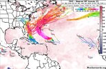
Either way it shows pretty clearly two camps at the moment, Humberto drags it OTS or it crawls into the Carolinas. Somehow we will probably find a way to get neither of those

we might be wandering backwards into the biggest threat the nc coast has had since isaiasHere’s your “”””Google Deep Mind””””” (whatever that means) for this evening. I’m told it did well with Erin but I haven’t paid it much attention tbh
Either way it shows pretty clearly two camps at the moment, Humberto drags it OTS or it crawls into the Carolinas. Somehow we will probably find a way to get neither of those
View attachment 175071
blueheronNC
Member
00z GFS rolling in has 94L farther north in the Fujiwhara dance getting it in front of Humberto instead of lagging like before
0Z UKMET: TD forms Mon night NW Bahamas, initially then drifts slowly NW followed by a stall and dissipation as the much stronger Humberto only ~500 miles east takes over:
NEW TROPICAL CYCLONE FORECAST TO DEVELOP AFTER 102 HOURS
FORECAST POSITION AT T+102 : 25.0N 77.5W
LEAD CENTRAL MAXIMUM WIND
VERIFYING TIME TIME POSITION PRESSURE (MB) SPEED (KNOTS)
-------------- ---- -------- ------------- -------------
1200UTC 29.09.2025 108 25.9N 78.2W 1008 27
0000UTC 30.09.2025 120 26.1N 78.3W 1007 23
1200UTC 30.09.2025 132 26.1N 78.1W 1007 20
0000UTC 01.10.2025 144 CEASED TRACKING
Brent
Member
we might be wandering backwards into the biggest threat the nc coast has had since isaias
Ironically this is gonna be another I storm too
Granted I think odds probably still favor out to sea but keep that in mind
Well that’s different! View attachment 175077
So, the 0Z Euro, just like the 0Z CMC, hits Georgetown, SC, on Monday evening though it isn’t as strong.
So, of major 0Z ops, Euro and CMC hit Georgetown while UKMET, GFS, and Icon stay well offshore.
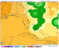
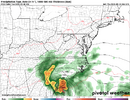
Canadian rainfall0Z CMC Georgetown, SC hit with 975 mb H as not as strong Humberto (983 mb) doesn’t dominate:
View attachment 175075
Edit: 0Z GFS safely OTS with help from Fujiwara with Humberto.
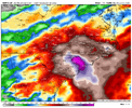
The 0Z EPS is by far the most ominous for the SE US (including some that get into the Gulf) with a whopping ~75% of the members hitting or skimming. Some of these are very weak (not full TCs) while ~1/3 of the hits are strong.
Last edited:
Tropical Weather Outlook
NWS National Hurricane Center Miami FL
200 AM EDT Thu Sep 25 2025
Eastern Caribbean Sea (AL94):
A tropical wave centered near the Dominican Republic continues to
produces widespread disorganized showers and thunderstorms. The
wave is expected to move west-northwestward around 10 to 15 mph,
spreading heavy rainfall and gusty winds across Puerto Rico and the
Dominican Republic through today. The system is then expected to
slow down and turn northwestward when it reaches the southwestern
Atlantic. A tropical depression is likely to form when the
disturbance is in the vicinity of the Bahamas late this week.
Interests in Puerto Rico, the Dominican Republic, Haiti, the Turks
and Caicos Islands, and the Bahamas should monitor the progress of
this system.
* Formation chance through 48 hours...medium...50 percent.
* Formation chance through 7 days...high...80 percent.
Forecaster Bucci
Blue_Ridge_Escarpment
Member
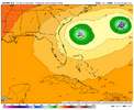
This was heading to the OP Euro and CMC run until it felt the tug.Euro AI is a close miss
View attachment 175079
Brent
Member
NCSNOW
Member
Tsappfrog20
Member
Allan is watching this closely…
Sent from my iPhone using Tapatalk
Sent from my iPhone using Tapatalk
Brent
Member
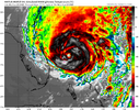
Dang didn’t realize the hurricane models were biting so hard on a stronger storm

