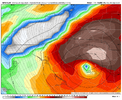
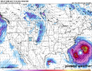
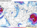
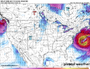
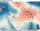
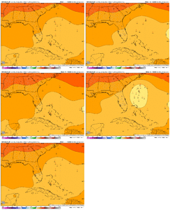
The high pressure that you mentioned will play an important role in what Humberto does as well. If it is stronger, it will slow down Humberto, giving what will probably become Imelda a better chance of escaping Humberto's influence.if (big if) this storm threads the needle and avoids humberto interaction, I think a SC landfall is favored as I think both the ULL and the HP that builds in from the north will limit how much latitude this can climb
-
Hello, please take a minute to check out our awesome content, contributed by the wonderful members of our community. We hope you'll add your own thoughts and opinions by making a free account!
You are using an out of date browser. It may not display this or other websites correctly.
You should upgrade or use an alternative browser.
You should upgrade or use an alternative browser.
Tropical 94L - PTC to be issued later today
- Thread starter SD
- Start date
LovingGulfLows
Member
- Joined
- Jan 5, 2017
- Messages
- 1,380
- Reaction score
- 3,628
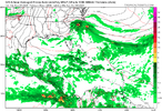
Actually not as much QPF on the GFS as I would've expected given the set up. Widespread 3-7 inches , wouldn't be catastrophic at those amounts, but I think GFS would be underestimating the amount of rain that would fall especially over and near the mountainous areas of the Carolinas.
NCSNOW
Member
NCSNOW
Member
This is going to be an interesting system to watch. A lot of uncertainty in an unusual steering and synoptic environment.
Hoping this one goes OTS and brings some nice fall air in its wake.
Hoping this one goes OTS and brings some nice fall air in its wake.
12Z UKMET: At hour 120, 993 mb Humberto, which is within only 500 miles ENE of 1000 mb 94L, causes 94L (which had been moving mainly NNW) to then get sucked toward it as 94L then suddenly turns SSE, then ESE, and then ENE to well OTS (near 27N, 72W)
NEW TROPICAL CYCLONE FORECAST TO DEVELOP AFTER 54 HOURS
FORECAST POSITION AT T+ 54 : 21.1N 76.5W
LEAD CENTRAL MAXIMUM WIND
VERIFYING TIME TIME POSITION PRESSURE (MB) SPEED (KNOTS)
-------------- ---- -------- ------------- -------------
0000UTC 28.09.2025 60 22.2N 76.2W 1006 31
1200UTC 28.09.2025 72 23.5N 76.9W 1006 32
0000UTC 29.09.2025 84 24.1N 77.4W 1004 33
1200UTC 29.09.2025 96 25.9N 78.3W 1004 39
0000UTC 30.09.2025 108 25.8N 77.8W 1002 38
1200UTC 30.09.2025 120 26.4N 78.1W 1000 37
0000UTC 01.10.2025 132 25.4N 77.6W 999 37
1200UTC 01.10.2025 144 25.0N 76.5W 997 43
0000UTC 02.10.2025 156 25.4N 74.8W 995 46
1200UTC 02.10.2025 168 26.9N 72.2W 991 47
——————
So far at 12Z for major operationals
-GFS hits just S of Georgetown, SC, Mon PM (9/29) as a H (with strong support from GEFS, it’s most ominous run by far yet for SE US)
-Icon, UKMET, CMC thanks to Fujiwhara go safely OTS from SE US
-Euro next
-JMA only out to 72 so far (can’t tell yet)
Been watching atlantic storms anecdotally for many years. Very atypical setup I don't recall ever seeing. Anybody got an analogue on this one? 
mx3gsr92
Member
Moyock storm for sure.
Noles1812
Member
I don't like the look for the Mountains with this track. I pray its wrong. Those guys don't need this.
lexxnchloe
Member
Based on the 12Z ops and individual members of GEFS/GEPS, the best bet for the SE to not get hit thanks to Fujiwhara is for 94L to not be moving too fast and thus never get N of Humberto’s latitude. Helping also would be for it to be significantly weaker than Humberto.
Last edited:
ASSUMING either of these models are in the ballpark on the track:
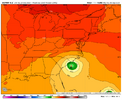
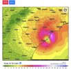
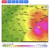
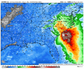
I get the feeling the GFS is just too fast with our storm on this run. Euro is slower (as well as a bit further west with Humberto) and allows for much more interaction between the two, which stops Imelda from sneaking off to the west/southwest and parks it over the Carolinas. Heres' the euro Wednesday morning after landfall:
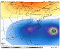
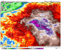
...and the gfs, which has a further east Humberto and a faster Imelda getting away from Humberto's track influence. The result is a gigantic discrepancy in inland rain threat
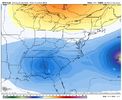
I get the feeling the GFS is just too fast with our storm on this run. Euro is slower (as well as a bit further west with Humberto) and allows for much more interaction between the two, which stops Imelda from sneaking off to the west/southwest and parks it over the Carolinas. Heres' the euro Wednesday morning after landfall:

...and the gfs, which has a further east Humberto and a faster Imelda getting away from Humberto's track influence. The result is a gigantic discrepancy in inland rain threat

The 12Z EPS, while still scary for the SE US with ~60% hitting and ~50%+ of those hitting being strong TS+, isn’t quite as ominous as the 0Z, which had ~75% hitting the SE. About 40% of members are strongly affected by Fujiwhara with Humberto.
the EPS presents just about any solution you could think of still. was hoping for a bit more consolidation this run
Tokenfreak
Member
Yeah same here. I was not expecting some to even show slipping into the gulf.the EPS presents just about any solution you could think of still. was hoping for a bit more consolidation this run
Gulf Coast Weather
Member
According to 12z GFS...landfall close to Charleston at 977 mb which would be a low end Cat 2 (roughly 95 mph max sustained winds).
https://www.pivotalweather.com/model.php?rh=2025092512&fh=105
For reference, Sally (2020) bottomed out at 965 mb as it made landfall in Gulf Shores and was officially classified as a high end Cat 2 at 105 mph when it finally made landfall although there was some debate that it should have been upgraded to 110 mph as it rapidly intensified in the last few hours before landfall
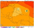
The MJO for 9/27 through 10/3 or 10/4 is again being forecasted by GEFS and EPS to be in phase 2, which is about tied for the most dangerous phase along with 8 for Conus H landfalls and by a large margin has been the most dangerous for Conus MH landfalls (inside or outside the circle).
MH Conus landfalls since 1974 during phase 2
-Ida (2021)
-Michael (2018)
-Irma (2017)
-Harvey (2017)
-Ivan (2004)
-Bret (1999)
-Emily (1993)
-Hugo (1989)
-Frederic (1979)
-Eloise (1975)
-Carmen (1974)
That’s 11 of 29 (38%) of all Conus MH hits since 1974 just during phase 2. These were all during Jul-Oct. During Jul-Oct 1974-2024, 16% of days were in phase 2. So, even after taking into account the fact that the # of days in phase 2 has been about the largest of any one phase along with phase 1, the 38% of all MH hits is still very high. If phase 2 were instead a neutral influence, one would expect the # of MH hits during phase 2 to be only ~3-5.
GEFS
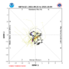
EPS
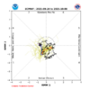
MH Conus landfalls since 1974 during phase 2
-Ida (2021)
-Michael (2018)
-Irma (2017)
-Harvey (2017)
-Ivan (2004)
-Bret (1999)
-Emily (1993)
-Hugo (1989)
-Frederic (1979)
-Eloise (1975)
-Carmen (1974)
That’s 11 of 29 (38%) of all Conus MH hits since 1974 just during phase 2. These were all during Jul-Oct. During Jul-Oct 1974-2024, 16% of days were in phase 2. So, even after taking into account the fact that the # of days in phase 2 has been about the largest of any one phase along with phase 1, the 38% of all MH hits is still very high. If phase 2 were instead a neutral influence, one would expect the # of MH hits during phase 2 to be only ~3-5.
GEFS

EPS

South Carolina has history with I named storms so I wouldn’t be shocked if it made landfall there tbhAccording to 12z GFS...landfall close to Charleston at 977 mb which would be a low end Cat 2 (roughly 95 mph max sustained winds).
https://www.pivotalweather.com/model.php?rh=2025092512&fh=105
For reference, Sally (2020) bottomed out at 965 mb as it made landfall in Gulf Shores and was officially classified as a high end Cat 2 at 105 mph when it finally made landfall although there was some debate that it should have been upgraded to 110 mph as it rapidly intensified in the last few hours before landfall
Shaggy
Member
Found this nugget in the ILM afternoon discussion.
.LONG TERM /MONDAY THROUGH THURSDAY/...
Data collected by multiple aircraft reconnaissance missions
offshore and 06z supplemental upper air soundings across the
Southeast U.S. last night appears to be paying dividends as
models and their ensembles have increased their potential for a
tropical cyclone strike along the Carolina coastline early next
week
Need to watch the speed of Humberto. It's been slowing, and if that continues, Imelda would be able to get out ahead a bit more and be less likely to pinwheel back east before landfall.
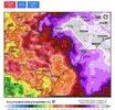
Vapor transport is off the charts on the Euro. Precip shield would get pulled north and west in this setup. It would be Helene-like, just for a different region. It could strengthen more than the Euro is showing too, given the OHC, though there appears to be some level of shear and an apparent lack of an upper level cyclone.
I'm still not confident this one comes in, yet. It's precarious, but the storms just seem too close together to me. BUT, like I said, the trend has been for Humberto to slow down, so we'll see.
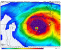
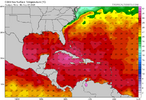
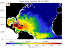
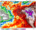


yep. The big wet is east this yearNeed to watch the speed of Humberto. It's been slowing, and if that continues, Imelda would be able to get out ahead a bit more and be less likely to pinwheel back east before landfall.
Vapor transport is off the charts on the Euro. Precip shield would get pulled north and west in this setup. It would be Helene-like, just for a different region. It could strengthen more than the Euro is showing too, given the OHC, though there appears to be some level of shear and an apparent lack of an upper level cyclone.
I'm still not confident this one comes in, yet. It's precarious, but the storms just seem too close together to me. BUT, like I said, the trend has been for Humberto to slow down, so we'll see.
View attachment 175112
View attachment 175113
View attachment 175114
View attachment 175115
View attachment 175116
Yeah same here. I was not expecting some to even show slipping into the gulf.
I wouldn't discount this solution or some up the FL peninsula look. Here is where weaker=farther west.
Mandatory viewing from Levi. Great info. Definitely worth the 15 minutes if you want to learn about this complex setup and what to look for
Last edited:
Brent
Member
Been watching atlantic storms anecdotally for many years. Very atypical setup I don't recall ever seeing. Anybody got an analogue on this one?
Lol there isn't one
Even forgetting Humberto(which is a huge part of it) the whole potential west turn approaching the coast is bizarre
Intriguing number of the usual TT spaghetti models followed a very GFS track, but likeyep. The big wet is east this year View attachment 175121
The GFS
For a complex tropical setup
I don't think I've ever seen a setup like this either. Hurricane Diane did approach the North Carolina coast from the west when it was doing some bizarre gymnastics in the Atlantic in 1999 for a short period but never made landfall. This is a one of a kind situation I've never seen beforeLol there isn't one
Even forgetting Humberto(which is a huge part of it) the whole potential west turn approaching the coast is bizarre
Downeastnc
Member
I don't think I've ever seen a setup like this either. Hurricane Diane did approach the North Carolina coast from the west when it was doing some bizarre gymnastics in the Atlantic in 1999 for a short period but never made landfall. This is a one of a kind situation I've never seen before
Diana made landfall in 1984, its the first hurricane hit I can remember.....but the loop it did just off the coast of ILM while a cat 3 or 4 saved NC from a major hit. Still ILM had major impacts from the system....even inland it was pretty windy.
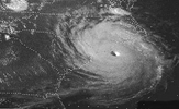
The tracks currently being spit out remind me more of a tamer Fran or Hugo with the rotting ULL over inland deep south turning the storm more NNW as it comes in.
lexxnchloe
Member
My first prediction. 961 mb landfall just S of Charleston
Yeah, literally been decades or maybe even longer since we had that high impact of a tropical system IMBY. I’m not even sure Hugo was that bad in the western Triangle. I would personally like to wishcast this storm offshore. I have no interest in going through that again!You’re not even mentioning Chantal, which had a landfall in SC and a major impact in especially parts of C NC earlier this year with tornadoes and record 24 rainfall in some areas. Most years don’t have that much impact in the Carolinas.
Textbook Miller A track for C NC!12z euro incoming
View attachment 175101
Brent
Member
I don't think I've ever seen a setup like this either. Hurricane Diane did approach the North Carolina coast from the west when it was doing some bizarre gymnastics in the Atlantic in 1999 for a short period but never made landfall. This is a one of a kind situation I've never seen before
Dennis is probably the one you're remembering
The same year as Floyd which caused the whole east coast to panic
At one point Floyd was gonna hit Cape Canaveral and then it kept going up the coast
Lol there isn't one
Even forgetting Humberto(which is a huge part of it) the whole potential west turn approaching the coast is bizarre
Gotcha. Yea I realized no true analogue existed but figured I’d float it out there in just in case I missed the obvious.
I’m no met but usually these landfalling TCs (from N of FL to S of NC/SC border) require a HP to the NE steering it westward? Can’t recall a scenario where a stronger TC that’s ESE does the steering, but that's what we are potentially facing here.
Also—not liking the Matthew-esque QPF amounts being spit out for the Carolinas (shifted a bit NW inland verbatim in comparison), but too early on the details at this point. Right?
This is perhaps the most “too early for details” situation in the history of 5 day forecasts lolGotcha. Yea I realized no true analogue existed but figured I’d float it out there in just in case I missed the obvious.
I’m no met but usually these landfalling TCs (from N of FL to S of NC/SC border) require a HP to the NE steering it westward? Can’t recall a scenario where a stronger TC that’s ESE does the steering, but that's what we are potentially facing here.
Also—not liking the Matthew-esque QPF amounts being spit out for the Carolinas (shifted a bit NW inland verbatim in comparison), but too early on the details at this point. Right?

