-
Hello, please take a minute to check out our awesome content, contributed by the wonderful members of our community. We hope you'll add your own thoughts and opinions by making a free account!
You are using an out of date browser. It may not display this or other websites correctly.
You should upgrade or use an alternative browser.
You should upgrade or use an alternative browser.
Tropical 94L - PTC to be issued later today
- Thread starter SD
- Start date
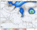
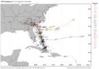
Need to dissect which steering influence wins out based on intensity. Does a stronger storm interact more with the other cane, or the ULL0Z EPS: 29 of 50 hit SE US with ~10-11 as hurricanes
You are thinking like me as far as the effects from what will probably become Imelda. I believe intensity wise it will not approach major hurricane status or possibly even hurricane status. The rainfall totals that I saw yesterday on the Euro showed a maximum of 15 inches + within 30 miles of where I live. That would cause major problems. This morning the Euro has halved the rainfall totals for my area which would still be heavy but would eliminate the possibility of major flooding for rivers, creeks and streams where I live.i've never been concerned about a major damaging wind event inland, i am worried for this thing potentially rotting and exaggerating rainfall amounts for a long duration with everything else going on, like the blocking overhead, etc.
as nice as that would be to be the case, back of the napkin logic (average hodo to take steering currents) says it will slow down. storm motion is NW but wind is lightly flowing SE at 200-300 mb. storm will feel more of that as it deepensHopefully Humberto overachieving increases the chance that 94L will be more influenced by it in a way that helps the SE US.
Humberto is cooking. Wonder what this means for 94L
Stormsfury
Member
Humberto is winding up rapidly, likely a lot stronger, maybe Cat 2 already but he's also moving at a snail's pace as well and compact. Without 94L having a well defined circ. and not knowing where it wants to close off doesn't help with confidence.convection firing over the wave axis. time for 94L to get busy living or get busy dying
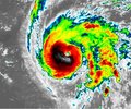
humberto, on the other hand, is overachieving. hot towers have been firing for a while... i just don't think this is a minimum cat 1. we're ahead of schedule
View attachment 175155
Brent
Member
Humberto is cooking. Wonder what this means for 94L
I'm gonna say it won't help the uncertainty
But I'm having a really hard time believing if it grows into a cat 4+ there won't be a major influence
ya nhc estimate is 10-15mb below the initialization for all the hurricane models. makes me think we'll need to take 12z models with a grain of salt if their initialization is all around 994ish. we've had this discussion a lot, does initialization matter yada yada yada... i think it does if stronger means slower for humberto and the thin margins we are dealing with with ULL interaction vs fujiwara carousalHumberto is winding up rapidly, likely a lot stronger, maybe Cat 2 already but he's also moving at a snail's pace as well and compact. Without 94L having a well defined circ. and not knowing where it wants to close off doesn't help with confidence.
I'm not on facebook really, but i'm seeing some tweets that if they migrate to FB, will get some panic drummed up in WNC.
way too early to know if its warranted but this is evil timing with Helene 1yr anniversary tomorrow
on the meteorology side, we all know the possibility for inland flooding is present with the crawl/about face modeling has, but too early to highlight specific inland areas IMO. I would venture to say most of NC and SC are still in play for that
Last edited:
Can you share some of the dooms day tweets?I'm not on facebook really, but i'm seeing some tweets that if they migrate to FB, will get some panic drummed up in WNC.
way too early to now if its warranted but this is evil timing with Helene 1yr anniversary tomorrow
on the meteorology side, we all know the possibility for inland flooding is present with the crawl/about face modeling has, but too early to highlight specific inland areas IMO. I would venture to say most of NC and SC are still in play for that
Can you share some of the dooms day tweets?
This is the first one that i saw. nothing crazy hype but scary enough for a scarred community. I just wish we'd hold off a little bit on deciding who inland is getting big rain when we don't know with certainty it'll even make landfall (although that window for not seems to be closing)
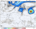
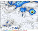
if i were to guess, 12z icon is about to fuji with a much stronger humberto (931mb vs 944) this run
edit. not really a fuji i guess, but ots
edit. not really a fuji i guess, but ots
Last edited:
12z rgem looks like if it went further, it'd make landfall, but still have a few more cycles to get into range
12z nam was gonna end up ots
12z nam was gonna end up ots
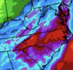
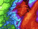
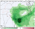
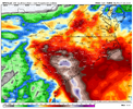
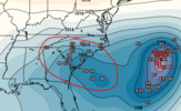
EPS Mean increasing...likely seeing more interaction with the trough to the west.Comparing the runs over the past few days of QPF (5-7 day). Painting now 5-7 across NC/SC. Obviously with models in more agreement to a landfall QPF has ramped up. View attachment 175162View attachment 175163View attachment 175164
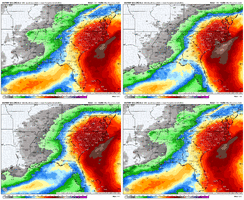
Man maybe I need to chase to Bermuda
Tsappfrog20
Member
Gfs has Landfall in Charleston
Sent from my iPhone using Tapatalk
Sent from my iPhone using Tapatalk
Brent
Member
I can't even believe Humberto right now
That water between Puerto Rico and Bermuda has been on fire this year
That water between Puerto Rico and Bermuda has been on fire this year
Moving a lot slower inland than the last several GFS runs as expected. Looks to be stalling, joining euro in that solution
looks like it's gonna wanna spin and rot inland turning into an absolute rainfall mess for someLets see where it goes after landfall, but 978 into CHS this run from the GFS
I really feel like this is gonna be the story for this one, assuming landfall occurs. There's just nothing to whisk it awaylooks like it's gonna wanna spin and rot inland turning into an absolute rainfall mess for some
Yeah just kind of rots over SC. These look underdone with that stalling tbh
Yeah, likely underdone, though probably about 2" too high at @SD 's house.
rainfall forecast probably underdone with regards to the duration and the dynamics at play
Stormsfury
Member
Very close. Should be by 5pm. 100%
storm will be smaller and getting dry air wrapped into it, my lean is that a landfall would be bad flooding-wise but i don't think we have the horses to make this upper-echelon/biblicalYeah just kind of rots over SC. These look underdone with that stalling tbh
View attachment 175173
Stormsfury
Member
Geez, that looks like Oct 2015 numbers...Yeah just kind of rots over SC. These look underdone with that stalling tbh
View attachment 175173
Still raining next Friday am lol
Stormsfury
Member
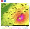
These winds would still be a problem, especially prolonged over wet ground. North Charleston's peak gust during Hugo was recorded at 98mph.Sullivan’s Island/IOP landfall on the GFS. Hugo esque location View attachment 175171
humberto is going beast mode lol might be a 4 before the sun sets
what about the interaction with a modest ull? i'm not well versed in dynamicsstorm will be smaller and getting dry air wrapped into it, my lean is that a landfall would be bad flooding-wise but i don't think we have the horses to make this upper-echelon/biblical

