-
Hello, please take a minute to check out our awesome content, contributed by the wonderful members of our community. We hope you'll add your own thoughts and opinions by making a free account!
You are using an out of date browser. It may not display this or other websites correctly.
You should upgrade or use an alternative browser.
You should upgrade or use an alternative browser.
Tropical TS Imelda
- Thread starter SD
- Start date
mx3gsr92
Member
ICON is on Tylenol.
ICON is on Tylenol.
it was dang close, though
lexxnchloe
Member
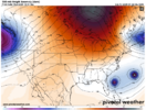
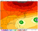
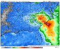
It didnt landfall at 12Z eithericon is good seashell and metal detecting beach conditions from this: (between hour 108-114, we lost the landfall on this run)
View attachment 175139
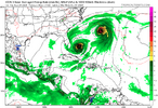
Much further nnw at 0Z
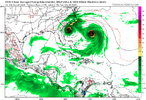
lexxnchloe
Member
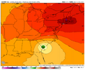
Stronger than 0ZGFS is pretty locked in. Bending NW here
View attachment 175146
dsaur
Member
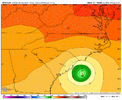
I hope you kept a generator. That might keep the storms off of you.18Z Euro: hits near NC/SC border:View attachment 175131
0Z: So far, similar to 12Z with GFS hitting Myrtle Beach while Icon, CMC, and UKMET again all Fujiwara 94L safely OTS
JMA only goes out to 72 at 0Z…so, can’t tell much
Euro is next
—————-
0Z UKMET:
NEW TROPICAL CYCLONE FORECAST TO DEVELOP AFTER 48 HOURS
FORECAST POSITION AT T+ 48 : 22.5N 76.7W
LEAD CENTRAL MAXIMUM WIND
VERIFYING TIME TIME POSITION PRESSURE (MB) SPEED (KNOTS)
-------------- ---- -------- ------------- -------------
0000UTC 28.09.2025 48 22.5N 76.7W 1004 39
1200UTC 28.09.2025 60 24.8N 76.1W 1003 41
0000UTC 29.09.2025 72 25.6N 76.6W 1000 42
1200UTC 29.09.2025 84 26.5N 77.1W 999 40
0000UTC 30.09.2025 96 27.3N 77.3W 997 43
1200UTC 30.09.2025 108 27.3N 77.3W 995 43
0000UTC 01.10.2025 120 27.1N 75.4W 992 44
1200UTC 01.10.2025 132 27.3N 73.5W 989 44
0000UTC 02.10.2025 144 28.8N 70.0W 984 52
1200UTC 02.10.2025 156 30.8N 65.1W 979 69
0000UTC 03.10.2025 168 34.6N 57.8W 972 76
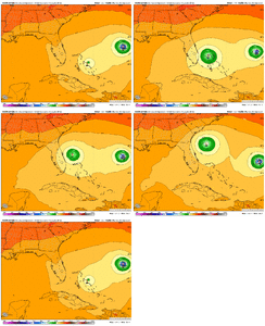
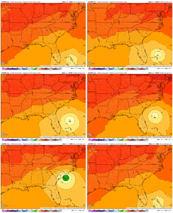
0Z Euro stalls for 48 hours just offshore SC/GA before turning back WNW into Beaufort, SC and not til Thu night!
View attachment 175148
i'd assume the ull is overpowering what "should have been" a fujiwara which is leading to the much later hit.. the ull tugs hard enough to let the other storm leave and it spins a bit from the tussle before coming into the se coast
interesting development, and goes with my idea right now with a stronger ull winning out
Downeastnc
Member
Crazy to look at timing differences in the ensembles its all over the place with the hits some hit Monday some Thur/Fri....0Z EPS: 29 of 50 hit SE US with ~10-11 as hurricanes
Blue_Ridge_Escarpment
Member
6Z GFS coming in with a landfall further south in SC closer to Charleston
Blue_Ridge_Escarpment
Member
6Z HMON appears to have its sight set on Charleston Harbor as well
LONG TERM /SUNDAY THROUGH THURSDAY/...
As of 230 AM Friday...
* While there is still significant uncertainty in the future track
and intensity of 94L, the chances for wind, rainfall, and rip
current impacts for a portion of the Southeast coast are
increasing.
A complicated and highly sensitive forecast is expected to evolve
across the Southeast CONUS driven by two features that are known for
low predictability forecasts until they are sampled adequately
(closed mid-level lows and tropical systems that have not formed
yet). The former is now more readily being sampled and providing
increased confidence in its placement and evolution by increased
supplemental upper-air soundings occurring across the Southeast, but
the latter is still about 24-48 hours from forming. Pinning an exact
center of circulation of Invest 94L after several land interactions
around the Dominican Republic, Haiti, and eventually the Bahamas
will be the final key to the puzzle that is currently lacking.
Although deterministic guidance has been showing a potential
scenario of landfall somewhere from the GA to NC coast Mon or Tues,
the multi-model ensemble approach (all 100 members from EPS, GEFS,
CMC) still shows significant differences in 94L`s center location by
Mon afternoon (with 75% or members having its center somewhere
within a 900 mile distance between north-central Cuba and the NC
coast Mon afternoon). The forecast is far from a slam dunk and a lot
can/will change, but there is enough support to warrant at least
increased awareness on the forecast for 94L with subsequent forecast
updates, especially after the circulation center is established. We
are encouraging residents to review their emergency action plans and
emergency kits.
With that said, let`s dive into the latest forecast. Regardless of
direct tropical impacts from 94L, a prolonged period of light to
moderate rain will bring mostly beneficial rainfall to central NC
Sun through potentially Tues night as anomalous moisture remains in
place with lingering influence from the mid-upper low just to our
west. Some northward advection of tropical moisture well ahead of
any tropical system could combine with marginal instability to
result in pockets of heavy rainfall, likely maximized in the
afternoon and late evening each day, and bring a risk for localized
urban and poor drainage flooding. From Wed and beyond, high pressure
is expected to move across the Northeast and down into the Mid-
Atlantic with a return to below normal PWAT values, suggesting a
drying trend for mid-late week.
As far as the latest on 94L, with the 12z multi-model ensemble
guidance and 18z global ensemble guidance, there is now moderate
confidence that it will track west-northwest between Cuba and the
Bahamas before turning north through the northern Bahamas. After
which point, forecast confidence decreases drastically with a
variety solutions ranging from staying out to sea and kicking
towards Bermuda, riding north and remaining well off the NC coast,
or making landfall along the Southeast coast somewhere between
southern FL to eastern NC. We expect forecast confidence in its
track to greatly increase over the next 24-48 hours, so stay tuned,
stay prepared, and be ready to take action/preparations if
necessary.
&&
This sums up the situation pretty well I think concerning 94L. Nothing is written in stone yet but this is something that we will be watching and could have a wide impact for many of us who live in the Southeast.
I was thinking that the ICON may be close to scoring a coup, but then the 6z runs came out. It still may, if 94L is greatly delayed. But man, the GFS and Euro Ops really are worrisome with gusts in the 50s and a foot + of rain over a widespread area.
Shaggy
Member
I'd suspect a wide area of warnings along the coast with the models showing TS winds along large areas of SC/NCI was thinking that the ICON may be close to scoring a coup, but then the 6z runs came out. It still may, if 94L is greatly delayed. But man, the GFS and Euro Ops really are worrisome with gusts in the 50s and a foot + of rain over a widespread area.
Brent
Member
I'm really surprised the NHC hasn't started a PTC yet. It's basically over the Bahamas already
I don't think they want to make a forecast for this


I don't think they want to make a forecast for this
You must’ve missed this past winter. There’s a guy in Moyock who was measuring snow in feet. It’s the new snow capital of the Southeast!LOL. First time I’ve heard Moyock on here. I’m in ECity.
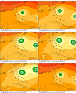
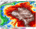
It’ll be a little more west I think but not enough to make a difference for you guys.Didn’t see the 6z Euro posted. It is back to a slightly faster solution. Almost the whole state of NC gets 6”+ of rain
View attachment 175149
View attachment 175150
Wxman57 on Storm2K said NHC is waiting until a LLC is formed.I'm really surprised the NHC hasn't started a PTC yet. It's basically over the Bahamas already
I don't think they want to make a forecast for this


Basically devastates the same areas that got historically flooded on July 6 from Chantal.
(Too early for details, though.)
Brent
Member
Wxman57 on Storm2K said NHC is waiting until a LLC is formed.
A PTC is before that though to warn of the potential and issue watches
If it has a closed circulation its already a cyclone
lexxnchloe
Member
Weaker as wellDidn’t see the 6z Euro posted. It is back to a slightly faster solution. Almost the whole state of NC gets 6”+ of rain
View attachment 175149
View attachment 175150
Blue_Ridge_Escarpment
Member
So pretty much the entire 6Z suite including the hurricane models are coming in more south and what is troublesome for the WNC crowd is this thing stalls out somewhere near Gatlinburg for a bit with a combination of strong mid level winds is not a good recipe.
BHS1975
Member
Hasn't the ICON been doing the best so far this year?I was thinking that the ICON may be close to scoring a coup, but then the 6z runs came out. It still may, if 94L is greatly delayed. But man, the GFS and Euro Ops really are worrisome with gusts in the 50s and a foot + of rain over a widespread area.
Last edited:
Tropical systems entering the Carolinas from the Atlantic don’t typically push far enough inland to have much effect on the western Carolinas but so far modeling is showing this won’t be a problem. Not seeing that sharp gradient/cutoff we normally do here. Messy
Brent
Member
All the hurricane models landfall on Monday basically 
Euro AI has it going OTS.
convection firing over the wave axis. time for 94L to get busy living or get busy dying
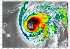
humberto, on the other hand, is overachieving. hot towers have been firing for a while... i just don't think this is a minimum cat 1. we're ahead of schedule
View attachment 175155
Hopefully Humberto overachieving increases the chance that 94L will be more influenced by it in a way that helps the SE US.
Yeah H intensifies ahead of schedule is a wild card, making a complex forecast even more complex. But hopefully in a good way.convection firing over the wave axis. time for 94L to get busy living or get busy dying
humberto, on the other hand, is overachieving. hot towers have been firing for a while... i just don't think this is a minimum cat 1. we're ahead of schedule
View attachment 175155
Also probably one of the times hurricane models aren't the best, 2 systems too close they can't process that properly.
We always say it but until we have a well defined LLC, no way of knowing anything yet
Brent
Member
Hopefully Humberto overachieving increases the chance that 94L will be more influenced by it in a way that helps the SE US.
Yeah I'm still wondering if Humberto won't keep this down somewhat at least on the wind surge front
i've never been concerned about a major damaging wind event inland, i am worried for this thing potentially rotting and exaggerating rainfall amounts for a long duration with everything else going on, like the blocking overhead, etc.
Last edited:

