-
Hello, please take a minute to check out our awesome content, contributed by the wonderful members of our community. We hope you'll add your own thoughts and opinions by making a free account!
You are using an out of date browser. It may not display this or other websites correctly.
You should upgrade or use an alternative browser.
You should upgrade or use an alternative browser.
Tropical 92L
- Thread starter SD
- Start date
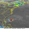
Just based on the satellite presentation I wouldn't be surprised if this is td2. Seemingly a closed circulation with a persistent convective blob to the N of the circulation.
Brent
Member
Recon close but not quite so far. Definitely some decent wind though
It's going to be interesting to see when the steering starts to collapse for this whether that's over S GA or just off shore. Then the ultimate fate of the remnant circulation and moisture plume
If that "cold front" and associated trough were a bit quicker in moving east, it might kick this potential tropical system in a more northerly direction and give NC/SC some of the rain it needs. As of now, it looks like whatever develops might be headed to the GA/FL border. I'm happy for the folks in that area, some of them could use the rain too.
Brent
Member
Hmmm recon found some west winds 
Southwestern Atlantic Ocean (AL92) Updated:
Data from an Air Force Reserve reconnaissance aircraft indicates
that the small area of low pressure located about 150 miles
northeast of the northernmost Bahamas does not have a well-defined
surface circulation. Environmental conditions remain marginally
conducive for further development and this system could become a
tropical depression while the low moves west-northwestward at 10 to
15 mph. The system is expected to approach the northeastern coast
of Florida or the Georgia coast early on Friday. Another Air Force
Reserve reconnaissance mission is planned for Thursday morning, if
necessary.
* Formation chance through 48 hours...medium...40 percent.
* Formation chance through 7 days...medium...40 percent.
Downeastnc
Member
It's going to be interesting to see when the steering starts to collapse for this whether that's over S GA or just off shore. Then the ultimate fate of the remnant circulation and moisture plume
Looks pretty decent right now all things considered. To bad it doesnt appear that it will do anything to help the building drought here.
Increased from 40% to 50%:
NWS National Hurricane Center Miami FL
800 PM EDT Thu Jun 20 2024
For the North Atlantic...Caribbean Sea and the Gulf of Mexico:
Active Systems:
The National Hurricane Center has written the last advisory on the
remnants of Alberto, which are located inland over northeastern
Mexico.
1. Southwestern Atlantic Ocean (AL92):
Satellite imagery shows that shower activity associated with the
area of low pressure located about 175 miles north-northeast of the
northern Bahamas has become a little better organized during the
past 24 hours. However, earlier Air Force Reserve Hurricane Hunter
aircraft data indicated that the system does not have a well-defined
circulation. Environmental conditions remain marginally conducive
for additional development and this system could become a tropical
depression while the low moves west-northwestward at 10 to 15 mph.
The system is expected to approach the northeastern coast of Florida
or the Georgia coast early on Friday, and interests there should
monitor the progress of the system. Another Air Force Reserve
aircraft is scheduled to investigate the system on Friday morning,
if necessary.
* Formation chance through 48 hours...medium...50 percent.
* Formation chance through 7 days...medium...50 percent.
So this is supposed to get shunted S and SE, and not give y’all any drought relief?? That’s odd
Downeastnc
Member
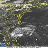
It's got a nice flare up under way...deep convection and it does appear slightly more stacked might try to do something crazy and get named.Hmmm…this is from 8:36PM EDT: I don’t know if that deepest convection is near the center, but if it is or if the center has jumped westward to it, it likely is getting better organized. And this is not far after DMIN:
View attachment 148053
Last edited:
Downeastnc
Member
I mean how do we not get rain here from this track....need some more north shifts.
lexxnchloe
Member
I mean how do we not get rain here from this track....need some more north shifts.
Will anything be left of it when it gets to NC? Also, if we have the same pattern look out SE coast in AUG/SEPT
Brent
Member
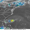
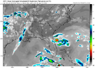
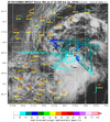
Here’s what the 18Z GFS had for the 9PM EDT IR satellite view:
View attachment 148055
Compare that to an actual 9PM IR satellite pic: not even close
View attachment 148056
Yeah I'm kind of surprised the NHC hasn't upgraded... Or at least a PTC given warnings are needed now
Fair the recon didn't actually find a center entirely but it's definitely improved since then
I mean how do we not get rain here from this track....need some more north shifts.
A lot of models are bringing the high pwats/ moisture envelope into our area from this. I think the nam had pwats over 2 on soundings.
Downeastnc
Member
Yeah recon is needed to see how well it's gotten organized but the sat loops are pretty convincing that it's close enough to get at least a PTCYeah I'm kind of surprised the NHC hasn't upgraded... Or at least a PTC given warnings are needed now
Fair the recon didn't actually find a center entirely but it's definitely improved since then
Yeah recon is needed to see how well it's gotten organized but the sat loops are pretty convincing that it's close enough to get at least a PTC
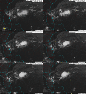
I wonder if this really has already made it as far N as 30N as IR images are at least suggesting is possible. If so, it would appear to be tracking further N than progged (this loop ends at 10:35PM):
Downeastnc
Member
I wonder if this really has already made it as far N as 30N as IR images are at least suggesting is possible. If so, it would appear to be tracking further N than progged
Yeah it's hard to say but the mlc does seem to have a wnw component for sure...
No recon till 8 am
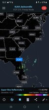
I need it to shift a little bit more west. Been bone dry here in Union County the past month. I know we all need it and hope some of us can cash out on it.A lot of models are bringing the high pwats/ moisture envelope into our area from this. I think the nam had pwats over 2 on soundings.
Downeastnc
Member
Brent
Member
Super weak if there's anything there
It might steal Beryl but probably barely
It might steal Beryl but probably barely
Last edited:
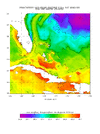
92L is now roughly centered over the Gulf Stream. So, SSTs have risen from yesterday’s ~81F to about the warmest to be crossed or in the 83-84F range. These warmest waters extend W to ~80 west long. Then they cool back to 81-2F to the coast.
Recon has been checking it out. I don’t know if they’re still there.
Recon has been checking it out. I don’t know if they’re still there.
Per recon center fix of 30.3N, 79.5W, center is on the far N edge of the main convection. Is this organized enough to warrant TD status?
Not quite as of yet:
Special Tropical Weather Outlook
NWS National Hurricane Center Miami FL
1035 AM EDT Fri Jun 21 2024
For the North Atlantic...Caribbean Sea and the Gulf of Mexico:
Special outlook issued to update discussion of the low pressure
system over the southwestern Atlantic (AL92).
Southwestern Atlantic Ocean (AL92):
Updated: Recent data from an Air Force Reserve reconnaissance
aircraft and visible satellite imagery indicate that the area of
low pressure located about 120 miles east of Jacksonville, Florida,
has developed a well-defined center of circulation and is
producing winds to near 35 mph, but the associated showers and
thunderstorms are not quite organized enough for this system to be
considered a tropical cyclone. However, only a small increase in
the organization of the showers and thunderstorms could result in
the formation of a short-lived tropical depression before it
reaches the coast of northeastern Florida or Georgia tonight, and
interests there should monitor its progress. For more information,
refer to High Seas Forecasts issued by the National Weather Service,
as well as local forecasts issued by your local National Weather
Service Forecast Office.
* Formation chance through 48 hours...medium...60 percent.
* Formation chance through 7 days...medium...60 percent.
Brent
Member
The NHC really does not want to upgrade this storm 
I guess this will settle the argument about naming too much stuff if they don't
I guess this will settle the argument about naming too much stuff if they don't
The NHC really does not want to upgrade this storm
I guess this will settle the argument about naming too much stuff if they don't
They could take the middle road and upgrade it to a TD and avoid the name.
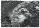
There is new convection that has popped since the special TWO was released very close to the center, which is now over the Gulf Stream with its 83-84F SSTs:
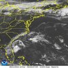
Stormsfury
Member
We need two things to happen in the SE from now til Sunday.
We need this to increase moisture available to at least bring much needed rains to the area and 2) dirty up the ridge to help at least give the SE afternoon thunderstorm chances in light of what could be a ridiculous stretch of 100+ temperatures starting Monday thru Thursday (if the GFS/EURO temp outputs are close to being right).
It's literally rained solid only once locally in the last 4 weeks and that was with a destructive thunderstorm that I just missed the core of large hail and destructive winds that impacted parts of Summerville, Ladson and Goose Creek back on the 10th of June. (Hail @ around 2" with some scattered 2.5" reports) and an 80 to 85mph downburst.
If they don’t designate this as a TD, I won’t be surprised if this gets upgraded in the post tropical cyclone report.They could take the middle road and upgrade it to a TD and avoid the name.
There is new convection that has popped since the special TWO was released very close to the center, which is now over the Gulf Stream with its 83-84F SSTs:
View attachment 148061
BHS1975
Member
Vis image from 11:52AM: one can see the obvious shear blowing convection southward from the center. But can’t a TC be sheared?
View attachment 148070

Sent from my iPhone using Tapatalk
Sent from my iPhone using Tapatalk
Your post (image?) didn’t come through.
Tropical Weather Outlook
NWS National Hurricane Center Miami FL
200 PM EDT Fri Jun 21 2024
For the North Atlantic...Caribbean Sea and the Gulf of Mexico:
1. Southwestern Atlantic Ocean (AL92):
Satellite imagery and National Weather Service Doppler radar data
indicate that showers and thunderstorms associated with a
well-defined low pressure area centered about 80 miles
east-southeast of Brunswick, Georgia, continue to lack the necessary
organization for the low to be considered a tropical cyclone.
Recent Air Force Reserve reconnaissance aircraft data indicate that
winds to 35 mph are occurring in association with the low. Only a
small increase in the organization of the showers and thunderstorms
could result in the formation of a short-lived tropical depression
before it reaches the coast of northeastern Florida or Georgia
tonight, and interests there should monitor its progress. For more
information, refer to High Seas Forecasts issued by the National
Weather Service, as well as local forecasts issued by your local
National Weather Service Forecast Office.
* Formation chance through 48 hours...medium...60 percent.
* Formation chance through 7 days...medium...60 percent.
lexxnchloe
Member
They can but it looks pretty bad and whatever weather it brings wont be a big deal. Maybe we can get a 1996 bertha type stormVis image from 11:52AM: one can see the obvious shear blowing convection southward from the center. But can’t a TC be sheared?
View attachment 148070
They can but it looks pretty bad and whatever weather it brings wont be a big deal. Maybe we can get a 1996 bertha type storm
I’ll pass on a Bertha type. Weak is fine with me! Regardless, a Bertha type or even worse is inevitable at some point. Hopefully no time soon!
One band of showers came through here during the last hour or so. The rain wasn’t heavy and it didn’t last long. Interesting to see and comment on nevertheless.
Last edited:

