• Hello, please take a minute to check out our awesome content, contributed by the wonderful members of our community. We hope you'll add your own thoughts and opinions by making a free account!

Severe 4/4-4/6 Severe Threat

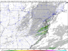
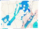
Clearing here. RAP/HRRR bringing over 1500 CAPE to most of central and eastern NC. SHR meh, but up toward SE VA along the warm front is looking like it has some potential later today
 
Clearing here. RAP/HRRR bringing over 1500 CAPE to most of central and eastern NC. SHR meh, but up toward SE VA along the warm front is looking like it has some potential later today
I was hoping it would stay cloudy and rainy all morning. I think that helped us avoid more severe storms last week.
 
Surely, the greatest threats were flooding and lightning with those storms last night, for my area. It was still as a corpse. Wind was not a factor.
Here in northern GVL county in SC it wasn't much more than a rainstorm.
No wind only a couple of strikes of ⚡ & thunder.
Nothing Sevier or even borderline.
Thankful watching places to my south & west.
 
Clearing here. RAP/HRRR bringing over 1500 CAPE to most of central and eastern NC. SHR meh, but up toward SE VA along the warm front is looking like it has some potential later today
It's a good set up for our area locally to have a severe storm or 2 that has broad rotation but I think our biggest threat with long straight hodos and steepening mid layer lapse rates will be abnormally large hail for our area and maybe some downbursts. I wouldn't entirely rule out a weak brief tornado as far west as US1 but it's going to be really hard to tighten any rotation up imo.
 
Full Sun is out here..

Currently
74F
Pressure 29.63 in
Visibility 10 miles
Clouds Partly Cloudy
Dew Point 65 F
Humidity 65 %
 
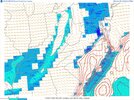
Little more warm sector development now. HRRRRRRRR says excitement ain’t till 4-5pm at least
 
Little more warm sector development now. HRRRRRRRR says excitement ain’t till 4-5pm at least
I get more worried about severe weather here when we've had some clearing and the sun has been out a while as opposed to what we had last week when it was raining all day. Seems that's when we have a better shot at having more widespread events, usually happening in the late afternoon and early evening. It's either then or we have it happen overnight when it's been warm for a while.
 
C416132E-E4FD-4613-885C-5408E6CC0BFE.png
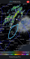
Probably the area to watch for development of cells over the next 60-90min. Little more bubbling of clouds and now some radar response in that region
 
Back
Top