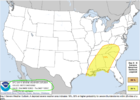
The GFS in the past few days has been barking at this.

Western Alabama.

Western Alabama.

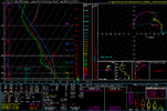
Thermodynamics don't look to be short from a quick look at that sounding ?The GFS in the past few days has been barking at this.
Western Alabama.
Decent sub 1000mb low with very good moisture. Always something to watch in the springDefinitely still have to watch this period, a ton of moving pieces here.
GFS is more of a dry line type deal. That would be different.
Euro isn’t far from something really nasty from extreme north AL through Kentucky. It keeps the first system much weaker and the atmosphere is better for the main following trough.Decent sub 1000mb low with very good moisture. Always something to watch in the spring
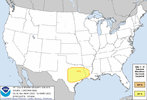
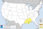
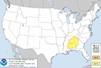
I am unsure of the accuracy but this model has painted a pretty good picture for the last couple events
Mind posting some euro stuff for Thursday? Looks like it may have something on the trash mapsThis is the first severe threat that's really going to move into a relatively hot air mass but moisture return may be lacking.
Seem to be stuck in a pattern with threats in the middle of the week.
So south Bama gonna get it rough again?That Tuesday threat looks gnarly for south Alabama,
Very good directional shear your biggest caveat is probably instability.
Maybe, I'd like to see the nam in range, but better placement of 500mb trough and winds for cellular development, 2nd wave may end up being worse in the end but don't really know at this point. Definetly better moisture these two rounds than all the previous ones this season.So south Bama gonna get it rough again?


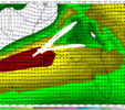
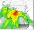
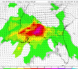
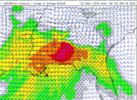
Your going to have some pretty hefty rain totals along that divergent jet axis. 18z still on board with 12z your main severe threat is going to be that south Alabama area mainly along and south of the boundary set up by the rain cooled air mass.
Talking about Tuesday with the post above.I’m assuming you mean with Wednesday event. But Tuesday a lot of areas will see 1-3 inches of rain. So Wednesday you may see some flooding issues
Sent from my iPhone using Tapatalk
Wensday has a lot more potential for our neck of the woods. NAM isn't in range so I haven't really checked that one. Our first real threat with widespread 2000-3000+ cape values. If what the nws is saying in there forecast happens wensday the environment is going to be really conducive for severe storms/ tornadoes. I'm really intrigued highest potential for discrete convection so far this year will be wensday .Bham NWS seems to be ramping up the Wednesday threat in their afternoon discussion.
Tuesday through Wednesday.
A low level jet of 40-50 kts will track eastward across Alabama Tuesday
morning. This will pull a surface warm front rapidly northward into
south Alabama Tuesday morning. Before the better forcing exits Alabama
later in the morning, there may be an overlap of lift and instability
across areas along and south of I-85 Tuesday morning. This area would
be favored for any severe storms, with enough helicity and shear for
tornadoes. Tuesday afternoon a little more nebulous for location
of severe storms, with some weak subsidence on the back side of
the exiting low level jet. The models are converging on a zone
of convection developing along the I-20 corridor, where
instability and CAPE increase due to diurnal heating. This may the
position of the surface warm front. Things settle down far
quickly after sunset Tuesday, and expect minimal activity during
the overnight period. Convection will ramp up on Wednesday as a
cold front enters northwest Alabama. Surface based CAPE will likely
exceed 2000 J/kg by early afternoon, possibly reaching 3000 J/kg
across areas south of I-20 in the afternoon. SRH and EHI values
have also increased with the 12Z model runs, and included a threat
for tornadoes on Wednesday, in addition to damaging straight line
winds and large hail. The stronger storms will linger into the
evening as the cold front progresses southeast.
58/rose
000Can anyone pull the latest GSP discussion? Thank you
Sent from my iPhone using Tapatalk
Last few model runs of globals have crapped on the wensday threat, more so to a severe thunderstorm threat rather than tornado with the lack of SRH helicity. But I've seen the CAMs revitalize systems that the globals have killed off, best to wait till CAMs get in range for the wensday threat.Huntsville is not ruling out tornadoes on Tuesday but it’s conditional. Wednesday looks like more of a damaging wind threat with the dry air aloft.
View attachment 116704
