• Hello, please take a minute to check out our awesome content, contributed by the wonderful members of our community. We hope you'll add your own thoughts and opinions by making a free account!

Severe 4/12 - (?) Severe Weather

What a tornado

Meanwhile we had a tornado watch I'm 3 hours south and it's been sunny all evening lol hasn't been one storm in Oklahoma that I've seen

The cap was just strong enough to choke off the updrafts that tried to take off (around Lawton). They ended up cancelling the Watch shortly after issuing it.

It was a razor thin close call though. A degree or two difference in temp/dewpoint, or slightly better forcing, and it would probably be a pretty active evening in OK too right now.

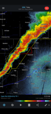
1651285861550.png
 
Last edited:
From what I see yeah that tornado is gonna be on the higher end. We'll see what daylight brings but the initial images are very bad(especially the YMCA)
 
From what I see yeah that tornado is gonna be on the higher end. We'll see what daylight brings but the initial images are very bad(especially the YMCA)

Yeah was pretty violent, EF2/3 easy IMO just based on motion....that drone video showed some major vertical motion lifting entire roofs or hell maybe even entire homes well into the air....crazy stuff.

 
Thursday/ Friday time frame looks intriguing for Alabama and the southeast. Westerly 500mb winds.
 
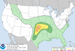
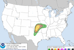
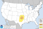
Tomorrow is gonna be another day where it will come down to if the cap breaks and storms develop off the dry line for OKC, but the SPC did go with 10% tornado probabilities down here

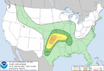
Wednesday might be the more interesting day now as the we’ve now got a day 4 30% ring introduced this morning.
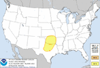
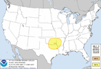
74106204-582B-4F1E-8B62-3F5F18932320.gif4E310895-1D4E-489A-BFB9-1C1ADC0A527F.gif49C8B4B5-309D-448B-A86B-722579BB8B85.gif
 
Yeah I'm not sure what to expect here. Wouldnt surprise me if Kansas is the bullseye again tomorrow like Friday. Even if storms go out towards OKC it'll probably be after dark before they get here

Wednesday definitely could be the bigger day if the timing lines up
 
Hi-Res models are now looking really chaotic with convection evolution this evening.

Some are even bringing a MCS through the Metroplex, with little activity in OK.

It seems the Hi-Res models are struggling with whether the corfidi vectors or instability gradient will drive storm propagation, provided it does organize into a complex.

The former would support a more NE-ward trajectory, and the latter would support a more SE-ward trajectory.
 
Back
Top