-
Hello, please take a minute to check out our awesome content, contributed by the wonderful members of our community. We hope you'll add your own thoughts and opinions by making a free account!
You are using an out of date browser. It may not display this or other websites correctly.
You should upgrade or use an alternative browser.
You should upgrade or use an alternative browser.
Severe 3/21-3/24 Severe Weather
- Thread starter SD
- Start date
bingcrosbyb
Member
Amazing only 1 death from this tornado.
A band of moderate to heavy rain with likely embedded thunderstorms is to our SW and is moving NE toward this area, probably arriving within the next 1/2 hour. I’ll be bringing home my brother from the hospital (he has just been discharged), but will wait for this mess to go through first as I made the nurse aware of the bad wx coming and there’s flexibility on the timing.
Jessy89
Member

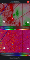
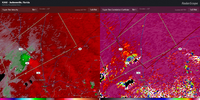
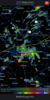
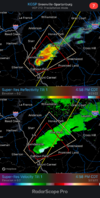
This cell near Knoxville rotating some
Sent from my iPhone using Tapatalk
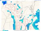
Cape is basically on track like the HRRR has been showing
Satellite imagery showing breaks/some sun in SC and it’s moving north
Something I'm trying to understand is the relationship between cape and DP values. Is there a direct correlation? My weather station has gone from 50DP at 11pm to 66DP at 2:25pmCape is basically on track like the HRRR has been showing
Jessy89
Member
Tennessee and Kentucky just saw a explosion of severe thunderstorm warnings. Few of them has broad rotation
Sent from my iPhone using Tapatalk
Sent from my iPhone using Tapatalk
Dew points is a part of it, mid level lapse rates are another big part, but typically higher dews is more likely to have higher instability, unless mid levels are a issueSomething I'm trying to understand is the relationship between cape and DP values. Is there a direct correlation? My weather station has gone from 50DP at 11pm to 66DP at 2:25pm
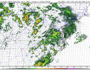
HRRR really trying to do some refiring along the cold front in the overnight bourse from about Raleigh eastward .. could be interesting but obviously limiting factor being time of day
lj0109
Member
lj0109
Member
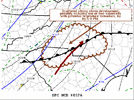
Mesoscale Discussion 0326
NWS Storm Prediction Center Norman OK
0312 PM CDT Wed Mar 23 2022
Areas affected...Parts of the South Carolina into North Carolina
Piedmont
Concerning...Severe potential...Watch possible
Valid 232012Z - 232245Z
Probability of Watch Issuance...40 percent
SUMMARY...Scattered strong thunderstorm development, including one
or two supercells posing a risk for tornadoes, appears possible by
6-8 PM EDT. While it is not certain that a severe weather watch
will be needed, trends are being monitored for this possibility.
DISCUSSION...Low-level warm air and moisture advection, and
insolation with increasing breaks in cloud cover, are contributing
to gradual boundary-layer destabilization along a remnant surface
frontal zone across the Piedmont. With further insolation, and weak
cooling in the 700-500 layer forecast through late afternoon, models
suggest that mixed-layer CAPE on the order of 500-1000 J/kg may
develop. It appears that this will coincide with the
east-northeastward propagation of a 45-50 kt speed maximum around
850 mb.
Mid/upper forcing for ascent appears likely to remain generally
weak, but models have been suggestive that scattered discrete
thunderstorm development is increasingly possible through 22-00Z.
With deep-layer shear already strong, beneath 50-70 kt southwesterly
flow around 500 mb, enlarging, clockwise-curved low-level hodographs
may become favorable for the evolution of at least one or two
supercells that may pose a risk of producing tornadoes.
Jessy89
Member

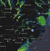
Headed into South Carolina
Sent from my iPhone using Tapatalk
Oh snap

