packfan98
Moderator
Good luck to those who may see some flakes tomorrow!
I mean you got a low pressure splashing up against the mountains.. I’d bet on a warm nose .. but I would also bet u start as snowQuestion: why does the NAM 3km always looks really icy in almost every setup? Does it overdo warm noses a tad?
I feel like these setups work out more than not. Like late March 2018 reminds me of this. Though I think that one was late in the afternoon.Thread=dead
I agree. Ik I will see some sleet but NAM is the most aggressive with icing.I mean you got a low pressure splashing up against the mountains.. I’d bet on a warm nose .. but I would also bet u start as snow

If we are going to do it this time of year this is probably the 2nd best wayI feel like these setups work out more than not. Like late March 2018 reminds me of this. Though I think that one was late in the afternoon.
The rule used to be, the worm nose is always under modeled. But if you have a disagreement between the NAM and RGEM or HRRR, then not sure what to bank on. NAM is normally good with thermals but there have been some resent storms the past few years where it seemed like the HRRR did better here. The NC crew also has examples of where all the models have broken their hearts.Question: why does the NAM 3km always looks really icy in almost every setup? Does it overdo warm noses a tad?
I mentioned this in the March thread before I realized that this was open, but it’s important to note that this potential is from strong FGEN forcing collapses the column to at least temporarily overcome the warm nose. The NAM does not pick up this up well until literally inside just a few hours. The HRRR, RGEM, and RAP do pick up this cooling of the column very well which could be why they are showing less of a warm nose.The rule used to be, the worm nose is always under modeled. But if you have a disagreement between the NAM and RGEM or HRRR, then not sure what to bank on. NAM is normally good with thermals but there have been some resent storms the past few years where it seemed like the HRRR did better here. The NC crew also has examples of where all the models have broken their hearts.
Hoping tomorrow works out!

In marginal setups, the HrrrrrRR almost always shows much more snow at its longer leads and then reduces as we work in.
I feel like realistically in these situations areas that so get heavy snow should drop into that 32-33 range, regardless of what the modeling shows.One thing I noted is the NAM drops the areas with heaviest snow down to freezing.
I feel like realistically in these situations areas that so get heavy snow should drop into that 32-33 range, regardless of what the modeling shows.
Also, as usual, I’d much rather be where you are than where I live for this one.This definitely has the feeling of one where N Durham County gets a ground whitener while all I get is mangled flakes and wet ground.
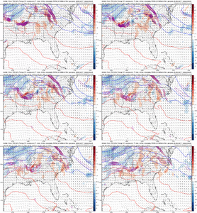
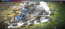
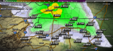
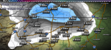 and finally a really sad 18z 3k
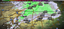
Yeah I think that’s the ballgame. The earlier we can get going and the more forcing, that enhances the chance for the better model depictions.Pretty sweaty forecast in the morning if I'm being honest. Just a couple of degrees in a deep layer makes the difference between a few hours of snow and nothing. If I had to guess right now I think the main change to all snow line even briefly is HKY to RDU to RWI with mixed rain/snow/Sleet possible 25-30 miles south of that, any accumulations are pinned into the better climo areas from say Elkin to Henderson N&W
Really interested to see how this initial shot if fgen and waa manifests on radar if this is accompanied by moderate banded constant precip it may aid in expanding the snow area and increase aerial coverage of light snow accumulations View attachment 134203
