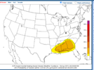
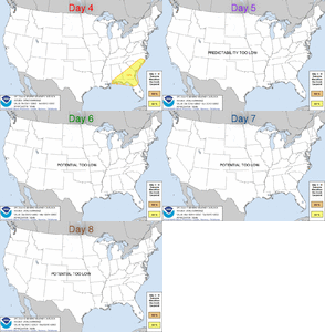
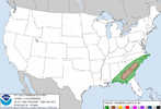
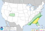
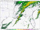
Pretty dynamic system but cape may be lacking
-
Hello, please take a minute to check out our awesome content, contributed by the wonderful members of our community. We hope you'll add your own thoughts and opinions by making a free account!
You are using an out of date browser. It may not display this or other websites correctly.
You should upgrade or use an alternative browser.
You should upgrade or use an alternative browser.
Severe 3/11-12 Severe Weather
- Thread starter SD
- Start date
Z
Zander98al
Guest
You beat me to it lol. Although I was going to wait until a risk area was outlined, either snowflakes or severe weather maybe both ?Pretty dynamic system but cape may be lacking
Z
Zander98al
Guest
Z
Zander98al
Guest
Lines up fairly well with current models. You'll probably see more shifts though. Wether you have a gulf hugger that only gets about a 100 or so miles inland or one that goes north of the apps
Z
Zander98al
Guest
Gee whiz the NAM is REALLY bullish with instability. Almost stupid. Nearing 2000j at midnight near the coast on the day of the potential storms. Looks like the NAM wants to push north of the apps. May have a pretty good system here, some significant height falls. And you'll probably have some really good moisture.
Z
Zander98al
Guest
Nws bham discussion for today.
Friday through Sunday:
A very dynamic mid and upper-level trough moves in Friday and
Friday night, while a deepening surface low moves northeastward
from the Lower Mississippi Valley to the central Appalachians.
Models are trending much wetter with this system along and ahead
of a very strong cold front. Steep mid-level lapse rates around 7
C/km will result in MUCAPE values around 500 to 1000 J/kg with
strong 0-6km bulk shear values around 60 to 80kts. These
parameters and strong dynamics warrant mentioning a low confidence
severe mention to the HWO. Will hold off on introducing a tornado
threat at this time due to uncertainty regarding how fast the
surface low deepens and availability of surface-based instability
which will be dependent on whether convection along the Gulf Coast
will keep the warm front from lifting northward and whether the
wedge erodes. But this may need to be added in further updates.
Given the rain earlier in the week, will have to monitor for a
flooding threat, though at this time the highest amounts are
forecast in the southeast counties which have been fairly dry
lately. Models have been trending a bit slower with the exit of
precipitation with colder air moving in. Have added a slight
chance mention of a brief changeover to a rain/snow mix late
Friday night. At this time no snow impacts are expected, but would
have to monitor for any leftover moisture on roadways freezing as
temperatures fall below freezing.
Z
Zander98al
Guest
Looks like convection will be hugging the coast, that'll make the severe threat here almost zero lol.
Z
Zander98al
Guest
Z
Zander98al
Guest
Z
Zander98al
Guest
Tornado threat on the gulf today maybe a bit higher will check tonight
Z
Zander98al
Guest
I'm actually pretty impressed for a mesoscale boom event. Divergent flow aloft. more favorable and backed shear due to boundary riders and posistioning. 3k cape 150+.
Z
Zander98al
Guest
You very well could have a strong tornado or two in the southern half of Alabama tonight/ tommorow morning. I'm thoroughly impressed
Z
Zander98al
Guest
going to be watching that bottom third of the state closely tonight and tomorrow morning. For any trends
Z
Zander98al
Guest
Z
Zander98al
Guest
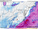
What really concerns me about this in the Carolinas is the potential for a sub 1000mb low to pass through the western piedmont and locally back sfc winds and help pull in 60+ dews. Timing isn't ideal for severe weather so that may be a saving factor vs this coming through late in the afternoon. We have though seen these sfc lows have associated supercells tucked near the triple point/tmb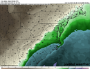


Z
Zander98al
Guest
Gotta watch that point right to the southeast of the low. pressure falls will back the winds. Making for locally higher shear .? Will probably start getting some decent height falls as storms move to around the Florida Alabama state line.What really concerns me about this in the Carolinas is the potential for a sub 1000mb low to pass through the western piedmont and locally back sfc winds and help pull in 60+ dews. Timing isn't ideal for severe weather so that may be a saving factor vs this coming through late in the afternoon. We have though seen these sfc lows have associated supercells tucked near the triple point/tmbView attachment 114997
View attachment 114998
We just saw a ef4 in Iowa from the triple point that happened there a few days ago so will see what happens.
Z
Zander98al
Guest
What we don't want here is an icon like solution where the system is slower and farther NW giving us more time for WAA and an larger warm sector. The big bugaboo in the forecast will be these old fronts and low amplitude waves through Thursday. The more that front is suppressed south the more likely we are to see WAA ride over a relatively cool stable sfc dome with pretty significant divergence over top which means a lot of elevated convection and rain but could help pin the sfc warm front southGotta watch that point right to the southeast of the low. pressure falls will back the winds. Making for locally higher shear .? Will probably start getting some decent height falls as storms move to around the Florida Alabama state line.
We just saw a ef4 in Iowa from the triple point that happened there a few days ago so will see what happens.

