Cbmatt2408
Member
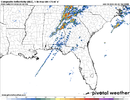
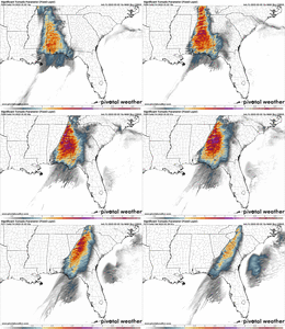
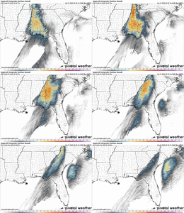
That really is a good thing, because the STPs on the HRRR are over 6 in a lot of areas. If storms broke through today, they could have been extremely intense in central and north GA and AL.
000
FXUS64 KBMX 031517
AFDBMX
Area Forecast Discussion
National Weather Service Birmingham AL
917 AM CST Fri Mar 3 2023
...New MESOSCALE UPDATE...
.MESOSCALE UPDATE FOR THE ONGOING SEVERE WEATHER THREAT...
Issued at 917 AM CST FRI MAR 3 2023
Mesoscale update.
The atmospheric conditions will be quite unusual today as a
powerful shortwave moves from the Lower Mississippi Valley to the
Ohio Valley. Extremely strong wind fields will accompany this
system throughout the column as a surface low deepens to around
978 mb near Paducah at noon today. The warmth and quality of
moisture already in place across Alabama would normally point to a
tornado outbreak. However, there is one significantly negative
ingredient today which makes this setup so unique, warm advection
at 600 mb. It is not often that high severe weather parameters are
wasted in Alabama, especially in the presence of height and
pressure falls. However, it appears that nearly all pre-frontal
development will be restricted by this warm layer. Healthy
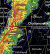
updrafts should be confined along the cold front where a QLCS is
currently being observed in eastern Mississippi. The QLCS is
quickly approaching the AL/MS state line and will cross into our
northwestern counties by 10 AM. As this moves across our forecast
area, the main impacts should be across our northern two rows of
counties, closer in proximity to the upper-level support and
slightly cooler mid-level temperatures. With strong wind fields in
place, these storms may be rather efficient at producing wind
gusts of 60-70 mph. A couple of line-embedded tornadoes are also
possible. Farther south, the mid-level warm layer will become
increasingly prohibitive to updraft development, so much so, that
dewpoints of 70F will not be sufficient for deep convection.
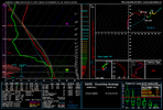
It appears the warm nose aloft is still there over most of AL and probably GA, too. I don't think we are getting 70F dews, so this will limit updrafts and the strong upper level wind fields will tear apart anything taking it's sweet time lifting from the lower levels.

