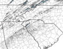
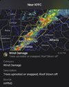
Not as exciting a storm as I expected at my house. Peak rain rate about 2"/hr, just over 0.5" total. Highest guts at my house about 26 mph (keep in mind, the anemometer is only at 4 m).
-
Hello, please take a minute to check out our awesome content, contributed by the wonderful members of our community. We hope you'll add your own thoughts and opinions by making a free account!
You are using an out of date browser. It may not display this or other websites correctly.
You should upgrade or use an alternative browser.
You should upgrade or use an alternative browser.
Severe 3/1-4 SEVERE WEATHER
- Thread starter SD
- Start date
tractor girl
Member
Sunny, balmy with dp 63 and temp 72 in Athens GA right now.
Tor watch comin east
565
ACUS11 KWNS 031912
SWOMCD
SPC MCD 031912
TNZ000-NCZ000-SCZ000-GAZ000-032045-
Mesoscale Discussion 0247
NWS Storm Prediction Center Norman OK
0112 PM CST Fri Mar 03 2023
Areas affected...Eastern Tennessee into parts of northern Georgia
Concerning...Severe potential...Tornado Watch likely
Valid 031912Z - 032045Z
Probability of Watch Issuance...80 percent
SUMMARY...An additional watch will likely be needed for parts of
eastern Tennessee and northern Georgia. Despite weaker
thermodynamics, strong, veering low-level winds will support a risk
for damaging winds and brief tornadoes.
DISCUSSION...A fast moving line of storms will continue eastward
through Middle Tennessee and northern Alabama. Strong wind fields
continue to be sampled by regional VAD data. Some cloud cover has
kept temperatures a bit subdued, particularly in north Georgia.
Parts of eastern Tennessee have warmed into the mid 70s F. Between
cooler temperatures, decreased moisture, and warmer temperatures
aloft (especially with southward extent), the overall thermodynamic
environment will likely be weaker than areas to the west. However,
storm motion in addition to 50-70 kts within the boundary layer
would support a threat for damaging winds even with relatively weak
updrafts. Strong low-level shear would also promote some risk for
brief tornadoes within the line of storms. A watch for parts of this
region will likely be needed this afternoon.
..Wendt/Grams.. 03/03/2023
weatherfide
Member
- Joined
- Jan 5, 2017
- Messages
- 3,076
- Reaction score
- 4,498
That couplet in NW GA is about to cross I-75...
The wind behind the storms ain't no joke, either!
I was watching it come in on my Ring camera that faces west. It is under a 10' overhang and well off the ground but just got knocked offline in the squall.
Same in McCalla AL. Had some of the biggest gusts of the day in the past hour.The wind behind the storms ain't no joke, either!
No wedge to save us today..incoming?
rburrel2
Member
njbarrineau
Member
Looks like the cells in the upstate are trying to strengthen closer to the GA border
Sent from my iPhone using Tapatalk
Sent from my iPhone using Tapatalk
Rome, GA had a gust up to 54. Pretty impressive.
Tuscaloosa had a 71.6 mph gust when the QLCS blew through.
weatherfide
Member
- Joined
- Jan 5, 2017
- Messages
- 3,076
- Reaction score
- 4,498
Is that a tornado near Holly Springs, GA?
Cbmatt2408
Member
The cell just outside of Carrollton, GA is becoming semi-discrete with a little rotation on the south end. Might be worth watching.
WXinCanton
Member
That cell has a warning on it nowIs that a tornado near Holly Springs, GA?
Last edited:
I hate the angle of this line. It’s taking its sweet time..
ForsythSnow
Moderator
That's very very close to my area but we didnt get it that bad


