• Hello, please take a minute to check out our awesome content, contributed by the wonderful members of our community. We hope you'll add your own thoughts and opinions by making a free account!

Tropical 2025 Tropical Thread

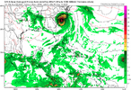
That 0z Euro run last night was wild lmao, apparently it would start lifting north as the run ends, but there’s really no way to avoid it striking the US and causing a lot of damage as configured.

I was a little confused by what’s actually the focus out in the Atlantic, but it looks obvious this morning and it’s cooking now. Probably will get designated soon.
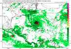
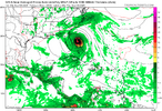
GFS similar to EURO

1756983319732.png

330

1756983746971.png


1756984152998.png
 
Last edited:
Every weather page on facebook is only posting ensembles that are completely opposite to the GFS and Euro operational. Never seen such an avoidance of a topic. Speaks volumes for me. Waiting for consistency run to run.....
 
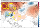
The similarities starting to line up between the op gfs and euro through day 10 are at least worth paying attention to. The OP GFS still shows a much more favorable pattern for a significant coastal and inland SE threat while the Euro suite is still largely coastal scraper or OTS. You could make a strong case that even with a system that far west the 0z Euro largely misses the east coast. A lot of things have to line up properly here to get a system west given the barrage of shortwaves crashing through the NE and off of the SE Canada coast so it's hard to buy scenarios that are well west.

Given the potential for east coast troughing to become less favored the 2nd half of September into at least early October it would be surprising if this is the only threat we have coming up
 
It's really, as always, going to come down to timing, but there are some features showing up that are increasingly concerning (if they are real). The Low back over the SE is not great, as it will act to pull Gabrielle west, if she is in the position that the GFS is showing. If the trough to the north is a little slower, farther north, or weaker, the block behind will build in faster, pulling the storm west.

Lots to watch. But the OTS scenario, while looking extremely likely previously, looks do be diminishing a bit in probability. That doesn't mean a landfall is more likely, but it is increasingly becoming more of a possibility, and so is a strong hurricane. Up until now, the Euro has been very weak.

gfs_z500a_atl_58.png
 
What’s that? That it’s over 10 days out and we have no clue?
We know a couple of things....
Unlikely that it's a fish storm, would have been best scenario.
Likely that it will hit the U.S. somewhere.....worse scenario.
Waiting on day 5 prior to event to better understand exact location.
No model is going to tell us intensity. So we get to experience that one in real time.
I wouldn't quite go likely or unlikely on very much at this point. A few nuance changes here or there will make a big difference in the ultimate outcome.

I tweeted it today, but the GFS tours almost the entire Atlantic-facing coastline from the Antilles to New England! 😂
 
I wouldn't quite go likely or unlikely on very much at this point. A few nuance changes here or there will make a big difference in the ultimate outcome.

I tweeted it today, but the GFS tours almost the entire Atlantic-facing coastline from the Antilles to New England! 😂
Yeah, take your pick on a landing....
 
Yeah, take your pick on a landing....
I get it, but it’s still over 10 days out. Everyone was so sure that Erin would be east of Bermuda at that time frame yet she came west more than some would like to admit. Still a ways out and nothing is in stone, so making statements at this point is futile!
 
I get it, but it’s still over 10 days out. Everyone was so sure that Erin would be east of Bermuda at that time frame yet she came west more than some would like to admit. Still a ways out and nothing is in stone, so making statements at this point is futile!
Why don't we just shut down the site....or you can ignore all of us talk about it. 🤣🤣🤣🤣🤣🤣🤣
 
I get discussion but speaking in absolutes is crazy! 🤣🤣🤣🤣🤣🤣🤣🤣🤣🤣🤣 It could still be OTS or in the gulf!
I don't think anyone has said an absolute. You go with ots or in the gulf it you like. I'm going with East Coast....the best scenario is that it vanishes, but unlikely that will happen. This is what we do. Ignore it is your best option. Just saying.....🤣🤣🤣🤣🤣🤣🤣🤣🤣🤣
 
Check this out from the Happy Hour GEFS: I don’t think that any of these are from Invest 91L, but I’m not saying it’s drunk either. I think these are from a legit system ahead of 91L.
Any thoughts?
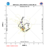
 
Check this out from the Happy Hour GEFS: I don’t think that any of these are from Invest 91L, but I’m not saying it’s drunk either. I think these are from a legit system ahead of 91L.
Any thoughts?

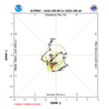
Yeah, that convection that's ahead of 91L is looking healthy and I'll admit...tricked me this morning.

Apparently, there might be a chance it finds its way to the gulf.
 
From something well to the W of 91L coming out of the Caribbean in 6-7 days, the 6Z GEFS is active mainly in the Gulf with a couple E of FL. Some of these members are hurricanes.

*Edit: The GEFS/EPS of the last few days have had the MJO then in or near the most dangerous phase for July-Sept CONUS H hits, phase 2:

IMG_4519.pngIMG_4520.png

———————
Edit: 6Z GEFS suggests there could be another TC coming out of the W Caribbean later.
 
Last edited:
LEAD CENTRAL MAXIMUM WIND
VERIFYING TIME TIME POSITION PRESSURE (MB) SPEED (KNOTS)
-------------- ---- -------- ------------- -------------
1200UTC 05.09.2025 0 13.9N 136.6W 959 79
0000UTC 06.09.2025 12 14.7N 138.4W 967 73
1200UTC 06.09.2025 24 15.3N 140.4W 972 64
0000UTC 07.09.2025 36 16.0N 142.3W 976 63
1200UTC 07.09.2025 48 16.7N 144.2W 980 63
0000UTC 08.09.2025 60 17.5N 146.2W 981 65
1200UTC 08.09.2025 72 18.5N 148.1W 985 60
0000UTC 09.09.2025 84 19.4N 150.2W 995 51
1200UTC 09.09.2025 96 20.0N 152.6W 1004 39
0000UTC 10.09.2025 108 20.6N 154.9W 1008 35
1200UTC 10.09.2025 120 21.5N 157.6W 1011 36
0000UTC 11.09.2025 132 21.7N 159.0W 1011 27
1200UTC 11.09.2025 144 22.7N 161.0W 1011 29
0000UTC 12.09.2025 156 23.8N 163.1W 1011 26
1200UTC 12.09.2025 168 24.9N 165.3W 1012 25

TROPICAL DEPRESSION 91L ANALYSED POSITION : 12.2N 35.6W

ATCF IDENTIFIER : AL912025
 
Back
Top