Because it's just like Alabama and Mississippi.Georgia needs to do a better job at growing outside of Atlanta. Why can’t the rest of Georgia grow ?
-
Hello, please take a minute to check out our awesome content, contributed by the wonderful members of our community. We hope you'll add your own thoughts and opinions by making a free account!
You are using an out of date browser. It may not display this or other websites correctly.
You should upgrade or use an alternative browser.
You should upgrade or use an alternative browser.
Misc 2022-23 Fall/Winter Whamby Thread
- Thread starter Drizzle Snizzle
- Start date
- Status
- Not open for further replies.
Drizzle Snizzle
Member
Ugh. I can’t stand the south sometimes. So behind the times.Because it's just like Alabama and Mississippi.
bruh
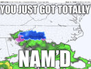
I’ve been NAM’d!!!!1!1!11!!
?Florida has twice as many people as NC. Yet somehow NC has like 20 times more posters than FL ? Doesn't make sense.
EastNcHeel
Member
Ugh, I can't stand people in the south telling people from the South they suck. Must be doing something right, people are still trying to get in. Too bad we can't use the one in one out system. Don't let the door hit ya where the good Lord split ya.Ugh. I can’t stand the south sometimes. So behind the times.
You had better specify where that is in extreme detail.Ugh, I can't stand people in the south telling people from the South they suck. Must be doing something right, people are still trying to get in. Too bad we can't use the one in one out system. Don't let the door hit ya where the good Lord split ya.
Webberweather53
Meteorologist
I work from home now so I would still have to work if it snowed a foot. Might as well not even snow at all. Doesn't matter if I still have to work.
ForsythSnow
Moderator
Whamby doesn't mean free-for-all
- Joined
- Jan 23, 2021
- Messages
- 4,545
- Reaction score
- 15,018
- Location
- Lebanon Township, Durham County NC
Me? My family has roots in this state since the early 1700s in edgecombe county.Lib Yankees like you and @Broken024. SAD ! VERY SAD !!
rburrel2
Member
let me get this straight...
One run of the GFS at like 200hrs out shows an arctic bowling ball swinging to our south and dropping 15-20 inches on NC. While literally every other model didn't and never did. But we can spending 50 pages discussing the possibilities and hope for a "trend" of the anomalous arctic trough to cut off even more anomalously and getting us back in the game.
But hoping for a 20-30 mile trend north with frontogenic forcing on short range models when some of them are already showing an advisory event is lunacy? When we know from past events that further north/stronger precip shield on the northern boundary happens all the time. lolz
Why does everyone here complain about something all the ------- time. Just enjoy being here with people who have similar interests good god
rburrel2
Member
fwiw, i doubt much of anything happens Tuesday either... but it's something to track in the short range for now and that's half the fun in this hobby.
- Joined
- Jan 23, 2021
- Messages
- 4,545
- Reaction score
- 15,018
- Location
- Lebanon Township, Durham County NC
I think you and @Oconeexman are the in the exact right spot to overperform if it does happen though.fwiw, i doubt much of anything happens Tuesday either... but it's something to track in the short range for now and that's half the fun in this hobby.
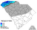
I am screaming myself to sleep if we get a 2/6/21 repeat
@NickyBGuarantee Is this the same Nicky B as always? I like the new and improved realistic Nicky B! I told you the other year you'd lose some of that optimism after enough failures! Can't will it to snow.
rburrel2
Member
I'd love it... got 2 inches from that one in my backyard. Definitely has similar potential... and equally high or higher bust potential.I am screaming myself to sleep if we get a 2/6/21 repeat
rburrel2
Member
Agree'd, which is why I've been watching it so closely. Probably a non-event, but there's definitely an outside chance at a surprise.I think you and @Oconeexman are the in the exact right spot to overperform if it does happen though.
False i spend every waking moment hoping it snows and sometimes it does@NickyBGuarantee Is this the same Nicky B as always? I like the new and improved realistic Nicky B! I told you the other year you'd lose some of that optimism after enough failures! Can't will it to snow.
Cuz we ain’t paid….Why does everyone here complain about something all the ------- time. Just enjoy being here with people who have similar interests good god
That can change though….
Oconeexman
Member
- Joined
- Jan 2, 2017
- Messages
- 1,556
- Reaction score
- 4,250
I've seen it happen many times before over the years. My favorite kind with little to no expectations and get a nice dusting or a couple inches.I think you and @Oconeexman are the in the exact right spot to overperform if it does happen though.
AJ1013
Member
18z GFS has a white christmas for parts of south florida (Punta Gorda area). It’s happening guys!!! ? ? ?
whatalife
Moderator
I was thinking about smoking a ham or a Boston butt on Christmas Eve or Christmas day. But with temperatures only being in the low to mid 30s for highs…my bones are telling me to think again. ?
severestorm
Member
If anyone deserves it, it's them after Ian.18z GFS has a white christmas for parts of south florida (Punta Gorda area). It’s happening guys!!! ? ? ?
AJ1013
Member
Christmas Blizzard incoming for Miami. Oh, oops, did I say Blizzard? I meant Christmas Lizard
Just get a load of Popeyes and get it over with!I was thinking about smoking a ham or a Boston butt on Christmas Eve or Christmas day. But with temperatures only being in the low to mid 30s for highs…my bones are telling me to think again. ?
Drizzle Snizzle
Member
South Florida is due. Good for them.18z GFS has a white christmas for parts of south florida (Punta Gorda area). It’s happening guys!!! ? ? ?
What program? Have a template to share?
31 when we left Gatlinburg. 21 at Clingman’s dome. 28 in Cherokee. Saw a coyote headed up 441
weatherguy
Member
No template, I manually drew it in Photoshop based off old W.C. maps I found on Wayback MachineWhat program? Have a template to share?
Usmeagle2005
Member
This is an old weather Channel template I have shared before, it’s pretty cool.
Weatherdaddy
www.weatherdaddy.us
weatherguy
Member
This is an old weather Channel template I have shared before, it’s pretty cool.
Weatherdaddy
www.weatherdaddy.us
I love those old Local on the 8s and graphics. The music in the early 2000s I miss as well.
Is this your site?This is an old weather Channel template I have shared before, it’s pretty cool.
Weatherdaddy
www.weatherdaddy.us
Usmeagle2005
Member
Is this your site?
Oh no, I found it years ago, can’t remember how I came across it but I love looking at it in the winter. I usually share it on here when winter starts.
Dang it I was going to see if we could find a way to incorporate it hereOh no, I found it years ago, can’t remember how I came across it but I love looking at it in the winter. I usually share it on here when winter starts.
@smast16 gave us this link probably a year or so ago... I've got it saved in my phone It's pretty cool to get the local forecast like it used to be.This is an old weather Channel template I have shared before, it’s pretty cool.
Weatherdaddy
www.weatherdaddy.us

WeatherStar 4000+
Web based WeatherStar 4000 simulator that reports current and forecast weather conditions plus a few extras!
 battaglia.ddns.net
- Status
- Not open for further replies.


