You still have any MVIS shares?Let me know the next time you’re in Alabama and we can figure out who daddy is. ??
-
Hello, please take a minute to check out our awesome content, contributed by the wonderful members of our community. We hope you'll add your own thoughts and opinions by making a free account!
You are using an out of date browser. It may not display this or other websites correctly.
You should upgrade or use an alternative browser.
You should upgrade or use an alternative browser.
Misc 2022-23 Fall/Winter Whamby Thread
- Thread starter Drizzle Snizzle
- Start date
- Status
- Not open for further replies.
severestorm
Member
Went from snow to tornadoes to balmy temps. Can't keep with with all this excitement LOLAbracadabra ?
LickWx
Member
I’ll be there December 15 2022 at 11:11 am. Be there!Let me know the next time you’re in Alabama and we can figure out who daddy is. ??
SnowNiner
Member
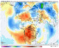
Was just looking at that. Long range ensembles look like the pattern breaks down pretty fast. Alaska low.
This great pattern is turning out to be pretty brief if that holds.
SASQUATCH
2-Time Defending SouthernWX Fantasy Football Champ
Member
2024 Supporter
2017-2023 Supporter
Looks like I'm gonna need more tequila!
Unpopular opinion so go ahead and let the clown emojis fly! We've never really had a legit storm threat on the 23rd or 26th. Only op that's even bit under the 200 hr mark is the GFS which is proving its horrible. You need to see more than one model bite and them at least take turns showing something. And don't get me started on ensembles. They aren't good either showing a particular storm 7 days out. We always have good snow means that never come to fruition. Ensembles are great for pattern recognition long range but not for storms more than a week away. A legit storm threat gets inside 120-150 hrs with multiple op models supporting each other and ensemble support. We are not there yet.
Broken024
Member
DadOfJax
Member
That’s what I figured.I’ll be there December 15 2022 at 11:11 am. Be there!
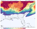
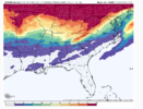
Could you pull up the probability of 3 inches and 6 inches on the same map if you could my good sir
NoSnowATL
Member
Good luck getting 3-6in when you live in Hell.Could you pull up the probability of 3 inches and 6 inches on the same map if you could my good sir
HahahahaGood luck getting 3-6in when you live in Hell.
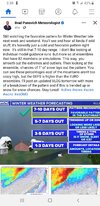
Nothing clownish about that at all. Honestly it’s like Brad P said in his post earlier today… we have a pattern recognition with a decent signal. In all honesty with the amount of energy showing moving around, I think we’ll have to really get under 120 hours before we can start tracking any individual storm.Unpopular opinion so go ahead and let the clown emojis fly! We've never really had a legit storm threat on the 23rd or 26th. Only op that's even bit under the 200 hr mark is the GFS which is proving its horrible. You need to see more than one model bite and them at least take turns showing something. And don't get me started on ensembles. They aren't good either showing a particular storm 7 days out. We always have good snow means that never come to fruition. Ensembles are great for pattern recognition long range but not for storms more than a week away. A legit storm threat gets inside 120-150 hrs with multiple op models supporting each other and ensemble support. We are not there yet.
Edit: and just to add to that… it wouldn’t suprise me at all with this kind of a pattern with blocking, to see something pop up inside 48-72. I remember a few times that happening back in the 80s and 90s
Last edited:
Drizzle Snizzle
Member
Unless he lives in Hell, Michigan (near Ann Arbor)Good luck getting 3-6in when you live in Hell.
Just wanted to say I’m sorry about earlier, I love youThat’s what I figured.
Ron Burgundy
Member
- Status
- Not open for further replies.

