????

Nice whipWaiting on the damn rain.
Thanks, hoping to use it one day in the snow.Nice whip

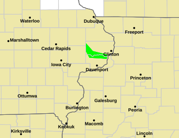
Got my shovel and rock salt ready! Biggest snowfall in 3 years.We're dancing tomorrow boysView attachment 105510
Damn that 0.2” is basically over MBY. We’re gonna kill it! ?We're dancing tomorrow boysView attachment 105510
Yep., It's a relief that we don't have to rely on this upcoming storm to work out. The areas who are getting mostly rain or freezing rain this weekend will have atleast 2 more shots at getting snow/sleet event before the pattern begins to break down. The Euro looked quite interesting to say the least for both day 6/7 and day 9/10. Same with the Ukmet, CMC and the GEFS.To have one storm possibly lined up in a couple days and another one possibly being sniffed out just a week or 10 days away has to be proof we're in a great pattern. This one might not work out for everyone this time, but just proves this doesn't have to be the storm.
Yep., It's a relief that we don't have to rely on this upcoming storm to work out. The areas who are getting mostly rain or freezing rain this weekend will have atleast 2 more shots at getting snow/sleet event before the pattern begins to break down. The Euro looked quite interesting to say the least for both day 6/7 and day 9/10. Same with the Ukmet, CMC and the GEFS.
Can you at least wait until the current failure is over before you start ruining next weeks dreams tooThere is a 100% chance of that storm moving almost due north from that spot. I'm not kidding either. Once the upper trough goes negative, it will probably pull it back to the NW for a time. Lots of rain incoming for central/eastern SC and NC.
Regardless, it's a very impressive setup. If that were to pan out, you'd see tremendous snowfall, strong winds, heavy rain, and probably severe weather, depending on the track.
I’m good! Fresh inch already!Speaking of Mack's chair, that thing sweatin bullets


Lol it's never too early get your hopes down! At any rate, it'll be a different solution at 0Z. Maybe the next run will show it 150 miles farther east. Come to papa hahaCan you at least wait until the current failure is over before you start ruining next weeks dreams too
I was actually experimenting with something and you know who must be asleep LolLol it's never too early get your hopes down! At any rate, it'll be a different solution at 0Z. Maybe the next run will show it 150 miles farther east. Come to papa haha
Next run might be a Dubuque special!!Lol it's never too early get your hopes down! At any rate, it'll be a different solution at 0Z. Maybe the next run will show it 150 miles farther east. Come to papa haha
Well Dahlonega is 1400' in elevation while Highlands is 4100'. I would go higher.Don’t wanna clog the other thread but i am chasing this storm and would like some opinions. I’m coming from Florida and don’t wanna get too far north so I’m thinking NE Georgia and SW NC like Dahlonega to highlands. Anyone have thoughts?
Sent from my iPhone using Tapatalk
Check back in around 5/6:00 and it'll be good to go.I was actually experimenting with something and you know who must be asleep Lol
Highlands or cashiers for sureDon’t wanna clog the other thread but i am chasing this storm and would like some opinions. I’m coming from Florida and don’t wanna get too far north so I’m thinking NE Georgia and SW NC like Dahlonega to highlands. Anyone have thoughts?
Sent from my iPhone using Tapatalk
Getting worried we’re all about to get HRRR’d and it’s all a fantasy. Been burned by them before. However, in theory, I suppose the higher resolution should resolve the CAD better…
I hope you guys get a good thump out of the front, I'm not confident in the amount of moisture on the back side.@NoSnowATL We gonna score Sunday Morning. I’m feeling it!

Winter ends in January?This would be a fitting way to end winter for Raleigh.?
View attachment 105547
Casual 7 inches from the first thump, now the death band on the backside ?
December 2017 turned me into a believer of heavy rates ?Correct me if I'm wrong, but isn't the way to calculate the true amount one might get is to take the number the model is showing and divide by that same number, then subtract 1, and add T.
7/7=1
1-1=0
0+T=T
That is your math lesson in calculating snow totals for the Atlanta
IF the wedge strength is being underplayed (like normal), continue to expect shifts south.. I still don't expect the primary low to cut thru the wedge (unless it stays on the wedge boundary)
Granted, southerly flow aloft will be ramping, which MAY have the SFC low try to ride along the coast...but with every depiction I've seen so far, the wedge boundary continues to reside offshore out towards the Western Wall of The Gulf Stream... That's where I'd expect a jump to occur or the primary to likely take it's path.
Guidance historically misjudges the erosion down in the Coastal Plain in SC.
Expect further downward adjustments on temps, track, and column crash with such potential heavy rates before latent heat processes can take over

Hopium. ?What in the world is the HRRR on?