-
Hello, please take a minute to check out our awesome content, contributed by the wonderful members of our community. We hope you'll add your own thoughts and opinions by making a free account!
You are using an out of date browser. It may not display this or other websites correctly.
You should upgrade or use an alternative browser.
You should upgrade or use an alternative browser.
Misc 2021-22 Fall/Winter Whamby Thread
- Thread starter jackendrickwx
- Start date
ATLwxfan
Member
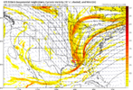
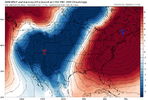
Some telling runs on tap for today. I would not be surprised to see a board wide flizzard.
Sent from my iPhone using Tapatalk
Sent from my iPhone using Tapatalk
Stephenb888
Member
If I had a dollar for every time a model was “close to something big” I’d be rich.
smast16
Member
and your roof would have collapsed in under all snow as well.If I had a dollar for every time a model was “close to something big” I’d be rich.
YetAnotherRDUGuy
Member
Bout time for one of those runs today! I wanna see a clown map that sends everyone in a frenzy. ???and your roof would have collapsed in under all snow as well.
This pattern from a long wave perspective has been about 75% of what you want for the better part of 4-6 weeks now. But this is why our snow climo is what it is, good patterns on paper or from a continent/hemispheric pattern can get us some snow but for something memorable it has to be near perfectIf I had a dollar for every time a model was “close to something big” I’d be rich.
Last edited:
Hypsometric
Member
I think the RGEM would have done it....Bout time for one of those runs today! I wanna see a clown map that sends everyone in a frenzy. ???
LukeBarrette
im north of 90% of people on here so yeah
Meteorology Student
Member
2024 Supporter
2017-2023 Supporter
I agree but with this look I think surface temps become an issue in most of NC and southeast at least initially. Heck surface temps look like an issue up here in Roanoke initially with what other models are projecting.I think the RGEM would have done it....
Give me my +PNA junk just one last time Mother Nature
L
Logan Is An Idiot 02
Guest
I’m sorry but didn’t you just say that the gfs was a horrible model yesterday? LolGFS very close to my first guess I’m going to put out tonight if that’s ok! There is hope for our Raleigh viewers and Virginia folks. Unsure about the foothills but think it could be overdone there mostly non-accum.
SnowNiner
Member
Hard meh. If we could back up the neutral tilt to around the Mississippi, then game on. This still looks to me to be progressive way off the coast poo with imaginary back end snows. Not buying any of it. I guess I'm just past this progressive pattern and ready for spring. It's just not working. Fool me once....


I here ya but look at the trends my friend the trendsHard meh. If we could back up the neutral tilt to around the Mississippi, then game on. This still looks to me to be progressive way off the coast poo with imaginary back end snows. Not buying any of it. I guess I'm just past this progressive pattern and ready for spring. It's just not working. Fool me once....
View attachment 113173
L
Logan Is An Idiot 02
Guest
I think you’re in a good position as of right now. These set ups are not good for western PiedmontI here ya but look at the trends my friend the trends
If I had a dollar for every time I heard thatI think you’re in a good position as of right now. These set ups are not good for western Piedmont
lexxnchloe
Member
We must hope for the best
We can get a Fab Feb 2015-esque slush bomb out of this.I agree but with this look I think surface temps become an issue in most of NC and southeast at least initially. Heck surface temps look like an issue up here in Roanoke initially with what other models are projecting.
The odds are certainly stacked against us, though. Gotta get precip first, which is no guarantee! ?
SnowNiner
Member
I here ya but look at the trends my friend the trends
Yeah, of course I'm a weenie and watching. But I'm eye rolling every time I see the storm form in Bermuda but somehow light snow forms over my house. lol.
smast16
Member
<princessleia.jpg>We must hope for the best
LickWx
Member
What’s goin on? We huggin the gfs I see?


