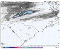
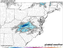
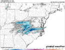
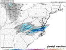
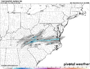
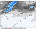
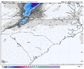
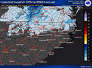
I have learned to trust rufus an fv3, more than nam. More i watch an observe. Its always dry an late to party with trends rain, sun, clouds, sleet or snow. Doesnt matter
-
Hello, please take a minute to check out our awesome content, contributed by the wonderful members of our community. We hope you'll add your own thoughts and opinions by making a free account!
You are using an out of date browser. It may not display this or other websites correctly.
You should upgrade or use an alternative browser.
You should upgrade or use an alternative browser.
Just scratch!!! WTFBig and heavy wet flakes here right now. In a bar and can’t finish this game of pool to video
Snow is more important than a pool win!
LukeBarrette
im north of 90% of people on here so yeah
Meteorology Student
Member
2024 Supporter
2017-2023 Supporter
Those big ass flakes mean way more tbhJust scratch!!! WTF
Snow is more important than a pool win!
CNCsnwfan1210
Member

Winter wx advisories already posted for eastern NC for light snow/ice accumulations and a few counties in the Wilmington CWA as well, RAH will probably issue some advisories for portions of central NC soon.
Sent from my iPhone using Tapatalk
Xlhunter3
Member
137 AM EST WED FEB 4 2026
...WINTER WEATHER ADVISORY IN EFFECT FROM 6 PM THIS EVENING TO 10 AM
EST THURSDAY...
* WHAT...MIXED PRECIPITATION EXPECTED. TOTAL SNOW ACCUMULATIONS UP
TO ONE INCH AND ICE ACCUMULATIONS AROUND A LIGHT GLAZE.
* WHERE...A PORTION OF CENTRAL NORTH CAROLINA.
* WHEN...FROM 6 PM THIS EVENING TO 10 AM EST THURSDAY.
* IMPACTS...ROADS, AND ESPECIALLY BRIDGES AND OVERPASSES, WILL
LIKELY BECOME SLICK AND HAZARDOUS.
* ADDITIONAL DETAILS...RAIN IS EXPECTED TO CHANGE TO LIGHT SNOW OVER
THE PIEDMONT TRIAD EAST ALONG AND NORTH OF INTERSTATE 85 LATE THIS
AFTERNOON AND EVENING. THE SNOW ACCUMULATIONS WILL BE LIGHT,
MAINLY LESS THAN 1 INCH. ELSEWHERE, A CHANGE TO A MIXTURE OF LIGHT
FREEZING RAIN AND DRIZZLE WILL OCCUR THIS EVENING. TEMPERATURES
WILL RAPIDLY FALL BELOW FREEZING OVERNIGHT CREATING HAZARDOUS
TRAVEL IN THE ADVISORY
AREA.
CNCsnwfan1210
Member
137 AM EST WED FEB 4 2026
...WINTER WEATHER ADVISORY IN EFFECT FROM 6 PM THIS EVENING TO 10 AM
EST THURSDAY...
* WHAT...MIXED PRECIPITATION EXPECTED. TOTAL SNOW ACCUMULATIONS UP
TO ONE INCH AND ICE ACCUMULATIONS AROUND A LIGHT GLAZE.
* WHERE...A PORTION OF CENTRAL NORTH CAROLINA.
* WHEN...FROM 6 PM THIS EVENING TO 10 AM EST THURSDAY.
* IMPACTS...ROADS, AND ESPECIALLY BRIDGES AND OVERPASSES, WILL
LIKELY BECOME SLICK AND HAZARDOUS.
* ADDITIONAL DETAILS...RAIN IS EXPECTED TO CHANGE TO LIGHT SNOW OVER
THE PIEDMONT TRIAD EAST ALONG AND NORTH OF INTERSTATE 85 LATE THIS
AFTERNOON AND EVENING. THE SNOW ACCUMULATIONS WILL BE LIGHT,
MAINLY LESS THAN 1 INCH. ELSEWHERE, A CHANGE TO A MIXTURE OF LIGHT
FREEZING RAIN AND DRIZZLE WILL OCCUR THIS EVENING. TEMPERATURES
WILL RAPIDLY FALL BELOW FREEZING OVERNIGHT CREATING HAZARDOUS
TRAVEL IN THE ADVISORY
AREA.

Sent from my iPhone using Tapatalk
a_gilmore88
Member
Wonder if GSP will include the easternmost counties in their coverage area into the WWA? Most models have Rowan County getting at least something out of this evening.
Shadow of the Apps
Member
GSP Hazardous Weather Outlook
.DAY ONE...Today and tonight.
Light rain moves back into the area this afternoon into tonight. As
colder air filters tonight, the rain may mix with or change to snow
before ending. Some light freezing rain or freezing drizzle is also
possible. For now, any snow accumulations are expected to be very
light, less than half an inch. Any icing would be very light as well
and limited mainly to elevated surfaces. A Winter Weather Advisory
may be needed if later forecasts show higher accumulations.
Hires models with a weak banding signal later tonight and in the morning is interesting. I worry that areas W of 95 may run out of deep moisture before getting cold enough so it's overall a light event on the frozen side. The liquid side looks decent one of the better rains since September
Yeah, gonna be a small corridor in that sweet spot that gets a little surprise. All models show it to some degree, just impossible to nail down the locationHires models with a weak banding signal later tonight and in the morning is interesting. I worry that areas W of 95 may run out of deep moisture before getting cold enough so it's overall a light event on the frozen side. The liquid side looks decent one of the better rains since September
Ryan87NC
Member
The latest HRRR shows much less moisture making its way over the mountains into the Triad.
I think that's the main issue here, the cold and dry moving in will quickly shut off precip west to east. Although I'd argue this isn't a typical cold chasing moisture event because of the wave developing along the front. On a positive, HRRR didn't show precip making up my way with last system until within 10 hrs. Only then it started to catch on, so that could be the case here.The latest HRRR shows much less moisture making its way over the mountains into the Triad.
Ryan87NC
Member
I think that's the main issue here, the cold and dry moving in will quickly shut off precip west to east. Although I'd argue this isn't a typical cold chasing moisture event because of the wave developing along the front. On a positive, HRRR didn't show precip making up my way with last system until within 10 hrs. Only then it started to catch on, so that could be the case here.
Honestly, I would be happy with no more snowfor a while.
Sent from my iPhone using Tapatalk
Tsappfrog20
Member
Allan Huffman’s Final Map

Sent from my iPhone using Tapatalk

Sent from my iPhone using Tapatalk
BullishAllan Huffman’s Final Map

Sent from my iPhone using Tapatalk
It’s going to be frustrating to see Roxboro get a couple inches while we get the shaft here again.
not at all looks fair to me. why is it bullish?Bullish
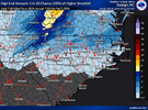
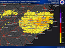
Because official forecast and most hi res models, along with NBM show less than an inch. He has decent area if 1-2, but maybe he's right. To be clear, I didn't say he was wrong, just bullish prediction for large area of dusting to 2".not at all looks fair to me. why is it bullish?
Dustin who?Allan Huffman’s Final Map

Sent from my iPhone using Tapatalk
This feels like one where sure somebody could wind up with a 0.5-1.0" report but you have very very low odds of getting that location correct so just slap a D-0.5" on most of the precip corridor and hope for the best
Thinking the same. Having looked at WebberWeather’s extensive NC snowfall history maps, I’ve noticed there’s a lot of systems that seem similar to this one over the years where there’s stripes of T-2” but you just can’t know where those are going to set up until they happen.This feels like one where sure somebody could wind up with a 0.5-1.0" report but you have very very low odds of getting that location correct so just slap a D-0.5" on most of the precip corridor and hope for the best
Yeah, feels like a late winter/early spring nickel+dimerThinking the same. Having looked at WebberWeather’s extensive NC snowfall history maps, I’ve noticed there’s a lot of systems that seem similar to this one over the years where there’s stripes of T-2” but you just can’t know where those are going to set up until they happen.
Yes id argue that we are getting back to "old times" type winters recently with a lot of small events spread across the area. Just need a higher frequency of larger events at least locallyThinking the same. Having looked at WebberWeather’s extensive NC snowfall history maps, I’ve noticed there’s a lot of systems that seem similar to this one over the years where there’s stripes of T-2” but you just can’t know where those are going to set up until they happen.
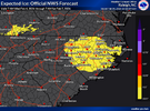
I know it's not a *big deal*, but I'm surprised WWAs got issued for so much of central/eastern NC based on the official forecast. The criteria doesn't seem to support it.
Brent
Member
Going to assume it's partially because of the last snow not being fully melted and being a weekday
But the ice could be what put it over the top too
But the ice could be what put it over the top too
Winter Weather Advisory is issued for accumulations of snow, lake effect snow, freezing rain, freezing drizzle, or sleet, that will create inconveniences. During an advisory, if caution is not exercised, life and property may be threatened. Snow of a coasting to less than 3" and any amount of ice accretion.
That's gotta be it. I forgot to check ice potential. lolI’m guessing it’s more for this. They seem to hoist WWAs for any amount of ice.
View attachment 193602
View attachment 193603
I can't help but notice that various model runs depict a speck or two of snow flurries over Gwinnett and Walton Counties in Georgia early tomorrow morning. So yes, of course I'll be squinting out the patio door to see if one or two rogue flakes pass by. 
And, may this little system shock the weather world for you, N.Carolina weenies!
And, may this little system shock the weather world for you, N.Carolina weenies!
BrickTamland
Member
If the precip comes in sooner and heavier than modeled, could that increase the chance of more frozen precip?
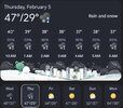
Beautiful day here. Currently 47 degrees
Yes. if there's more precip, there would be more precip.If the precip comes in sooner and heavier than modeled, could that increase the chance of more frozen precip?

