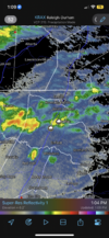
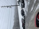
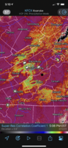
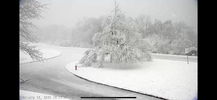
Brasstown gets a pretty good lickin down there in GA it seems. I lived briefly in Towns County and wow it was a welcome change to Charlotte at the time. Clean water and air and soil...I think you would have to go up in elevation. Check out Brasstown Bald ripping right now!https://www.resortcams.com/webcams/brasstown-bald-mtn-north/
-
Hello, please take a minute to check out our awesome content, contributed by the wonderful members of our community. We hope you'll add your own thoughts and opinions by making a free account!
You are using an out of date browser. It may not display this or other websites correctly.
You should upgrade or use an alternative browser.
You should upgrade or use an alternative browser.
J1C1111
Member
Unfortunately it's not looking good for us outside of the mountains to see some flakes later today. I still have hope until the precip moves out but it's not looking good.So is the precipitation in East Tennessee going to possibly give the NC Piedmont some flakes later? I am looking for an absolute Yes/No... no scientific terms or explanations please.. lol..
Actually a huge Big THANKS to all of you that share your knowledge of wx with the forum!
- Joined
- Jan 23, 2021
- Messages
- 4,602
- Reaction score
- 15,197
- Location
- Lebanon Township, Durham County NC
It would seem as if those of us from Greensboro to @metwannabe will see some flakes if we get heavy enough echoes. We’ll see.
BHS1975
Member
Desperado lol
Sent from my iPhone using Tapatalk
Great day skiing. Beautiful up here. Now it’s time to head down the mountain and ice these 34 year old knees.
Last report from Beech Mountain/Banner Elk. Went back to peak 5000’+ and nothing but cold rain/mist. Came through Banner Elk and down 105 between Banner Elk and Grandfather. Interestingly there was quite a lot of snow and sleet on the north side of Grandfather on 105, maybe the high peak allowed cold air to filter down a bit more, even to lower elevations? Was not actively snowing/sleeting there, just cold rain. Anyways, after a mile or two of 1”-2” or so of snow/sleet on the ground it went back to nothing on the ground and still just raining coldness. Heading to Boone for a bit and then back east home. For me, a huge bust and possibly even for the Boone/Blowing Rock/Banner Elk/Beech area unless something changes.
Sent from my iPhone using Tapatalk
Sent from my iPhone using Tapatalk
accu35
Member
Yep rained buckets for a few minutes, 1.26 so farView attachment 133112Metwannabe special?
accu35
Member
I 100% agree. Big bust. Nothing down here in Maggie valleyLast report from Beech Mountain/Banner Elk. Went back to peak 5000’+ and nothing but cold rain/mist. Came through Banner Elk and down 105 between Banner Elk and Grandfather. Interestingly there was quite a lot of snow and sleet on the north side of Grandfather on 105, maybe the high peak allowed cold air to filter down a bit more, even to lower elevations? Was not actively snowing/sleeting there, just cold rain. Anyways, after a mile or two of 1”-2” or so of snow/sleet on the ground it went back to nothing on the ground and still just raining coldness. Heading to Boone for a bit and then back east home. For me, a huge bust and possibly even for the Boone/Blowing Rock/Banner Elk/Beech area unless something changes.
Sent from my iPhone using Tapatalk
Cad Wedge NC
Member
Yep, it's hammering fatties on Beech!Looks like on webcam it’s now ripping fatties at Beech not 30 after I went down the mountain. Do I turn around? Possibly.
Sent from my iPhone using Tapatalk
accu35
Member
Got my first snow alert for Maggie Valley possible heavy snow
It’s not a good sign when Pittsburgh is at 50 degrees during your “winter storm”.

Didn’t have to go all the way back to Beech, got into some cotton balls here in Banner Elk, did the Alpine coaster with the wife in the snow and off to home. Not a complete bust after all!

Sent from my iPhone using Tapatalk
@BIG FROSTY that band filling in back your way and I spy a sn mPING report just across the border NW of Pilot Mt. Maybe you luck out a few flakes here shortly
Yes I been watching radar all afternoon, I just took a ride up to Mt.Airy thought I might find a flake but no luck. It's a dang shame this thing was wasted just TOO WARM 40 degrees now.@BIG FROSTY that band filling in back your way and I spy a sn mPING report just across the border NW of Pilot Mt. Maybe you luck out a few flakes here shortly
So we left at 6 AM and the entire drive from Greenville all the way to Maggie Valley was pouring rain. My brother said “ I know you didn’t bring me up here to ski in a rain storm.” LOL It kept raining until we got to the top of the road to Cataloochee and then immediately started puking snow. When we left at 2:30 you could tell the snow line from earlier that morning still had not dropped. This storm was very elevation dependent.
Drizzle Snizzle
Member
I can't say I'm surprised really. We all knew it would be elevation dependent.So we left at 6 AM and the entire drive from Greenville all the way to Maggie Valley was pouring rain. My brother said “ I know you didn’t bring me up here to ski in a rain storm.” LOL It kept raining until we got to the top of the road to Cataloochee and then immediately started puking snow. When we left at 2:30 you could tell the snow line from earlier that morning still had not dropped. This storm was very elevation dependent.
accu35
Member
Yeah snow was beautiful up there. Lots of people skiing. Definitely a elevation dependent.So we left at 6 AM and the entire drive from Greenville all the way to Maggie Valley was pouring rain. My brother said “ I know you didn’t bring me up here to ski in a rain storm.” LOL It kept raining until we got to the top of the road to Cataloochee and then immediately started puking snow. When we left at 2:30 you could tell the snow line from earlier that morning still had not dropped. This storm was very elevation dependent.
This is about 1200 feet higher than me, Roaring Gap Club "nice place"
I have a distant cousin who has lived in a cabin in the Sauratown area at Hanging Rock in Stokes County. I'm guessing she has many many stories of what her winter wx is like compared to those down the mountain... a bit jealous I am indeed
NBAcentel
Member
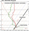
That warm nose is gonna be gone in the next hour, what the biggest issue is, is below 950mb, there’s gonna be no warm nose the the ULL right over you lolYou’d have to be pretty damn lucky to see snowflakes in the piedmont over the next couple hours.. these are the type of soundings we’re seeing in and around Greensboro. I suppose high enough rates might be able to help erase this warm nose but i doubt it. Maybe a few lucky neighborhoods. View attachment 133122
Congrats you understand it’ll be too warm for snow ?That warm nose is gonna be gone in the next hour, what the biggest issue is, is below 950mb, there’s gonna be no warm nose the the ULL right over you lol
LukeBarrette
im north of 90% of people on here so yeah
Meteorology Student
Member
2024 Supporter
2017-2023 Supporter
I thought 3k feet would be sufficient but it wasn’t. Needed to be well above that line and even up at 5k feet it was teetering a very fine line. I guess that’s why the snow was so beautiful.I can't say I'm surprised really. We all knew it would be elevation dependent.
Rainforrest
Member
Looked like Caesar’s head got a couple inches. You could’ve stayed closer to home.I thought 3k feet would be sufficient but it wasn’t. Needed to be well above that line and even up at 5k feet it was teetering a very fine line. I guess that’s why the snow was so beautiful.
NCHighCountryWX
Member
- Joined
- Dec 28, 2016
- Messages
- 699
- Reaction score
- 1,918

The Bluffs on Blue Ridge Parkway - Resort Cams
Located on the Blue Ridge Parkway in Allegheny County, NC, the Bluffs webcam gives a great view of the popular tourist road and mountains.
NCHighCountryWX
Member
- Joined
- Dec 28, 2016
- Messages
- 699
- Reaction score
- 1,918
Can’t complain about banking in some solid rain W24 hour QPE from MRMSView attachment 133131
Hard to ski black ? @ Caesar’s headLooked like Caesar’s head got a couple inches. You could’ve stayed closer to home.
- Joined
- Jan 23, 2021
- Messages
- 4,602
- Reaction score
- 15,197
- Location
- Lebanon Township, Durham County NC
Canadian models nailed this storm. Had Thermals dialed in.
It all comes down to this lol
If we don't start seeing some ground truth of change over to our west and nw it'll be a pointless chase imoIt all comes down to this lol

