-
Hello, please take a minute to check out our awesome content, contributed by the wonderful members of our community. We hope you'll add your own thoughts and opinions by making a free account!
You are using an out of date browser. It may not display this or other websites correctly.
You should upgrade or use an alternative browser.
You should upgrade or use an alternative browser.
12/8/2025 Event - Repeat of Last Week?
- Thread starter packfan98
- Start date
CNCsnwfan1210
Member


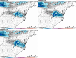
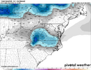
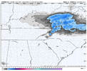
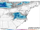
A couple of the CAMS for viewing pleasure
Sent from my iPhone using Tapatalk
CNCsnwfan1210
Member
Just for fun (and I mean  ) my tempest forecast has snow likely for Monday (60%)
Sent from my iPhone using Tapatalk
 ) my tempest forecast has snow likely for Monday (60%)
 Sent from my iPhone using Tapatalk
Bigedd09
Member
Really wish we could have the icon and rgem on our side in NC
Sent from my iPhone using Tapatalk
Sent from my iPhone using Tapatalk
Why are we replacing the NAM instead of the tequila sisters? I just don’t get it

A couple of the CAMS for viewing pleasure
Sent from my iPhone using Tapatalk
CNCsnwfan1210
Member

Looks like the GFS was a hit, I don’t have the pretty wxbell maps
Sent from my iPhone using Tapatalk
NWG_WX14
Member
GFS moved north slightly from 18z
Tsappfrog20
Member
Looks pretty good to me!!

Sent from my iPhone using Tapatalk

Sent from my iPhone using Tapatalk
CNCsnwfan1210
Member
Looks pretty good to me!!
Sent from my iPhone using Tapatalk
Looks like a little coastal enhancement down east.
Sent from my iPhone using Tapatalk
BrickTamland
Member
Yeah, looks about the same as the last run.Looks pretty good to me!!
Sent from my iPhone using Tapatalk
i agree, this is a weird model artifact, don't sweat itSure there could be some issues at onset within the model of boundary layer dry air, but not literal stationary pockets of zero precip. That doesn’t make sense. I would think it should be pretty closed to fully filled in like the 3k, and would imagine it’ll correct
chris lived in nc, is a state grad, a smart met and is as well versed as anybody in north carolina snow cultureChris Michaels is relatively new to the area and North Carolina as a meteorologist at WRAL so all I'll say is that he may be in for a surprise come Monday if these model trends keep swinging our way. Greg Fishel got burned when he said that Raleigh would not get an inch of snow when a system like this came our way one time. He was a man of his word and did his next broadcast standing in the fountain at WRAL.
could be your storm, my storm, our storm, this is absolutely not baked in like the last storm wasRGEM another @Ross special
high leverage event. a little more digging would do a lot of good. paying attention to what's going on upstream will be helpful. on the other end, the failure mode is slight ticks with less digging/more progressive storm. self obvious, since two days this wasn't a storm. but cold, dry air will be streaming in. cold air advection causes sinking. virga is still on the table
I think I’m most worried abt the existence of precip and marginal BL temps away from the VA border. if you do get precip to get going it still may be rate dependent for many in NC with temps 33-36 at the sfc, and hard to imagine precip will be heavy enough everywhere to verify something like what the NAM showsi agree, this is a weird model artifact, don't sweat it
chris lived in nc, is a state grad, a smart met and is as well versed as anybody in north carolina snow culture
could be your storm, my storm, our storm, this is absolutely not baked in like the last storm was
high leverage event. a little more digging would do a lot of good. paying attention to what's going on upstream will be helpful. on the other end, the failure mode is slight ticks with less digging/more progressive storm. self obvious, since two days this wasn't a storm. but cold, dry air will be streaming in. cold air advection causes sinking. virga is still on the table
iGRXY
Member
I haven’t been very hopeful on this one, and especially not for mby … but even here in the northern upstate we are 2-3 runs away from quickly getting in on this if the SW keeps digging more and more southwest
Yep and as noted previously, flow to fast to really allow this to dig but so much, limiting those heavier rates needed. On the other hand, it wouldn't take much for it to drive those rates up some, personally I'd like to see a little taller ridge out west to help carve out the trough. I've shared some pretty maps but deep down I'm not sold on them just yetI think I’m most worried abt the existence of precip and marginal BL temps away from the VA border. if you do get precip to get going it still may be rate dependent for many in NC with temps 33-36 at the sfc, and hard to imagine precip will be heavy enough everywhere to verify something like what the NAM shows
Working on itHey. I'm probably headed your way. Tuesday. So how about? Putting down a nice white blanket in your area before I get there. So I'll have something pretty to look at. lol
Working on it
Actually the plan now is for Monday. Bring it!

Sent from my iPhone using Tapatalk
NBAcentel
Member
iGRXY
Member
Shift that north a county or 2 in NC, and give a bit more heavier axis is the high country and SW VA and I think that’s much more likely at this point. Even when things are driven by dynamic cooling, if it’s 50/50 going into the storm for this side of the apps, it’s probably a Virginia and high country storm.
Bigedd09
Member
What an absolute buzz kill from the models overnight. Hopefully we flip the script today
Sent from my iPhone using Tapatalk
Sent from my iPhone using Tapatalk
CNCsnwfan1210
Member

I know we’re more focused on the short term models, but the GFS ticked colder. Probably doesn’t really matter in the grand scheme of things because this can fluctuate with the amount of moisture that will be available or thrown into the system. It really depends on how much interaction (if any) we have with the coastal low.
Sent from my iPhone using Tapatalk
packfan98
Moderator
I was hoping the good trends from yesterday would keep trending in our favor. 6z seems to have reversed our momentum. Here’s the overnight discussion from the National Weather Service in Raleigh:
SHORT TERM /MONDAY AND MONDAY NIGHT/...
As of 240 AM Sunday...
* Chance of precipitation areawide Mon, likely mixing with then
changing to a period of all snow before ending, especially across
the N and W.
* Precip amounts should generally be under a quarter inch liquid
equivalent, suggesting that any snow accumulation would be mostly
under an inch given the initial rain/snow mix, but stay tuned.
Forcing for ascent focused in the mid and upper levels should
continue to ramp up early Mon as the aforementioned trough
approaches, but the incoming PW values will likely be just near
normal and falling further late in the day as the mid-upper levels
start to dry out. But forecast soundings show at least a few hours
in which the column is saturated or nearly so throughout the mixed
phase region aloft down to the surface, occurring in conjunction
with peak mid level DPVA from late morning through late afternoon W
to E. The incoming Arctic front is expected to push SSE through
central NC in the afternoon, so the coldest air may be chasing the
better moisture to some degree during the morning hours,
particularly if the higher terrain manages to delay the coldest and
most dense air for a few hours. But we`re still likely to see an
atypical temp trend with surface temps falling in the afternoon, and
confidence is increasing that we`ll see at least a couple of hours
of predominant light wet snow over all but the far S and SE CWA Mon
afternoon as the low levels cool, with accumulations potentially
limited by the initial rain/snow mix, the surface temps sitting near
or slightly above freezing for much of the day, and the modest PW
values. Model agreement is good in showing a thermal pattern
supporting patchy light rain chances at onset, followed by good
chance to likely pops for a light rain/snow mix, then changing to
mostly light snow before ending in the late afternoon or very early
evening, with no reasonable chance of any icing or freezing precip.
Total accumulation should range from a trace along and N of a line
from the Triad to near Goldsboro, ranging to one half to just under
one inch near the VA border. Expect highs in the upper 30s to mid
40s early, with readings falling through the 30s in the afternoon.
Cold lows Mon night in the mid teens to low 20s will lead to minimum
wind chills in the teens in most places overnight into Tue morning.
While any lingering precip on the ground will begin to dry out
overnight, we`ll be lacking a strong wind to aid in the drying
process, and there is a good chance in a flash freeze with areas of
black ice developing, which would cause travel concerns late Mon
night into early Tue. -GIH
CNCsnwfan1210
Member

I know we’re more focused on the short term models, but the GFS ticked colder. Probably doesn’t really matter in the grand scheme of things because this can fluctuate with the amount of moisture that will be available or thrown into the system. It really depends on how much interaction (if any) we have with the coastal low.
Sent from my iPhone using Tapatalk
GFS might be overdoing it with the moisture.
Sent from my iPhone using Tapatalk
CNCsnwfan1210
Member

6z GEFS FWIW
Sent from my iPhone using Tapatalk
packfan98
Moderator
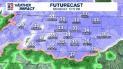
Yeah RAH has this:Well, the Futurecast model didn’t work out so well last week. Fingers crossed it gets a win tomorrow. Regardless, there’s going to be some travel issues with black ice overnight into Tuesday morning I think.
View attachment 178335
......"Cold lows Mon night in the mid teens to low 20s will lead to minimum
wind chills in the teens in most places overnight into Tue morning.
While any lingering precip on the ground will begin to dry out
overnight, we`ll be lacking a strong wind to aid in the drying
process, and there is a good chance in a flash freeze with areas of
black ice developing, which would cause travel concerns late Mon
night into early Tue."
packfan98
Moderator
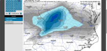
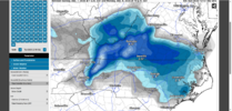
The difference between what the GFS and Euro are showing as far as totals for tomorrow's event appears to be the coastal enhancement that the GFS shows. The Euro has none so to speak. The GFS has stuck to its guns for the last few runs while the Euro and other models other than the NAM have slightly moved towards the GFS. Soundings show a mostly snow event for the GFS while the Euro has a rain/snow transition as the event takes place. For once, GFS, please be right.
Last edited:
packfan98
Moderator
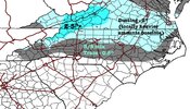
The HIGH END MAP from the NWS is definitely showing more potential than the last event for the I-40/85 corridor. Can we ever get the high end map to verify???

Definitely juicier but also shifted slightly north, warning shots. It did have a little coastal action though noted with slight enhanced accums near coast. Maybe this will trend better, but may only help my area out, sorry not sorry6z Euro is definitely juicier. Looks almost like the same footprint as Friday’s system. I’m guessing the American models will correct a little more north to come to consensus.
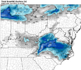
View attachment 178336
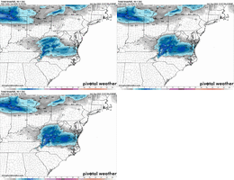
I think we will be lucky to see flakes fly in clt, just not enough moisture this far south. Would be pretty excited if I was in RDU east though.
Remember a few years back, where we got two/three events that were focused from Raleigh up towards your area. You were the snow king that year.Not a bad trend on the Euro tbh
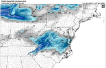
View attachment 178345
No, it's not allowed down hereThe HIGH END MAP from the NWS is definitely showing more potential than the last event for the I-40/85 corridor. Can we ever get the high end map to verify???

Tsappfrog20
Member
Allan will be putting out his first guess map after church!
Sent from my iPhone using Tapatalk
Sent from my iPhone using Tapatalk

