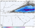
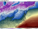
When was the last time he was right? I remember the crayon maps he would post lolI approve of this D - T map!
-
Hello, please take a minute to check out our awesome content, contributed by the wonderful members of our community. We hope you'll add your own thoughts and opinions by making a free account!
You are using an out of date browser. It may not display this or other websites correctly.
You should upgrade or use an alternative browser.
You should upgrade or use an alternative browser.
Wintry 12/4-6 Winter Weather Potential
- Thread starter SD
- Start date
I'm not sure. Can you run him through your database and see? I didn't say it will be right, I just approve of it!!! lolWhen was the last time he was right? I remember the crayon maps he would post lol
NCHighCountryWX
Member
- Joined
- Dec 28, 2016
- Messages
- 697
- Reaction score
- 1,914
Bigedd09
Member
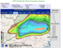
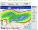
Very interesting how they are so sold on freezing rain for the piedmont. What am I missing?Good Thursday Morning.
Referencing the latest early morning official guidance from WPC
View attachment 177938View attachment 177939
Blue_Ridge_Escarpment
Member
That’s more sleet IMOVery interesting how they are so sold on freezing rain for the piedmont. What am I missing?
Gsp thinking foothills will stay mostly snow per the overnight AFD. Precip might be gone by the time the warm nose takes hold. It's rare but I've seen Marion get 3in while Asheville got freezing rain. Rare but someone along the escarpment may be in for a suprise.
Hopefully for some token flakes / ice down in the southern foothills.
Sent from my iPhone using Tapatalk
NCHighCountryWX
Member
- Joined
- Dec 28, 2016
- Messages
- 697
- Reaction score
- 1,914
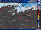
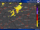
Alan’s morning update.

Sent from my iPhone using Tapatalk

Sent from my iPhone using Tapatalk
A lot, but mostly in this situation the warm noseVery interesting how they are so sold on freezing rain for the piedmont. What am I missing?
The kiss of death. I’d be surprised if MBY gets more than a dusting of snow, and I’m not confident about that, either.
URGENT - WINTER WEATHER MESSAGE
National Weather Service Raleigh NC
153 AM EST Thu Dec 4 2025
NCZ007>011-021>025-041500-
/O.NEW.KRAH.WW.Y.0008.251205T0500Z-251206T0500Z/
Person-Granville-Vance-Warren-Halifax-Forsyth-Guilford-Alamance-
Orange-Durham-
Including the cities of Scotland Neck, Norlina, Enfield, Roanoke
Rapids, Henderson, Greensboro, Roxboro, Rougemont, Kittrell,
Carrboro, High Point, Hillsborough, Graham, Winston-Salem,
Mebane, Durham, Oxford, Burlington, Creedmoor, Warrenton, and
Chapel Hill
153 AM EST Thu Dec 4 2025
...WINTER WEATHER ADVISORY IN EFFECT FROM MIDNIGHT TONIGHT TO
MIDNIGHT EST FRIDAY NIGHT...
* WHAT...Mixed precipitation expected. Total snow accumulations up
to one inch and a light glaze of ice accumulation are expected.
* WHERE...Portions of the northern Piedmont and northern Coastal
Plain of central North Carolina, including the following counties,
Forsyth, Guilford, Alamance, Orange, Durham, Person, Granville,
Vance, Warren, and Halifax.
* WHEN...From midnight tonight to midnight EST Friday Night.
* IMPACTS...Plan on slippery road conditions. The hazardous
conditions could impact the Friday morning and evening commutes.
PRECAUTIONARY/PREPAREDNESS ACTIONS...
Slow down and use caution while traveling. The latest road
conditions for the state you are calling from can be obtained by
calling 5 1 1.
&&
$$
10
BrickTamland
Member
I'm holding out for a dusting to half an inch here. I'll take that for the first week of December.
yknow the timing has moved to a spot where if it gets there before guidance there's gonna be sleet issues pretty far north
Yea matches all the latest Guidance. I'LL be riding from GSO to Richmond at 8am tomorrow. Gonna be slow going, Hope I'm seeing snow pile up on Grass/ elevated surfaces and not the roads. No choice to delay/ cancel. Have to go. Wont snow 364 days out of the year, but the one day it does ugh.I see why no one is talking about the 12z HRRR, congrats Va! Can I just ban @Ross now, just temporarily?
smast16
Member
You'll be safe through NC and into the VA border counties. Its evaporatively cooled in our area, so it won't even be below freezing prior to onset and i haven't seen one solution that brings the surface below freezing.Yea matches all the latest Guidance. I'LL be riding from GSO to Richmond at 8am tomorrow. Gonna be slow going, Hope I'm seeing snow pile up on Grass/ elevated surfaces and not the roads. No choice to delay/ cancel. Have to go. Wont snow 364 days out of the year, but the one day it does ugh.
You'll have to deal with the salt spray glazing your windshield more than icy / snowy roads.
Bust!
Too early?
Too early?
If you believe one off runs and obscure models with known biases its never too early!Bust!
Too early?
I thought it was just living in the SE for the past 11 years?If you believe one off runs and obscure models with known biases its never too early!
Brent
Member
Like I said earlier 30 miles away had accumulating snow and we had nothing so we're off to a great start after 10 flakes on Monday with nothing else in sight 

Our winters are like the Dallas cowboys. Everyone tells us how good they used to be and they get hyped up every preseason. Sometimes they are better than mediocre but most times we just end up disappointedI thought it was just living in the SE for the past 11 years?
SnowNiner
Member
Oh to live in the past! The 90’s weren’t the best for winters but the Cowboys fans will never forget!Our winters are like the Dallas cowboys. Everyone tells us how good they used to be and they get hyped up every preseason. Sometimes they are better than mediocre but most times we just end up disappointed
LukeBarrette
im north of 90% of people on here so yeah
Meteorology Student
Member
2024 Supporter
2017-2023 Supporter
Would never say bust for an early December snowstorm!!!Bust!
Too early?
(I might say bust if we don’t get at least 2 inches haha)
a_gilmore88
Member
Roads are treated in southern Rowan County, NC. Why do they throw money away for absolutely no reason?
WolfpackHomer91
Member
A dang plow truck just drove through my neighborhood here in Mooresville.... why? I have no clueRoads are treated in southern Rowan County, NC. Why do they throw money away for absolutely no reason?
Snowman63
Member
A snow plow truck? Kind of like the state of Alabama issuing a state of emergency for overnight frost. lol
Brent
Member
A snow plow truck? Kind of like the state of Alabama issuing a state of emergency for overnight frost. lol
Well they have closed school for simply cold air before haha
I have family over there I hear about it
NCHighCountryWX
Member
- Joined
- Dec 28, 2016
- Messages
- 697
- Reaction score
- 1,914
......WPC has updated......
smast16
Member
Kids school is already closed, as I knew they would. I think they secretly did it for a 3 day weekend...
SimeonNC
Member
The WPC is very bullish on ZR for the CLT metro despite no forecasts predicting it lol......WPC has updated......
They update and change about as much as a clock......WPC has updated......
NCHighCountryWX
Member
- Joined
- Dec 28, 2016
- Messages
- 697
- Reaction score
- 1,914
Yes I find that interesting. Either GSP will have to go with it in the afternoon package or WPC will back off on iceThe WPC is very bullish on ZR for the CLT metro despite no forecasts predicting it lol
SimeonNC
Member
I said the other day, in marginal setups, go with the warmest solution showing the least frozen. It's a decent rule.
Or you can just go with what the WRF is showing and be wrong. Both are fun to doI said the other day, in marginal setups, go with the warmest solution showing the least frozen. It's a decent rule.
LukeBarrette
im north of 90% of people on here so yeah
Meteorology Student
Member
2024 Supporter
2017-2023 Supporter
I'm taking the middle road between these takes...Or you can just go with what the WRF is showing and be wrong. Both are fun to do
Ceilings lowering over here near Winston Salem. Always bet moisture arrives and departs 3 hours earlier than modeled. You will be right 99% of the time.
totally shocked that qpf has ticked up and the r/s line has edged northward in guidance consensusI see why no one is talking about the 12z HRRR, congrats Va! Can I just ban @Ross now, just temporarily?
I've gone back and forth on this. there will be some CAD (1028 high in NY during the event). about that CAD- not only is the high transient, but this is a weak overrunning system with almost no low pressure signature at the coast, neutering how much cold air the CAD can inject. i'm settling on a middle ground that there's room for temps to bust low at the surface bc of this, but not low enough to cause major ptype issues. i could see sleet making it further south than forecast or modeling suggests, think down to a hickory-sanford-rocky mount line. but it's nothing worth getting up forCall me a weenie but I think this is the only model that is realistic to me when it comes to temps, all the other short range models are running super warm.
View attachment 177981
What are y'all punting again?

