Unfortunately seems about right for NC crowd. Congrats to you thoughHas not come out on WeatherBell for some reason but here it is on pivotal
18z:
View attachment 177900
vs. 12z
View attachment 177901
-
Hello, please take a minute to check out our awesome content, contributed by the wonderful members of our community. We hope you'll add your own thoughts and opinions by making a free account!
You are using an out of date browser. It may not display this or other websites correctly.
You should upgrade or use an alternative browser.
You should upgrade or use an alternative browser.
Wintry 12/4-6 Winter Weather Potential
- Thread starter SD
- Start date
DOT out enhancing local car wash industry
NCHighCountryWX
Member
- Joined
- Dec 28, 2016
- Messages
- 700
- Reaction score
- 1,921
716pm Official Guidance Updates

Thanks, Luke! I would still be happy with that, just no more drying up on future runs. lolHas not come out on WeatherBell for some reason but here it is on pivotal
18z:
View attachment 177900
vs. 12z
View attachment 177901
Bigedd09
Member
Can’t wait for another 34 degree rain
Sent from my iPhone using Tapatalk
Sent from my iPhone using Tapatalk
Nomanslandva
Member
Yea, it seems like we had a lot of decent chances dry up for whatever reason last year, so hoping this year will be different.Thanks, Luke! I would still be happy with that, just no more drying up on future runs. lol
00Z hrrr looks like it held so far?
NCHighCountryWX
Member
- Joined
- Dec 28, 2016
- Messages
- 700
- Reaction score
- 1,921
WPC updated guidance


LukeBarrette
im north of 90% of people on here so yeah
Meteorology Student
Member
2024 Supporter
2017-2023 Supporter
Yea, it seems like we had a lot of decent chances dry up for whatever reason last year, so hoping this year will be different.
00Z hrrr looks like it held so far?

Wowzers from the 00z HRRR, clearly a boom scenario here for VA
Boy Robert, much more bullish than WPC on snow...
NCHighCountryWX
Member
- Joined
- Dec 28, 2016
- Messages
- 700
- Reaction score
- 1,921
Superb analysis from Robert Gamble. Please consider giving him a subscription
 open.substack.com


How Much Snow On This Friday Event?
First Guess at Where and How Much (Plus a Sleet Dividing Zone). Good CAD Event VA/NC
open.substack.com
Not sure I trust the HRRR thermals, especially northern NC. It has literally no ice, I'm certain there would be more ip and even some zr. Also not a fan of it starting as rain, crashing the column as rates pickup and turning to snow. But then again, the RGEM showed something similar... of course NAM coming in very similar now. Just not a fan being on southern edge of the footprint. 9 out of 10 times doesn't end well
I know I know, but not a bad trend, right?!

Blue_Ridge_Escarpment
Member
The race for the models to find I-40!I know I know, but not a bad trend, right?!
View attachment 177915
Tsappfrog20
Member
I know I know, but not a bad trend, right?!
View attachment 177915
Looks great to me keep it up lol!
Sent from my iPhone using Tapatalk
I  the 41 hr HRRRRr
the 41 hr HRRRRrBrent
Member
We werent even in this yesterday and now look at us lol
Hope that's a good trend for yall
Hope that's a good trend for yall
Look at this evaporative cooling in the mid levels at onset.
A lot of people are going to at minimum sleet to start
The earlier heavier arrival really seemed to help the r/s line on the 0z Nam
A lot of people are going to at minimum sleet to start
The earlier heavier arrival really seemed to help the r/s line on the 0z Nam
Bigedd09
Member
Look at this evaporative cooling in the mid levels at onset.
A lot of people are going to at minimum sleet to startView attachment 177916
The earlier heavier arrival really seemed to help the r/s line on the 0z Nam
I hope we can pull off what Atlanta did last year. Came in around the same time and they got dumped on as it was not expected
Sent from my iPhone using Tapatalk
The Rapid Refresh went pound town on the sleet at 12z for much of the state. I can't really see a big icing event here or many people picking up more than 2" of snow...and that would be most likely in the NW mountains over to Roxboro into southern VA.Look at this evaporative cooling in the mid levels at onset.
A lot of people are going to at minimum sleet to startView attachment 177916
The earlier heavier arrival really seemed to help the r/s line on the 0z Nam
At least there's no real warm nose. But many of us are going to eventually lose the stale cold air battle.
Blue_Ridge_Escarpment
Member
In our area, it’s been showing some heavy sleet on most runs over the past 24 hours. Someone right along the transition line is going to get a pile of sleet.The Rapid Refresh went pound town on the sleet at 12z for much of the state. I can't really see a big icing event here or many people picking up more than 2" of snow...and that would be most likely in the NW mountains over to Roxboro into southern VA.
At least there's no real warm nose. But many of us are going to eventually lose the stale cold air battle.
- Joined
- Jan 23, 2021
- Messages
- 4,603
- Reaction score
- 15,199
- Location
- Lebanon Township, Durham County NC
Earlier. Heavier.
That’s what you want to see.
That’s what you want to see.
The earlier this system arrives early Friday morning, the better the chances of areas south of the NC/VA border see appreciable wintry precipitation before it changes to rain later in the day. With a stronger and slower moving cold air feed, this would be an interesting event for many of us in the Northern half of North Carolina but with the limited cold air supply it looks to be a sloppy mess for areas south and east of the Northwestern Piedmont.
That fv3 hires is going to start creating unrealistic expectations..
Blue_Ridge_Escarpment
Member
CAMs coming into range and I really agree with this as where I see the transition lines. This view lays it out nicely.

The hi res models are sucking me in, why do I always fall for it???That fv3 hires is going to start creating unrealistic expectations..
- Joined
- Jan 23, 2021
- Messages
- 4,603
- Reaction score
- 15,199
- Location
- Lebanon Township, Durham County NC
GRAF model really bullish
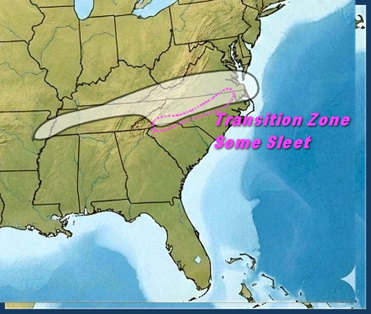
Mostly grass accumulation he told me as far as the bigger rates. I am sure roads will be slick for a while if any moisture fallsSuperb analysis from Robert Gamble. Please consider giving him a subscription
View attachment 177910View attachment 177911How Much Snow On This Friday Event?
First Guess at Where and How Much (Plus a Sleet Dividing Zone). Good CAD Event VA/NC
I just noticed the RAP gave me 4"........................................................................ 
LukeBarrette
im north of 90% of people on here so yeah
Meteorology Student
Member
2024 Supporter
2017-2023 Supporter
Holy shiiiiiiThat fv3 hires is going to start creating unrealistic expectations..
Well I have found my model of choice ride or die
Bigedd09
Member
Well I have found my model of choice ride or dieView attachment 177919
Me too lol
Sent from my iPhone using Tapatalk
MichaelJ
Member
WRF is some kid using crayons to make you think something is coming 
packfan98
Moderator
DT’s prediction.

Brent
Member
Well we're getting the snowing south of me out of the way early this year 
Gsp thinking foothills will stay mostly snow per the overnight AFD. Precip might be gone by the time the warm nose takes hold. It's rare but I've seen Marion get 3in while Asheville got freezing rain. Rare but someone along the escarpment may be in for a suprise.

As SD said. Gotta ride the Warf Sisters. Cause the 6Z Nam skunks us in NC pretty much. 6Z RDPS is middle ground between the two.


The 6Z Nam jumped way north from its 0Z Run. Hopefully a Hiccup

The 6Z Nam jumped way north from its 0Z Run. Hopefully a Hiccup
BHS1975
Member
Beware the warm nose.As SD said. Gotta ride the Warf Sisters. Cause the 6Z Nam skunks us in NC pretty much. 6Z RDPS is middle ground between the two.
View attachment 177932
View attachment 177933
The 6Z Nam jumped way north from its 0Z Run. Hopefully a Hiccup
View attachment 177934
Brent
Member
30 minutes south of the metro lol no precip at all 5 minutes north
I approve of this D -T map!DT’s prediction.
View attachment 177927