• Hello, please take a minute to check out our awesome content, contributed by the wonderful members of our community. We hope you'll add your own thoughts and opinions by making a free account!

12/2/2024 - Potential Clipper Action!

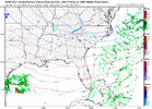
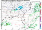
The "heaviest" snowfall right now appears to be in a band running from St. Louis down into S Illinois and W Kentucky. The location of that precip lines up well with the track of the 700mb vort max and max RH. Think we can keep it simple and just track that down into the Carolinas. We're already late in the game, but I don't think we're going to see some noteworthy jump to the northeast with the expected precip shield. Having said that, I hope all get in on some action here.

xwLurzp.gif

IYVHhLn.gif

bf5cwjQ.gif
 
last runs of the 3k keeps improving
 

Attachments

  • nam3km_mslp_pcpn_frzn_seus_fh13_trend.gif
    nam3km_mslp_pcpn_frzn_seus_fh13_trend.gif
    854.7 KB · Views: 29
This is why I still like the area NE of Charlotte just north of the US 74 corridor here.

It's where your low-level convergence & low-level frontogenesis zone extending NE of the mesolow is being maximized. Based on the low-level hodographs, which suggest these updrafts will tilt N-NE into the DGZ further aloft, you'll want to be near or just N-NE of this convergence axis to jackpot & get accumulating snow.

Screenshot 2024-12-02 at 1.24.18 PM.png
 
Our old Clint Eastwood Poster lives right in that sweet spot on webbers map. Aint seen him in while, great poster/Knowledgeable. Forgot his username.
 
This is why I still like the area NE of Charlotte just north of the US 74 corridor here.

It's where your low-level convergence & low-level frontogenesis zone extending NE of the mesolow is being maximized. Based on the low-level hodographs, which suggest these updrafts will tilt N-NE into the DGZ further aloft, you'll want to be near or just N-NE of this convergence axis to jackpot & get accumulating snow.

View attachment 155343
This is a smaller/lighter and more NE version of this event it seems https://www.weather.gov/cae/Feb162013SnowEvent.html
 
NWS GSP says...

Clouds will definitely break containment and spread southeast across
the area overnight. Given the strength of the forcing and very low
ice crystal growth zone, flurries or even light snow showers will be
possible across the foothills and Piedmont of NC and maybe into York
County. Can`t rule out a flurry farther west, but no significant snow
expected over NE GA and most of the Upstate. With lows falling into
the low to mid 20s, snowfall rates could briefly become high enough
for a light dusting in grassy or elevated surfaces. If this does
occur, amounts will be less than half an inch. Best timing for snow
would be midnight to 4 AM. Gusty winds will develop overnight as
well and linger into Tuesday morning. Clouds will quickly scatter
out tuesday morning. Highs will be in the low to mid 40s.
 
Given how this event has been (over)performing upstream, the pronounced and discrete low-level forcing mechanisms in place here & the cold air temperatures, it's almost a given that some lucky folks east of the mountains are going to see some light snow accumulation out of this.
Gonna make a map for this event ?
 
Back
Top