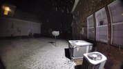
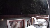
I got a dusting a couple of years ago at the new place on something similar. Just got under a little band for awhile.Think we could get some flakes down into the northern ATL burbs. Feels like sometimes these events can overperform a bit before they dry up around I-20
-
Hello, please take a minute to check out our awesome content, contributed by the wonderful members of our community. We hope you'll add your own thoughts and opinions by making a free account!
You are using an out of date browser. It may not display this or other websites correctly.
You should upgrade or use an alternative browser.
You should upgrade or use an alternative browser.
12/2/2024 - Potential Clipper Action!
- Thread starter packfan98
- Start date
Cad Wedge NC
Member
This has Jan 2003 vibes..... with the meso-low in the upstate and the angle of the clipper. Someone will be surprised. I believe the ratios will be high also, due to the cold upper levels and lift the DGZ
SimeonNC
Member
What happened in January 2003?This has Jan 2003 vibes..... with the meso-low in the upstate and the angle of the clipper. Someone will be surprised. I believe the ratios will be high also, due to the cold upper levels and lift the DGZ
I just wanna set expectations as far as early cliff jumping. Models generally starting up precip E of the Apps ~10pm so please don’t come in here saying bust at 8:15
Hickory, NC 6pm: 34 Temp / 17 Dewpoint
Cad Wedge NC
Member
The highest ratio snow of all time ..... 49 to 1 in charlotte. Happened with a set up very similar to this one.What happened in January 2003?
Up in the frozen northHickory, NC 6pm: 34 Temp / 17 Dewpoint
Oxford: 32/10(!)
Roxboro: 32/16
Also, NAM MOS had HKY at 33/16 at 7pm, so looking good there for guidance
Webberweather53
Meteorologist
That’s the one. I had trouble getting off my street on to 41 and didn’t hit snow again to near Atlanta.Might have been 1/29/22. Downtown got a dusting as I was leaving work. Here’s a pic of Centennial Olympic park
View attachment 155362
SimeonNC
Member
37.4/21.1F dew points. I think this is the quickest I've hit the 30s so far.
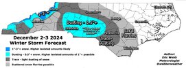
Seems realistic! Would be a welcome sight after the past 2.5 years+My best guess for this event. Admittedly, I was a little rusty at making these. It's been a while
View attachment 155364
A clipper system was forecast to give the CLT metro area around and inch or so of snow. A mesolow formed near GSP at the last minute and the are metro area ended up getting 6-10” in just a matter of a few hours. There was officially 8.5” at the airport with an unheard of around here 40:1 snow to liquid ratio. Some parts of Cleveland County over to Lincoln County ended up with over a foot. There was also thundersnow throughout the eventWhat happened in January 2003?
Blue_Ridge_Escarpment
Member
32/20 here on the shores of Lake Hickory
SimeonNC
Member
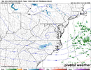
On a scale of 1-10, how much should I get about the north shifts on both the HRRR and the RAP? I'm assuming due to the meso low and the potential frontogenesis I shouldn't care that much at all right?
SimeonNC
Member
Oh wow. It would be amazing if we got like 1/3 or 1/4 of that.A clipper system was forecast to give the CLT metro area around and inch or so of snow. A mesolow formed near GSP at the last minute and the are metro area ended up getting 6-10” in just a matter of a few hours. There was officially 8.5” at the airport with an unheard of around here 40:1 snow to liquid ratio. Some parts of Cleveland County over to Lincoln County ended up with over a foot. There was also thundersnow throughout the event
J1C1111
Member
I got 12.5 out of that one in SW Rutherford county. One of the best surprised clipper systems coming over the mountains I've ever seen in my 42 years living here. Ended up turning into one of the best snowstorms of all time around here that wasn't supposed to be. Hoping for some surprises tonight for everyone after the storm crosses the mountains and reforms. I have a feeling someone is going to be surprised in the morning. Good luck to all. We are definitely way past overdue.A clipper system was forecast to give the CLT metro area around and inch or so of snow. A mesolow formed near GSP at the last minute and the are metro area ended up getting 6-10” in just a matter of a few hours. There was officially 8.5” at the airport with an unheard of around here 40:1 snow to liquid ratio. Some parts of Cleveland County over to Lincoln County ended up with over a foot. There was also thundersnow throughout the event
GoDuke
Member
Alright yall. Dinner a success. Christmas movie on. Dog in lap. Kid gone nuts. May flurry watch 2024 commence. 


NBAcentel
Member
Basically the beginning of him probably realizing it might be more then just a flurry east of the mountains
Basically the beginning of him probably realizing it might be more then just a flurry east of the mountains
I love Brad but what’s with all his hate/down talk to possible winter weather. I get a lot of meteorologists make bad calls and get burned but he takes the cake for downplaying everything!
We’re not terribly far off from having the entire state below freezing! Even in Raleigh the Econet sites are around 33 (RDU 36 ofc)
I'd say models improving close to go time is always better than the opposite, soOn a scale of 1-10, how much should I get about the north shifts on both the HRRR and the RAP? I'm assuming due to the meso low and the potential frontogenesis I shouldn't care that much at all right?
SimeonNC
Member
I was mainly talking about the recent RAP runs seemingly having most of the precip north of CLT, it's a selfish weenie question lolI'd say models improving close to go time is always better than the opposite, so
CNCsnwfan1210
Member
29.7/23 in SW Wilson county, rooting for my neighbors in western/southern piedmont!
Sent from my iPhone using Tapatalk
Sent from my iPhone using Tapatalk
olhausen
Member
I hear ya. I am watching them too. We can say with good confidence that this isn’t going to explode into some big event, but the goal would be to see the precip blossom some east of the apps and hang around for a few hoursI was mainly talking about the recent RAP runs seemingly having most of the precip north of CLT, it's a selfish weenie question lol
Rock Hil, SC (south of Charlotte) were at 33.1, 24.1 dew point, and 70% humidity. Humidity has gone up substanually over the last 2 hours or so from 38%. Temp down from 44.1 2 hours ago and dewpoint is down 1 from an hour ago.
Edit: now at 28.9F and 24.1F dewpoint with 82% humidity.
Edit: now at 28.9F and 24.1F dewpoint with 82% humidity.
Last edited:
Noticed it too, hrrr showing it as well last run. Hoping it’s just feedback issues and won’t be a worry.I was mainly talking about the recent RAP runs seemingly having most of the precip north of CLT, it's a selfish weenie question lol
Webberweather53
Meteorologist
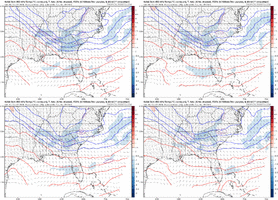
I can definitely see some potential for release of conditional symmetric instability (CSI) in this event, which would increase the snowfall rates in some isolated areas/enhance the banding.
You don’t have much warm advection obviously but you do have some decently defined snow bands that are oriented parallel to the deep-layer thicknesses/thermal wind and a moist neutral type of profile up to about 600mb
You don’t have much warm advection obviously but you do have some decently defined snow bands that are oriented parallel to the deep-layer thicknesses/thermal wind and a moist neutral type of profile up to about 600mb
Blue_Ridge_Escarpment
Member
Temp plummeting on the north side of hickory. 30/22
Clear skies galore and below freezing. Little frost formation by midnight before clouds roll in would be insurance to catching every flake on top of the grass blades
Looking at hrrr runs a few hours ago even to the latest it had TN with spotty returns and Nashville area is getting it good right now so hopeful for usNoticed it too, hrrr showing it as well last run. Hoping it’s just feedback issues and won’t be a worry.
If it lasts more than 4 hours call a doctor.View attachment 155371
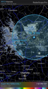
The virga has begun
Webberweather53
Meteorologist
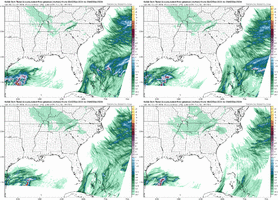
Man this thing is juiced up over TN. Gonna be an overperformer for many
severestorm
Member
Anything for Asheville?Man this thing is juiced up over TN. Gonna be an overperformer for many
Twister
Member
Wouldn't be surprised if some of us upstate folks sees some as juiced as this thing is
NBAcentel
Member


