• Hello, please take a minute to check out our awesome content, contributed by the wonderful members of our community. We hope you'll add your own thoughts and opinions by making a free account!

Wintry 1/9-12 Winter Potential Great Dane or Yorkie

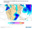
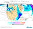
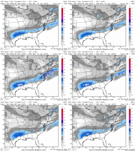
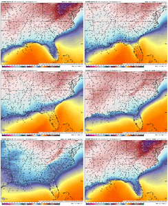
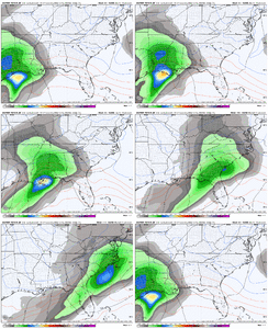
Not sure if anyone posted the CMC ensemble mean. Looks about the similar to EPS and then it’s much snowier over North Carolina View attachment 160405

d8a3d2edb09899034972b487ed9498a3.gif

Overall (still) gulf coast to off SE coast surface low track, many snowy but more icy members for the Carolinas


Sent from my iPhone using Tapatalk
 
Glenn Burns and his secret model:

Here we go!
1. We have the arctic air in place Friday
2. Low pressure in the emerges from the
Gulf of Mexico and hurls moisture into
the cold air
4. Result will be snow, wintry mix, and rain
5. On average 1-3 inches for north Georgia
and a huge drop off for areas south of
I-20. Normally I would not show totals
this far out but I have access to
computer models no one else has and
the skill they have is incredible
6. Let’s also remember there is a HUGE
difference between SNOWFALL and
SNOW ACCUMULATION. Although it
Is cold the average ground temp,
according to the UGA weather
Station was 50 degrees 3 days ago.
There will also besome rain mixed in
so 1-3” might fall, maybe 1 -1.5”
would be the actual accumulation.

CONFIDENCE LEVEL: HIGH
a787a7cdfbfd7bb2353cf58abd93785a.jpg


Sent from my iPhone using Tapatalk
 
FFC Afternoon Disco
----------------------------------------------------------------------------
.LONG TERM...
(Wednesday morning through next Sunday)
Issued at 238 PM EST Mon Jan 6 2025

Key Messages:

-Temps will fall to near 10 degrees below normal through the
long term.

-Confidence is pretty high that we`ll some kind of precip. Friday
and into Saturday, but what type is still up in the air.

Forecast:

Cold will remain in place as the long term picks up on Thursday.
Highs will be in the low 40s and upper 30s with overnight lows in
the low 20s and possibly some teens in the mountains. Breezy NW
winds will make it feel colder during the day with widespread
windchill in the teens for much of the metro area and northwards.

By Friday afternoon a low out of the SW is expected to push up along
the Gulf Coast brining our next round of precipitation. Timing is
going to be the big issue with getting the wx element correct here.
As it currently stands, both the GFS and Euro favor an
evening/overnight event in which temperatures could drop below
freezing. If that`s the case, the I-20 corridor would likely see a
rain snow mix while northern GA sees all snow. Some of that mix will
likely change to snow during the overnight hours, though the system
appears to be in a hurry to get outta here which means little to no
accumulations expected. As far as northern GA goes, accumulations
less than an inch seem to be most likely, though areas of higher
elevation in NE Georgia could see 1 to 3 inches.

As the system moves out, temperatures look like they might try and
rebound a little which highs in the upper 40s and lower 50s as we
kick off the start of next week.

The most important take away here is there is still plenty of
uncertainty in the forecast. While the tracks may be in agreement
small changes in timing and mid layer temperature will drastically
change the precipitation type. Please continue to monitor the up
coming updates for the latest information.
 
Glenn Burns and his secret model:

Here we go!
1. We have the arctic air in place Friday
2. Low pressure in the emerges from the
Gulf of Mexico and hurls moisture into
the cold air
4. Result will be snow, wintry mix, and rain
5. On average 1-3 inches for north Georgia
and a huge drop off for areas south of
I-20. Normally I would not show totals
this far out but I have access to
computer models no one else has and
the skill they have is incredible
6. Let’s also remember there is a HUGE
difference between SNOWFALL and
SNOW ACCUMULATION. Although it
Is cold the average ground temp,
according to the UGA weather
Station was 50 degrees 3 days ago.
There will also besome rain mixed in
so 1-3” might fall, maybe 1 -1.5”
would be the actual accumulation.

CONFIDENCE LEVEL: HIGH
a787a7cdfbfd7bb2353cf58abd93785a.jpg


Sent from my iPhone using Tapatalk
He literally hand-drew this in MS paint and called it a 'secret model with unparalleled accuracy'.
 
MRX Afternoon Discussion:

LONG TERM...
(Tuesday night through next Monday)
Issued at 158 PM EST Mon Jan 6 2025

Key Messages:

1. Much below normal temperatures through next week. Coldest
temperatures will be Thursday morning with lows ranging in the
teens to single digits above zero.

2. Dry weather expected Tuesday night through very early Friday
morning.

3. Friday into Saturday will be one to watch with the potential
for snow for most likely the entire forecast area. Too early for
details.

Discussion:

Nearly zonal flow with high pressure dominating at the surface can
be anticipated through Thursday. So once the snow mentioned above
ends, dry, but cold weather will take hold for Wednesday and
Thursday. Coldest lows will be Thursday morning where generally
teens are forecast and the possibility of isolated spots dipping
into the single digits. 850 temperatures for the northern parts of
our forecast area may end up in the teens below 0C.

Now the focus on Friday into Saturday. A ridge and trough will become
highly amplified Thursday into Friday. Strong surface high
pressure will slowly jog eastward. Sometime Thursday, a low
pressure center will develop over the western Gulf along Texas`
coastline. Appears will begin as a Miller A and then transition
to a Miller B. Deterministic models are still highly variable with
arrival time; GFS has been the fastest the past couple of model
runs with precip at our doorstep 12Z Fri, while the Euro and
Canadian lag a bit behind. This will all come down to exact track,
arrival time, any intrusions of warm air at the surface or aloft
after this cold pocket we will be in, QPF amounts, etc. But what we
can confidently say is, a system will impact the early part of
this coming weekend. Precipitation type, snowfall amounts and
other sorts of details are too far out in time to determine.
Based on our latest forecast the entire forecast area will see at
least more than one inch of snowfall. LREF probabilities do show
as high as a 60% chance of greater than two inches of snowfall.

Mid to late day Saturday, the snow may end as NW flow across the
mountains before we dry out for Sunday. No considerable cool down
after this system, but we will stay below normal.
 
NWS Raleigh

.LONG TERM /FRIDAY THROUGH MONDAY/...
As of 300 PM Monday...

* Chances for wintry weather continue late Friday through Saturday,
but uncertainty continues with respect to specific p-types.

Friday and Saturday: Still looks like there could be a potential
winter weather event across central NC late Fri through Sat.
However, there are some differences between the medium-range model
guidance in the upper level pattern, particularly the track of a
northern stream low Thu-Sat, and subsequently the impact it has on
the synoptic scale trough and how it interacts with a low ejecting
newd from the Baja. Generally, both lows will be embedded within a
high amplitude trough as they all track ewd through the CONUS. The
GFS brings the northern stream low south into the mid-MS Valley by
12Z Sat, while the EC keeps the low over Canada, near the Hudson Bay
at 12Z Sat. Consequently, the southern stream wave remains separate
in the EC solution as it continues ewd through the mid-Atlantic and
Southeast US Fri night/Sat, while in the GFS the southern stream
wave begins to lift newd as it moves through the mid-Atlantic Fri
night/Sat, wrapping into the northern stream low over New England
Sat/Sat night. How this translates at the surface, the EC solution
continues to show a Miller A track, with a single low moving ewd
across the Gulf coast, through the Southeast US and enewd along the
Carolina coast. The GFS on the other hand, while still showing a
Miller A track, is starting to show hints of a secondary low over
the OH Valley as the primary low lifts newd along the Southeast US
and Carolina coast. The GFS low is also a bit farther west, scraping
along the Carolina coast rather than offshore of it. Then, rather
than heading ewd over the Atlantic like the EC, the GFS low bombs
out over New England Sat eve/night. Leading up to the arrival of the
low, high pressure will remain over central NC on Fri, then be
shunted nwd Fri night as the low moves through the Southeast US. The
eventual track of the low will determine how far north the high will
be shunted and thus impact temperatures during the event. With all
that in mind, there is still a good amount of forecast uncertainty,
especially wrt the p-types, with this system. For now, onset timing
appears to be as early as Fri aft, but more likely Fri eve/night.
Over the Piedmont, with the cold air in place, saturation in the
dendritic growth zone, and all but the near-surface layer at or
below zero C, precipitation should start as snow. Farther east over
the Sandhills and Coastal Plain onset could be rain or snow. There
will be the chance for some mixed p-type (fzra/sleet) before a
transition to rain, if the warm nose aloft is strong enough (GFS).
Precipitation should gradually come to an end from W-E through the
day Sat as the low moves away and a cold front moves in. Would
expect to see the medium-range guidance coming into better agreement
Tue night/Wed as the wave, which becomes the northern stream low,
moves inland over western Canada.
 
34 in Winston-Salem right now with a 32 dew. An absolutely miserable day to be outside very much. As for the Fri/Sat/Sun storm for the SE, I think a blend of the UKMET and Euro AI are very likely to be the outcome, but there is also a chance the CMC is right with everything except its QPF (which is too high). Temps are going to be problematical for Ga, SC and Eastern NC from Raleigh East. I think N Ala and Miss have a high chance for a very short period of sn followed by much more IP and ZR. I hope for your power it is IP predominantly. Tn. will be the biggest winners in the SE IMO as has been the case for several years now. If we had a parent high of 1032 or so, we all would be in business but it is just not there on any of the models
 
From CAE (Columbia)

Confidence increasing in the potential for winter weather late
this week into the weekend, especially in the northern portion of
the forecast area.

Friday ensemble members are consistent in a surface low developing
along the southern Gulf coast which will move towards the forecast
area as it is picked up by an amplified trough moving across the
central CONUS. Moisture transport will rapidly increase with NAEFS
mean indicating integrated water vapor transport will exceed the
90th percentile. Rain will likely overspread the area, although with
the cold air mass in place, there is concern with the potential for
mixed wintry precipitation late Friday into Friday night. Forecast
soundings indicate a deep layer of temperatures right around 0C so
uncertainty remains high which is not unexpected with a day 5 winter
weather forecast. The caveat to this is the ensemble (ENS and GEFS)
members have trended colder with more members below 32F at the
surface, mainly along the northwestern most counties, with less
confidence in winter weather in the Columbia and Augusta metro
areas. This would be a potential setup for freezing rain as more
GEFS and GEPS members are indicating the potential for measurable
freezing rain, especially north of I-20 (around 30 percent of
members, although GEPS members generally have trended much colder
the GEFS members). WPC Probabilistic Winter Storm Severity index has
also trended upwards for the potential for minor impacts across the
northern portion of the forecast. While in general, as specifics
really are difficult to ascertain at this point, the overall trends
are concerning in the potential for winter weather, especially with
the increasing potential for ice. &&
 
I don't like how the GFS takes the low from Tallahassee to Macon to Columbia; that really pushes the warm gulf air up our way and dry slots the peidmont; 2 negatives. We need it to track east to minimize the WAA and give more people a chance.
With the CAD in place...it will go around...likely not the correct solution.
 
GSP (Greenville-Spartanburg NWS)
) Cold temperatures well below normal and dry conditions through
Thursday.

2) A low pressure system may bring moisture with cold air in place
across the region late Friday into Saturday.

As of 200 PM Monday: By the end of the week, model guidance
continues to signal for an area of low pressure forming somewhere in
the Gulf and swinging up the southeast coast Friday into Saturday.
This consensus does increase confidence that a system could bring a
round of precipitation into the CWA during that time frame. Ahead of
the low, cold are remains in place as moisture starts to increase a
bit. The combination of colder air and moisture returning to the
area increases the likelihood of wintry precipitation across the
region. Now, this is where the forecast gets tricky. Ensemble
guidance suggests a 35%-60% of wintry precip in the Upstate of SC
and NC mountains. Taking a look at current trends for the placement
of this area of low pressure, the exact type of precip is uncertain.
Depending on how this system behaves and whether or not it lifts
more north or sags south, can be the difference between rain and a
wintry mix. At this time, model guidance has slowed the system a tad
and brings it in more during the overnight hours on Friday into
Saturday. So, for now, what we can say with more certainty is a low
pressure system is likely to move into the southeast and move across
the CWA. However, what the precipitation will look like exactly
remains uncertain as this event remains 5 days out. Either way, the
system does appear to be at least a fast mover and shouldn`t linger
when it arrives. The system looks to clear the area late Saturday
with quiet weather ensuing. Temps remain below normal with dry
conditions expected afterwards.
 
Wow that would definitely help the I-20 crowd.
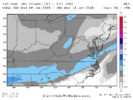
That low can be seen on the last frame definitely in the moment seem like its moving more due east staying off-shore moving east it might turn up eventually but the longer it orients eastward the more benefit areas in mid-southern states will benefit with less WAA which is basically what UKMET did
 
1736196657055.png
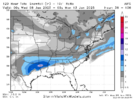
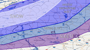
I'm not even going to think about doing a first call on totals until Wednesday. But just my first idea at least on where I think as of now the P-Types are looking like. I still think we trend to a bit more precip as a general consensus. Along and north of 85 and east of 77 I feel more confident that in snow especially in the beginning. South and east of there I think we are looking at more mix bag. Again this can easily change as we are 3-4 days left with changes to what feels like every run.
 
Back
Top