Well the good news is that you all have had a Winter storm multiple times the last few Winters. And this will no doubt be one also.All of that guidance is warmer for N AL.
-
Hello, please take a minute to check out our awesome content, contributed by the wonderful members of our community. We hope you'll add your own thoughts and opinions by making a free account!
You are using an out of date browser. It may not display this or other websites correctly.
You should upgrade or use an alternative browser.
You should upgrade or use an alternative browser.
Wintry 1/9-12 Winter Potential Great Dane or Yorkie
- Thread starter SD
- Start date
Storm5
Member
12z euro is ukmet like with a flatter wave vs the mega amped gfs that bombs and crushes the MA
Cant wait to watch this one slide to their south
Cant wait to watch this one slide to their south
wow
Member
Even we're going for less of an amped solution, I still think the QPF output will trend higher with this one over the east. Given this look at the start. Euro really starts to lose the juice after crossing the MS river. We'll see

Xlhunter3
Member
ROOT HARD FOR THE UKMET: My best advice
thanksgivingbrown
Member
Yeah, I’m not buying that at allDo we really think it gets warm enough for the back side to be rain in the Tennessee valley?
That’s a Miller A all the way. It produces areas of mixed precip, but that can happen with A’s depending on what’s going on in the mid levelsBy the looks of what Fro just posted I guess you could call it a hybrid? The way I look at it it’s close to a Miller A track with a B style transfer

SimeonNC
Member
I wonder if the EPS is gonna have more juice members
SnowNiner
Member
Even we're going for less of an amped solution, I still think the QPF output will trend higher with this one over the east. Given this look at the start. Euro really starts to lose the juice after crossing the MS river. We'll see
This seems to be consistent through many of the models. You can see it on the ensembles too. TX gets hit hard and the storm just dies out as it moves east past the mountains (save the Ukmet). I saw a mention about it's the jetstreak for the storm or something? Do we have a consensus why it's a moderately strong storm but it weakens so fast? Just too progressive and positive tilt?
I'm more worried about this being a nuisance event than I am being too amped at this point.

Drizzle Snizzle
Member
I know people in Dallas like itEPS...we like or nah?
View attachment 160375
Storm5
Member
Areas west of the apps will like the eps
Blue_Ridge_Escarpment
Member
I like the changes it showed through hour 84. I think you’ll see those keep translating down the lineEPS...we like or nah?
View attachment 160375
Ron Burgundy
Member
That looks alarmingly like the Canadian ice map

CNCsnwfan1210
Member
EPS...we like or nah?
View attachment 160375
Looking more and more like a southern slider
Sent from my iPhone using Tapatalk
ForsythSnow
Moderator
I wonder if we will start to see the amounts grow more eastward like how the UK has it. May take some energy or models picking up on signs but I'd wonder.EPS...we like or nah?
View attachment 160375
This lines up more with the UKMET and some what the GFS as are as orientation of Frozen stuff but some gave more love to NC then Euro Ensembles doEPS...we like or nah?
View attachment 160375
Showmeyourtds
Member
Euro didn't help GA folks, but that's mostly due to the slightly stronger LP system in the Gulf. Still alot to resolve.
As an aside- the concept of naming winter storms is perhaps one of the most useless things shoved down the throats of the American public in quite sometime.
As an aside- the concept of naming winter storms is perhaps one of the most useless things shoved down the throats of the American public in quite sometime.
Dallas is at an 8 inch MEAN on the EPS. I’m gonna throw up lol
The ensembles for Euro really were not that bad and definitely more south with winter stuff so in general a more shifted sign if anythingEuro didn't help GA folks, but that's mostly due to the slightly stronger LP system in the Gulf. Still alot to resolve.
As an aside- the concept of naming winter storms is perhaps one of the most useless things shoved down the throats of the American public in quite sometime.
NBAcentel
Member
Euro has been trending colder. I think 2mt are becoming less of a concern 
SimeonNC
Member
2-4 inch mean for the I-85 corridor, i can deal with thatEPS...we like or nah?
View attachment 160375
NBAcentel
Member
To me it just seems the EPS is increasing the closer you are to the event, further out still not much confidence 
Thoughts around this could this be modeling datapoint adjustments reflecting the storm that has progressed from last night with snow cap above? Obviously WAA affects and just how the stream comes will have a say in the boundary layers but would be fun to find out if soEuro has been trending colder. I think 2mt are becoming less of a concern View attachment 160376
Yeah if we keep trending that way we can worry more about track than anything else. That alone will determine a tonEuro has been trending colder. I think 2mt are becoming less of a concern View attachment 160376
SnowNiner
Member
EPS...we like or nah?
View attachment 160375
Looks like a great storm west of the Mississippi. Hopefully they leave us some.
Showmeyourtds
Member
I haven't had a chance to look at the ensembles yet, but the overall look is better- that, I would agree with. I'm still (and continue to be) more intrigued with how the gulf low will navigate any kind of CAD that sets up. The 12z GFS had a really nice HP system in the NE that ( I would like to think at least), would funnel some more cold air down the apps. It does wobble a little bit from frame to frame, but again, its more than workable.The ensembles for Euro really were not that bad and definitely more south with winter stuff so in general a more shifted sign if anything
rburrel2
Member
Every model trended towards more liquid for GA/SC/NC at 12z... that's a great sign. I think they all pretty much trended colder both at the surface and mid levels too. All in all, a great 12z cycle. Rain is pretty much out of the equation for upstate, SC and Central,NC.
carolinachaos
Member
Euro has been trending colder. I think 2mt are becoming less of a concern View attachment 160376
I wonder if that Baroclinic zone off the coast of SC is where a Low pressure forms? That gradient is crazy.
Sent from my iPhone using Tapatalk
EPS has >50% chance of >0.1" freezing rain across much of Metro Atlanta...

Bigedd09
Member
I like how this is trending for the southeast. Also snow mean dropping further south is greatTo me it just seems the EPS is increasing the closer you are to the event, further out still not much confidence View attachment 160377
At onset i think I agree. I would definitely not rule out a switchover yet though. Maybe for far northern upstate and favored cad regions of nc, but there’s still too much guidance that either outright flips to rain or gets close to rule out imoEvery model trended towards more liquid for GA/SC/NC at 12z... that's a great sign. I think they all pretty much trended colder both at the surface and mid levels too. All in all, a great 12z cycle. Rain is pretty much out of the equation for upstate, SC and Central,NC.
Storm5
Member
Yeah seems the eps is trending colder with time and expanding the snow further east .
Nice improvement at 12z
Ukmet / euro flatter southern wave
GFS amped to hell
Nice improvement at 12z
Ukmet / euro flatter southern wave
GFS amped to hell
CNCsnwfan1210
Member
To me it just seems the EPS is increasing the closer you are to the event, further out still not much confidence View attachment 160377
Snowfall mean creeping south toward I-20 again, nice trend overall on the EPS
Sent from my iPhone using Tapatalk
iGRXY
Member
Okay let’s relax now.It’s wild—it really feels like the winter weather in this storm is just going to completely skip over South Carolina altogether.
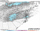
Updated WPC probabilities 
Look at the amount of gulf air.Okay let’s relax now.