griteater
Member
GFS here shows 500mb mid-upper level vertical motion and moisture increasing late this afternoon into this evening. Will be an abrupt end to the snow on the backside and blue skies in the morning for early pictures


Thing almost went comma head there near the endGFS here shows 500mb mid-upper level vertical motion and moisture increasing late this afternoon into this evening. Will be an abrupt end to the snow on the backside and blue skies in the morning for early pictures


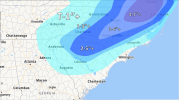
Can you nudge that a little higher. I’m right on the edge here in Huntersville.Final call. Can’t help but go bullish with the way things look OBS wise, had to rush this one tho because I’m at work View attachment 109180
Yea radar is looking great. Optimistic here in se Charlotte.


What's your call for Raleigh KyloG?
Per my wife who at our home in Wingate, there is some very light snow falling… I’m at work in Stallings and so far haven’t seen anythingVirga, let’s see if it can start to make it down to the ground
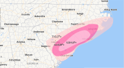
View attachment 109179
Interesting. Nothing here in Waxhaw yet.Per my wife who at our home in Wingate, there is some very light snow falling… I’m at work in Stallings and so far haven’t seen anything
