Heelyes
Member
I think we get another day out of it
He used to post on weather forums back in the day too. I learned a lot from him.Allan Huffman nailed this forecast. I’ve been following him for quite a while on Twitter and there’s a reason why
Drove up 95 today and was thinking about how close you were to seeing ice. I saw ice hanging in the trees not far past the state line and frozen all the way up from that point in one way or another. I've done that drive a ton over the years and seeing it covered in snow seemed a bit otherworldly.SN/liquid per official measurements:
Charlotte 1.9"/0.15" 13:1
RDU 2.3"/0.21" 11:1
GSO 1.0"/0.10" 10:1
How do these ratios compare to expectations?
Aside: my lowest with the rain was 32.7, making it easily the coldest rain here in 4+ years!


Man I love that part of the banks. It makes me wonder how the horses behave in a storm like that.Just got this picture sent to me this evening my cousin has a house up there a friend sent it to him. Carova beach!
Impressive snowfall. A FOOT!

Sent from my iPhone using Tapatalk
That would be interesting to know how the horses cope with the snow! And yes I love going down there also, It's fun as heck driving on the beach. My cousin house is one mile below the Virginia border, I think I turn and jump the dunes at MM 22 or 23 lol. Love it!Man I love that part of the banks. It makes me wonder how the horses behave in a storm like that.
Father in law has a place a block off the beach in Kitty Hawk. OBX is a special place no doubt about it. I enjoyed taking a day trip down to Ocracoke my first year going. This year will be my 6th and I’ve yet to explore the northern sections but it’s happening this year. Big money up on the north side.That would be interesting to know how the horses cope with the snow! And yes I love going down there also, It's fun as heck driving on the beach. My cousin house is one mile below the Virginia border, I think I turn and jump the dunes at MM 22 or 23 lol. Love it!
Father in law has a place a block off the beach in Kitty Hawk. OBX is a special place no doubt about it. I enjoyed taking a day trip down to Ocracoke my first year going. This year will be my 6th and I’ve yet to explore the northern sections but it’s happening this year. Big money up on the north side.
 and I’ve seen plenty 4x4 stuck.

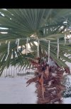
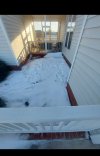
Yeah I love that I live on the shady part of our apartment so my snow when I walk out of my place is always there .. probably for as long as we have below freezing nightsView attachment 109966
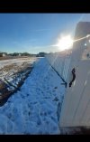
Bye! Thanks for coming. Headed to Umstead should be a decent amount left since it’s a shady place. But in sun spots it’s gone
I would say it just illustrates why you can’t bank on crazy good snow ratios around here, no matter the conditions. 10:1-13:1 is certainly better than normal here, but it’s a far cry from 15:1-20:1 like seemed potentially possible.SN/liquid per official measurements:
Charlotte 1.9"/0.15" 13:1
RDU 2.3"/0.21" 11:1
GSO 1.0"/0.10" 10:1
How do these ratios compare to expectations?
Aside: my lowest with the rain was 32.7, making it easily the coldest rain here in 4+ years!
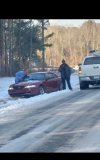
Still holding on to some decent snow pack in most places. Some yards are clear some still have full snow In the shade. Just drove in to town and some shaded roads are still bad and a car just slid off the road.