
-
Hello, please take a minute to check out our awesome content, contributed by the wonderful members of our community. We hope you'll add your own thoughts and opinions by making a free account!
You are using an out of date browser. It may not display this or other websites correctly.
You should upgrade or use an alternative browser.
You should upgrade or use an alternative browser.
Pattern Octorchber
- Thread starter SD
- Start date


I swear I'm gonna miss the NAM



LukeBarrette
im north of 90% of people on here so yeah
Meteorology Student
Member
2024 Supporter
2017-2023 Supporter
Right after the Virginia Tech game in Blacksburg
 .
I will be there and would stay the night for that

Get ready to lose storms to DC in the D3-4 range many times this winter! NE trend baby!!!This is an insane trend we are seeing in the short range. View attachment 198906

It will create its own cold air! October 2014 redux!


I'm on mission / still anticipating a Halloween / late Oct Hit job/ Big ticket east coast storm ( not Cane/ but extratropical/ Noreaster type with some tropical influence ). Don't see one yet. We shall see. Did see the ole CFS throw its first digital flakes of the season here in NW NC late 1st week NOV.
Euro and ICON try to get a coastal going this weekend. Actually close to a big deal eastern sections
NCSNOW started hinting at this idea in Sept for this autumn. There’s a strong correlation between very strong El Niños and having one significant to historic U.S. E coast storm in Oct. What I didn’t realize til today is that ALL 9 of the other very strong El Niño Octobers had one:
1877: Hatteras had 1002 mb on 10/27 along with significant rainfall and strong NE winds caused by gradient between a sub 1000 mb low offshore and a 1022 mb high over Quebec. Norfolk got 2.71” of rain. The low was TS #7 then to the S moving OTS:
1888: TS#7 went up the coast 10/11-12
1957: a strong nor’easter (995 mb) went up the coast 10/5-6 giving Hatteras 4.62” of rain:
1965: TS # 9 formed 10/16 NW Bahamas and hit NE FL 10/19 producing a whopping 8.3” of rain at CHS:
1972: very strong nor’easter went up coast NC-NE 10/5-8 with strong winds and heavy rains (>4” NYC, nearly 4” Hatteras):
1982: strong winds/heavy rain (3.64” of rain Hatteras) from nor’easter 10/23-26 due to strong gradient between 1004 mb low Hatteras and 1030 mb high NE US. I experienced this in DC and still clearly recall it:
1991: “Perfect Storm” 10/30-11/1H #8 (Boston rain 2.69”):
1997: nor’easter 10/18-20 (Hatteras rain 1.4”):
2015: strong front pushed by 1045 mb SE Canadian high gets hung up along E coast with ~stationary upper low SE US and MH Joaquin ~stationary Bahamas interacting in a way few have ever seen resulting in >17”/historic flooding CHS Oct 1-4:
———————————————
So, all 9 very strong El Niño had one impactful to historic US E coast storm in Oct! Are the 12Z UKMET, Euro, Euro-AIFS, and Icon sniffing out something real next week for 2026’s turn? Based on NCSNOW’s intuition and the history noted above, I wouldn’t at this point discount at least the possibility of something notable happening near the E coast next week.
Last edited:

Raleighwxauthority
Member
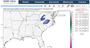
First call for possible snow on 10-18:
Raleigh: 2-4"
Charlotte: 1-3"
Asheville: 3-6"
Albemarle: Trace- Dusting (I think they get dry slotted)
Wilmington: 4-8"
Stay tuned for more updates! I hope to see more models hop on board with this event.
Raleigh: 2-4"
Charlotte: 1-3"
Asheville: 3-6"
Albemarle: Trace- Dusting (I think they get dry slotted)
Wilmington: 4-8"
Stay tuned for more updates! I hope to see more models hop on board with this event.
Attachments
Raleighwxauthority
Member
I think this is a sleeper event that could catch a lot of people off-guard.

It can’t be ruled out for the high peaks yet
I mean as 2014 showed, anything is possible, but I will believe it when I see it, LOL. I believe the earliest measureable snowfall for Raleigh is November 6th, for reference (not sure about sub-measurable).
Certainly is possible for the mountains, though!
Certainly is possible for the mountains, though!
Raleighwxauthority
Member
What are you thinking for snow totals?It can’t be ruled out for the high peaks yet

And I mean maybe. With that said I remember getting Snow in late November 2013 but this is mid October. It ain’t snowing ANYWHERE under 5k elevation right now. And even the guys above that need a lot of help.It can’t be ruled out for the high peaks yet

Drizzle Snizzle
Member
I saw snow around October 20th in 2018 ! Of course this was in Ohio near Dayton.And I mean maybe. With that said I remember getting Snow in late November 2013 but this is mid October. It ain’t snowing ANYWHERE under 5k elevation right now. And even the guys above that need a lot of help.
Bigedd09
Member
And I mean maybe. With that said I remember getting Snow in late November 2013 but this is mid October. It ain’t snowing ANYWHERE under 5k elevation right now. And even the guys above that need a lot of help.
Didn’t Columbia see snow November 1 a while ago
Sent from my iPhone using Tapatalk

Brent
Member
Meanwhile out here we're going from famine to feast! Still not over yet
And Friday is looking downright chilly with strong winds and I'm expecting to hear about some frost Saturday morning. The heat index touched 100 yesterday!
And Friday is looking downright chilly with strong winds and I'm expecting to hear about some frost Saturday morning. The heat index touched 100 yesterday!
Can't help but laugh
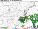
Someone did point out to me that though I was looking just at Oct storms, the late Sep ‘26 nor’easter may be the 2026 version of the Oct E coast storm. I think that’s a valid point to consider. If so, I wonder if that reduces the chance of getting one later this month since I saw only one bad one for each of the 9 very strong Nino analogs.
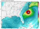

Holy cow….984 mb TC on 0Z Icon:View attachment 198925
If it went any further in its run, it would still be pulling cold air down and provide a good opportunity for freezing temps in some of the mountains.
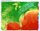
It’s also on the 0Z UKMET, the 3rd run in a row with this one a little stronger with a min of 1003 mb/max of 52 knots/60 mph. It forms off of S SC and then moves N into NC OB area followed by a move E a little offshore and then a S drift as it weakens:
NEW TROPICAL CYCLONE FORECAST TO DEVELOP AFTER 72 HOURS
FORECAST POSITION AT T+ 72 : 32.4N 76.0W
LEAD CENTRAL MAXIMUM WIND
VERIFYING TIME TIME POSITION PRESSURE (MB) SPEED (KNOTS)
-------------- ---- -------- ------------- -------------
0000UTC 18.10.2026 72 32.4N 76.0W 1010 42
1200UTC 18.10.2026 84 34.0N 75.1W 1008 48
0000UTC 19.10.2026 96 32.5N 75.9W 1003 52
1200UTC 19.10.2026 108 34.2N 75.2W 1005 45
0000UTC 20.10.2026 120 36.2N 75.6W 1004 40
1200UTC 20.10.2026 132 36.6N 74.7W 1006 35
0000UTC 21.10.2026 144 36.4N 73.1W 1007 33
1200UTC 21.10.2026 156 35.0N 72.7W 1009 34
0000UTC 22.10.2026 168 32.7N 73.4W 1012 35
Brent
Member
Incoming 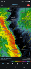
RDU had a high of 90 today, the latest 90 degrees has been recorded on record, breaking the prior record by a few days.


Dear Lord 0z Euro Op lets this thing just sit off the NC Coast and Cook for almost a week. As it gets down to 984 mb it finally takes off NE and deepens and hits the ole yanks up north,
This scenerio would be massive erosion for NC coast/ espeacilly OBX if it played out like this.
next friday/ same system
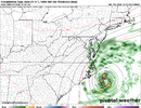
NEXT WEEKEND final chapter
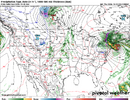
This scenerio would be massive erosion for NC coast/ espeacilly OBX if it played out like this.
next friday/ same system
NEXT WEEKEND final chapter
Is the lack of federal funding the reason for all of these wild swings with the models.

NoSnowATL
Member
They are given 1.3B a year. Money isn’t the problem.Is the lack of federal funding the reason for all of these wild swings with the models.
tennessee storm
Member
Blame it on the super Nino . lolIs the lack of federal funding the reason for all of these wild swings with the models.
Modeling is just a tool. They/Man will never be able to conquer forecasting weather with pin point accuracy on a consistent basis. Atmosphere is just to complex and evolving at warp speed. What makes our hobby fun imo.Is the lack of federal funding the reason for all of these wild swings with the models.
Is the lack of federal funding the reason for all of these wild swings with the models.
I doubt it. To the extent it affects them, it would probably affect further upgrades more than anything else, I’d suspect. And this would only affect the American modeling, anyways.
It is just a touchy situation. UKMET is one that has persistently produced a cutoff and a wet weekend in the Carolinas, while the Euro is a tamer solution. Not too terribly different at 06z Saturday, but the slightly more negative tilt at the base of the trough on the ukie helps swing it even further negative 12 hours later until it wraps up and gets left behind at 18z Saturday, whereas the Euro doesn't cut off until later. Big sensible wx difference between the twoIs the lack of federal funding the reason for all of these wild swings with the models.
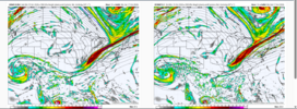
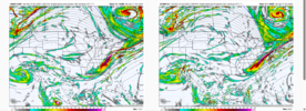
Full rundown of 12Z main global non-AI for the possible E coast storm next week excluding the not yet released Euro:
The 12Z UKMET, after 3 full runs in a row with an E coast “tropical cyclone”, has no TC and not even an E coast storm as the non-tropical low forms well offshore (300 miles) and then moves out NE from there to just NW of Bermuda.
12z Icon is much further offshore than its 0Z with little E coast effect.
12Z GFS is a bit closer (similar to the 0Z) but like for the 0Z the low still is far enough out to have little effect on the E coast as it then moves out.
OTOH, the 12Z CMC is its first run with effects on the E coast with it getting caught 300 miles SE of the Carolinas and then then coming back WSW to Jacksonville on 10/23. That’s now an extreme outlier pending that the 12Z Euro shows.

CNCsnwfan1210
Member
Based on hour 96 of the 12Z Euro, my guess is that it still will have an E coast storm.

12z Euro AI FWIW
Sent from my iPhone using Tapatalk
If flying a kite is your thing. Go spend 4 days on the obx with sustained 40mph wind per euro.

Ones coming this weekend!Just make sure you enjoy Fri/Sat
These “cold” shots may be few and far between this yearView attachment 198892
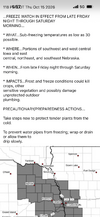
Precip shield is always further NW than modeled! -It will create its own cold air! October 2014 redux!


Man I can't wait for that front to move through tomorrow evening. Miserable out there right now. Feels like June!
The 18Z GFS came well W and is thus the most threatening GFS run yet by far to the E coast with it only 200 miles ESE of Hatteras as its closest! Also, the 18Z Icon has come back W a bit from the 12Z, which itself was less threatening than its 0Z that was coming right into the SE.
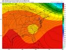
Back to 12Z, the JMA has it for the first time and hits much of the SE solidly with this with much of the Carolinas and S VA getting a very beneficial 2”+ of rain the next 8 days:
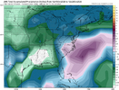
Back to 12Z, the JMA has it for the first time and hits much of the SE solidly with this with much of the Carolinas and S VA getting a very beneficial 2”+ of rain the next 8 days: