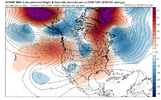
• Hello, please take a minute to check out our awesome content, contributed by the wonderful members of our community. We hope you'll add your own thoughts and opinions by making a free account!

Pattern December Doldrums 2025 🎄 ❄️

There is this, if you advance the loop a few hours and live in coastal SC.


prateptype_cat-imp.conus.png
 
Had surprise frost this morning. Looking like a run tonight decently below freezing but too much wind for more. ILM still discussing 4-5 days AN this at or below normal around Sunday timeframe. I still don't think this stretch will be enough to get us AN for the month at KFLO.
 
Related to my post just above this….
From elsewhere, look at how much the EPS has evolved for late month over one week of runs: note that this major evolution has occurred with the Aleutian ridge not budging but at same time the -NAO gets stronger and forces the rise of the PNA/big colder E US change from the NE!
IMG_6381.gif

@Webberweather53
 
Last edited:
Related to my post just above this….
From elsewhere, look at how much the EPS has evolved for late month over one week of runs: note that this major evolution has occurred with the Aleutian ridge not budging but at same time the -NAO gets stronger and forces the rise of the PNA/big colder E US change from the NE!
View attachment 179529

@Webberweather53
That ridge on the west coast hooking up with the -NAO, is good for cold in the East? Correct??
 
Related to my post just above this….
From elsewhere, look at how much the EPS has evolved for late month over one week of runs: note that this major evolution has occurred with the Aleutian ridge not budging but at same time the -NAO gets stronger and forces the rise of the PNA/big colder E US change from the NE!
View attachment 179529

@Webberweather53
The -NAO is getting stronger and stronger and more west based. It’s pushing the North Atlantic trough further and further south and west.
 
FWIW, the 06z euro is back to showing a similar solution that spit out the snowstorm on the 00z run from yesterday…

View attachment 179531View attachment 179533
Good catch! Wouldn't it be something if we see our little slider make a comeback over the next few cycles? Perusing through the various parameters confirms a near-perfect match with the execption of the stronger LP over the Canadian Maritimes.
1766413329468.png1766413488633.png
 

Attachments

  • 1766413349723.png
    1766413349723.png
    559.3 KB · Views: 10
Look how much the EPS has cooled for the lows of Dec 30th in just 6 runs thanks to the pushback from the strengthening -NAO despite the Aleutian ridge not budging!
It has cooled this much from the Friday 12Z run, an amazing amount for an ensemble mean over such a short period:

- Roxboro 12F from 38 to 26
- Charlotte 14F from 40 to 26
- CAE 14F from 43 to 29
- SAV 15F from 48 to 33
- ATL 18F from 45 to 27
- Chattanooga 19F from 41 to 22
- Nashville 19F from 42 to 23
- Birmingham 20F from 47 to 27
- Tupelo 19F from 48 to 29
- Chicago 13F from 30 to 17
- Tulsa 11F from 43 to 32

IMG_6396.gif
 
Last edited:
Look at how much the US population weighted HDD rose on the EPS mean from the 12/17 12Z run to the 12/22 0Z run for 12/28-31: 25 HDD (from a way BN 74 to a NN 99)! Normal is 100 HDD.

12/17 12Z HDD run in purple on left
IMG_6399.png

12/22 0Z HDD run in purple on left
IMG_6400.png
 
Last edited:
Back
Top