• Hello, please take a minute to check out our awesome content, contributed by the wonderful members of our community. We hope you'll add your own thoughts and opinions by making a free account!

Pattern April Showers

A secondary wave develops on the front and slings moisture back across the cold front in NC leading to snow on the backend for the same areas that were in the 60s/70s just several hours prior.
View attachment 4946
That would be crazy. Not sure what will happen with such temp extremes. Really depends on the timing.
 
I've seen enough to give up on the 100+ year SE US cold rain/wintry event possibility on 4/7. Yesterday, both the 0Z & 6Z GFS runs had a very weak low cross N FL underneath an Arctic high, highly unusual for this late in the season and thus producing the 100+ year April inland SE wintry/coastal SE cold rain. Also, the 12Z Euro had a very weak low cross S GA. However, today's 0Z/6Z runs pretty much all have any low crossing C or N GA. There have now been 4 GFS runs in a row without anything even close to the 0Z/6Z GFS runs of yesterday.
Yeah, but now we have a crazy cut off upper low wandering drunkenly about in the far out range...it's a veritable plethora of possible pleasures ahead, lol.
 
Got some pretty good rain and wind here a bit ago...was near 70 now down to 61. Freeze warning for tonight. Gonna feel a bit chilly out today in the 50s with a strong breeze.


Sent from my iPhone using Tapatalk
 
Thinking about chasing this weekend, probably going to kentucky. Seems the best spot.
 
If the Euro is correct for Saturday there could be a legitimate tornado threat in the Carolinas. There’s already going to be a large amount of storm relative helicity across the frontal boundary that will be draped over central NC, the surface low will add even more SRH and if we have some CAPE, I can imagine we’ll recieve a severe risk for it on Saturday.
1987D3BE-1B72-4671-9BE3-E47A0DC5AFA4.jpeg
395BADD1-A3B5-45E8-8E8E-55F8DBA9D015.jpeg
 
The line of storms really disappeared as it made it to the W Carolinas! I didn’t even get a sprinkle! :(
 
Wow, that's quite a swing from a snow threat to a severe threat with temps in the 70s.
 
Well, if there is a severe threat, hope we get some rain early enough to cancel my son's flag football game.
 
In just over 24 hours of elapsed time, the op GFS went from the threat of historic April winter storm/cold rain Columbia/SE coast 2 days ago to the threat of DC area April historic snowstorm in yesterday's runs. Today's 6Z GFS hints at the north trend resuming. Will the prior north trend resume in earnest or not? If I were a betting man, I'd bet on enough further north trend over next 3 days to take DC outside of the historic April snow threat. But if it doesn't resume, April snow history may be made at DC this weekend. They have received no more than 0.6" of snow in an entire April in over 90 years! Marietta, GA, got way more than that in April of 1987! But again, I'm predicting no historic DC snow due to north trend resumption.
 
I know it's the 84 hour NAM but this would be a wild and crazy weather day to say the least..... Saturday could be fun

namconus_ref_frzn_seus_52.png
 
Saturday looks wild. Could have severe storms here with snow just to the north.
 
Nice thundershower just formed ahead of the cold front draped near the I 85 corridor in northern Halifax county and appears to be headed towards metwannabe. It honestly looks like it wants to pour out here in Raleigh right now but nothing substantial is on radar quite yet. That may change in the next hour or two
 
Nice thundershower just formed ahead of the cold front draped near the I 85 corridor in northern Halifax county and appears to be headed towards metwannabe. It honestly looks like it wants to pour out here in Raleigh right now but nothing substantial is on radar quite yet. That may change in the next hour or two
Missed me this much...
302e914720eb0f44de63862601fc5336.jpg


Sent from my SM-G920V using Tapatalk
 
Nice thundershower just formed ahead of the cold front draped near the I 85 corridor in northern Halifax county and appears to be headed towards metwannabe. It honestly looks like it wants to pour out here in Raleigh right now but nothing substantial is on radar quite yet. That may change in the next hour or two
But wait I got new development
8412bdd77988fd931b9d36368db9ef58.jpg


Sent from my SM-G920V using Tapatalk
 
In just over 24 hours of elapsed time, the op GFS went from the threat of historic April winter storm/cold rain Columbia/SE coast 2 days ago to the threat of DC area April historic snowstorm in yesterday's runs. Today's 6Z GFS hints at the north trend resuming. Will the prior north trend resume in earnest or not? If I were a betting man, I'd bet on enough further north trend over next 3 days to take DC outside of the historic April snow threat. But if it doesn't resume, April snow history may be made at DC this weekend. They have received no more than 0.6" of snow in an entire April in over 90 years! Marietta, GA, got way more than that in April of 1987! But again, I'm predicting no historic DC snow due to north trend resumption.

Based on the 12Z Euro, the northward trend has resumed and is no surprise to me. Whereas DC was near the heart of an historical April snow on the 0Z, the 12Z, with its further north surface low, has DC on the southern edge of significant snow. I'm expecting further north adjustments over the next 3 days, which should take away big snow chances from DC. Keep in mind, however, that only 0.6" is the heaviest April snow there since 1925.
 
I had a high of 79 yesterday and I’m sitting at 46 degrees as of 1:33 pm today. Multiple hard Freezes are due over the next 4-5 days which will do a number on sensitive vegetation.
 
Per the 12Z model consensus, a wx related delay is likely for at least a short time Saturday afternoon in the 3rd round of the Masters. However, the 4th round looks great with dry and much cooler than normal.
 
Cold Monday hot yesterday cold today hot again by friday then cold again Saturday

About ready to pick one :p
 
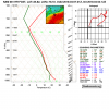
Yikes, if the 12km NAM even came anywhere close to verifying certainly could get very interesting Saturday afternoon/evening in central NC. If the surface low tracks over or to the north of the region, there's definitely a legitimate severe threat particularly from wind damage and isolated tornadoes. It is the LR NAM of course so buyer beware, but synoptically it's not all that different from the Euro & GFS suites.
nam_12_081_78806484_skewt_weathernerds.png
 
Last edited:
I was bored the other day & decided to play around w/ data from the Tornado history project and looked at all tornadoes in NC since 1950. There's an intriguing bi-modal distribution to our tornado climatology w/ a peak in Apr-May near the tail end of the cold season and a secondary peak in early-mid September corresponding to the peak of the hurricane season and when we often begin to see fall cold fronts penetrate into the deep south. (Note the tornadoes per day doesn't represent the average number per year, but the averaged sum from all years since the mid 20th century).
NC Tornado Climatology (1950-2017).jpg
 
Bummer this weekends wave tracks to far north but even so Saturday could be a wild day as Webber pointed out. The 18z GFS temperature drop on Saturday afternoon is crazy.

GFS 50-STATES USA Mid Atlantic 2-m Temperature 69.png GFS 50-STATES USA Mid Atlantic 2-m Temperature 72.png
 
The 18z run had more prefrontal convection that quelled the cross-frontal temperature change but the 12z had absolutely absurd 3-hourly changes in the Triangle and areas just to the SE. Goldsboro for example dropped 43F in 3 hours...

nam_2018-04-04-12Z_081_37.879_274.373_32.866_285.092_Temperature_Surface_highways_cities.png
nam_2018-04-04-12Z_084_37.879_274.373_32.866_285.092_Temperature_Surface_highways_cities.png
 
Per the 12Z model consensus, a wx related delay is likely for at least a short time Saturday afternoon in the 3rd round of the Masters. However, the 4th round looks great with dry and much cooler than normal.
How bout that par 3 today. 3 oldtimers playing, 1 winning it out right. But the highlight of the day was the Golden Bears grandson still in HS, caddying for grandpa and getting to hit the tee shot on #9 and Aced it.
 
I just moved to Charlotte from Birmingham.. I've been here for a week and two storm systems have totally dissipated before they got to the Charlotte area and they were very robust for Birmingham and Atlanta.. is it normal for storm systems to shrink by the time they get to North Carolina? Just curious..
 
I just moved to Charlotte from Birmingham.. I've been here for a week and two storm systems have totally dissipated before they got to the Charlotte area and they were very robust for Birmingham and Atlanta.. is it normal for storm systems to shrink by the time they get to North Carolina? Just curious..
Yes, it is. Normally, we don't get the instability that areas farther south and west get. A lot of times we are spared by a wedge of cold air trapped east of the mountains. Don't worry, things will get more interesting for us a little later in the month and on into May.
 
I just moved to Charlotte from Birmingham.. I've been here for a week and two storm systems have totally dissipated before they got to the Charlotte area and they were very robust for Birmingham and Atlanta.. is it normal for storm systems to shrink by the time they get to North Carolina? Just curious..

What did you expect? If AL is the heart of dixie, that makes NC like Arkansas, the armpit.
 
Temps better fall in a hurry the next 6 hours if theres going to be a freeze in many of the areas under a Freeze Warning. At 1am, Rome is at 45, Cartersville 44, and Dalton 43.
 
You're not supposed to get elevated mixed layers like this outside of traditional tornado alley in the Great Plains. Pretty crazy to see one being advected in over NC on Saturday on the 3km NAM
Unknown.png
 
Back
Top