Webberweather53
Meteorologist
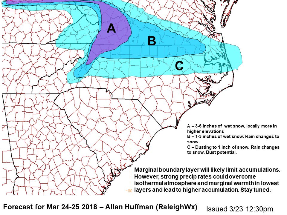
Pretty much just echoes what I said above. Even if some of the NWP models look meh I’d be on stand by along the HWY 64 and I-40/85 corridors, have to really like your chances for some wet snow NW of the Triad atm however.


.png")
.png")


