• Hello, please take a minute to check out our awesome content, contributed by the wonderful members of our community. We hope you'll add your own thoughts and opinions by making a free account!

Tropical Major Hurricane Isaias

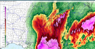
Will be a nice test of the REFS. It isn't too different from the current HREF so I imagine it'll perform fairly well
 
There's a user on a Roblox Wx Discord server who is stationed at Elgin Air Force Base and he was notified to be prepared for a high-end C3/low-end C4 landfall.
Are you saying that Roblox, that online game one of my granddaughters is addicted to, has its own weather server? That would give me more incentive to play the next time she begs me to play with her.
 
Are you saying that Roblox, that online game my granddaughter is addicted to, has its own weather server? That would give me more incentive to play the next time she begs me to play with her.
There are weather games on Roblox. The 3 biggest games are TornadoX, Helicity and Twisted
 
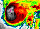
Shear definitely beginning to hit the structure now. You can see the higher, colder cloud tops beginning to be pushed NW over the center.
 
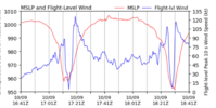
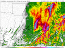
Does anyone have an updated max wind gust map for Alabama? James Spann showed one this morning but I was curious if a new one was out yet.
 
This one's for me, hah (and dad):


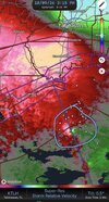
Definite half a cane type look with the speed now, but it doesn't mean that it can't pack a punch and cause problems elsewhere, like flooding.
 
SUMMARY OF 400 PM CDT...2100 UTC...INFORMATION
----------------------------------------------
LOCATION...29.2N 87.0W
ABOUT 90 MI...145 KM S OF PENSACOLA FLORIDA
ABOUT 125 MI...195 KM SSE OF MOBILE ALABAMA
MAXIMUM SUSTAINED WINDS...115 MPH...185 KM/H
PRESENT MOVEMENT...N OR 10 DEGREES AT 17 MPH...28 KM/H
MINIMUM CENTRAL PRESSURE...959 MB...28.32 INCHES
 
Deep-layer shear from the southwest has increased to 30-40 kt, and
the hurricane's structure is responding accordingly. WSR-88D radar
data shows that the structure is becoming increasingly asymmetric,
with very intense convection mainly confined to the northern
eyewall. Tail Doppler radar data from the NOAA P-3 has also shown
that the circulation is becoming tilted with height. That said,
some impressive winds were measured at flight-level--136 kt by the
Air Force Reserve at 10,000 feet and 126 kt by NOAA at 8,000 ft.
While these winds themselves would normally support a higher
intensity, several dropsondes released in the eyewall showed that
there is a sharp drop-off of winds at the ocean surface, with
layer-averaging suggesting a surface intensity of 90-95 kt. In
addition, recent Doppler radar data from Mobile show winds of
100-110 kt at about 10,000 feet in the northern eyewall. Combining
all this data together, the maximum surface winds appear to be
around 100 kt, although it's very likely that Isaias will be a
gustier-than-normal hurricane when it makes landfall.

Isaias has turned northward and is accelerating with a current
motion of 010/15 kt. The track guidance has honed in on a landfall
over the western Florida Panhandle near the Pensacola area sometime
this evening. A northward motion is expected to continue through
Saturday, bringing Isaias's center through Alabama, followed by a
northeastward trajectory across the Tennessee and the central
Appalachians on Sunday. The circulation is expected to dissipate by
hour 60.

The high-resolution hurricane regional models (HAFS-A, HAFS-B, and
HWRF), as well as the statistical-dynamical models (SHIPS and LGEM)
indicate that Isaias is likely to be at or near major hurricane
strength at landfall this evening. After landfall, fast weakening
is expected, with some caveats. As mentioned previously, Isaias is
likely to be a gusty hurricane, and its fast motion could bring
strong hurricane-force gusts well inland. Simulated satellite
imagery from global model guidance indicates that Isaias is likely
to transition to a post-tropical cyclone over Alabama by Saturday
afternoon, although it could still be producing
tropical-storm-force gusts, especially in areas of higher terrain.


Key Messages:

1. A life-threatening storm surge is expected from the Mouth of the
Mississippi River to Suwannee, Florida. Residents under evacuation
orders should leave immediately and follow advice from local
officials.

2. Extremely dangerous and damaging hurricane force-winds are
expected over portions of the Florida Panhandle, southern Alabama,
and southern Mississippi where a Hurricane Warning is in effect.
Residents in these areas should have a safe room to ride out the
storm and prepare for long-duration power outages.

3. Damaging wind gusts are likely over a large portion of the
southeastern United States from western and northern Georgia and the
southern Appalachians, westward over much of central and northern
Alabama, southern middle Tennessee, and Mississippi, especially in
areas of higher terrain. Residents should secure loose outdoor
items, avoid driving high-profile vehicles, prepare for power
outages, and be aware of the potential for falling trees.

4. Isaias will bring areas of heavy rainfall to the central U.S.
Gulf coast and much of the Southeast through the weekend.
Considerable flash and urban flooding, along with significant river
flooding, will be possible. Landslides are also possible across the
Southern Appalachians.

5. The tornado potential will continue through tonight. The greatest
risk will be east of the center, particularly across the Florida
Panhandle into southern Georgia. This risk will continue spreading
north-northeast across parts of the Southeast on Saturday.
 
User on the Roblox WX server still says the base is preparing for 140 MPH winds from the storm.
 
Back
Top