• Hello, please take a minute to check out our awesome content, contributed by the wonderful members of our community. We hope you'll add your own thoughts and opinions by making a free account!

Tropical 92L

Yeah I get you on that, but it's still going to be getting hit hard unless it's going almost due east, which seems unlikely. I wouldn't say a cat 1 is out of the question, maybe a 2 if everything was perfect, but it still looks like too much shear to me to get a big dog.

Really don't see that much shear over the system at all, at least looking at the GFS.
 
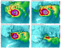
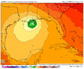
GFS not as crazy this run. Strong TS landfall near New Orleans
Slower moving storm= blasted by shear by the time it hooks to the north late Saturday. Makes landfall Sunday.
Faster moving storm= movies in tandem with the trough and jet helps ventilate (therefore helps it intensify). Already makes landfall by Saturday.
 
0Z UKMET: landfall ~175 miles W of 12Z run with it near far SE LA and then MS. Strongest run yet with high end TS/990 mb:

NEW TROPICAL CYCLONE FORECAST TO DEVELOP AFTER 54 HOURS
FORECAST POSITION AT T+ 54 : 22.2N 92.1W

LEAD CENTRAL MAXIMUM WIND
VERIFYING TIME TIME POSITION PRESSURE (MB) SPEED (KNOTS)
-------------- ---- -------- ------------- -------------
1200UTC 08.10.2026 60 22.7N 91.7W 1003 30
0000UTC 09.10.2026 72 22.9N 89.9W 1001 30
1200UTC 09.10.2026 84 25.4N 88.6W 999 39
0000UTC 10.10.2026 96 26.4N 88.5W 997 48
1200UTC 10.10.2026 108 29.2N 88.7W 990 58
0000UTC 11.10.2026 120 32.1N 89.5W 992 29
1200UTC 11.10.2026 132 33.8N 88.8W 1002 25
0000UTC 12.10.2026 144 38.4N 83.2W 1003 12
1200UTC 12.10.2026 156 CEASED TRACKING
 
0Z UKMET: landfall ~175 miles W of 12Z run with it near far SE LA and then MS. Strongest run yet with high end TS/990 mb:

NEW TROPICAL CYCLONE FORECAST TO DEVELOP AFTER 54 HOURS
FORECAST POSITION AT T+ 54 : 22.2N 92.1W

LEAD CENTRAL MAXIMUM WIND
VERIFYING TIME TIME POSITION PRESSURE (MB) SPEED (KNOTS)
-------------- ---- -------- ------------- -------------
1200UTC 08.10.2026 60 22.7N 91.7W 1003 30
0000UTC 09.10.2026 72 22.9N 89.9W 1001 30
1200UTC 09.10.2026 84 25.4N 88.6W 999 39
0000UTC 10.10.2026 96 26.4N 88.5W 997 48
1200UTC 10.10.2026 108 29.2N 88.7W 990 58
0000UTC 11.10.2026 120 32.1N 89.5W 992 29
1200UTC 11.10.2026 132 33.8N 88.8W 1002 25
0000UTC 12.10.2026 144 38.4N 83.2W 1003 12
1200UTC 12.10.2026 156 CEASED TRACKING
Wow!! UK has been very consistent so far.
 
0Z UKMET: landfall ~175 miles W of 12Z run with it near far SE LA and then MS. Strongest run yet with high end TS/990 mb:

NEW TROPICAL CYCLONE FORECAST TO DEVELOP AFTER 54 HOURS
FORECAST POSITION AT T+ 54 : 22.2N 92.1W

LEAD CENTRAL MAXIMUM WIND
VERIFYING TIME TIME POSITION PRESSURE (MB) SPEED (KNOTS)
-------------- ---- -------- ------------- -------------
1200UTC 08.10.2026 60 22.7N 91.7W 1003 30
0000UTC 09.10.2026 72 22.9N 89.9W 1001 30
1200UTC 09.10.2026 84 25.4N 88.6W 999 39
0000UTC 10.10.2026 96 26.4N 88.5W 997 48
1200UTC 10.10.2026 108 29.2N 88.7W 990 58
0000UTC 11.10.2026 120 32.1N 89.5W 992 29
1200UTC 11.10.2026 132 33.8N 88.8W 1002 25
0000UTC 12.10.2026 144 38.4N 83.2W 1003 12
1200UTC 12.10.2026 156 CEASED TRACKING
1791261935895.png
 
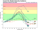
traditional models haven't been very good at all lately. google's ai model seems to sniff this one out; but i don't buy ANYTHING from the normal globals at this point. recon will help a lot i hope
 
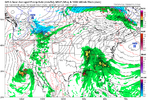
The timing differences are really something. GFS wants to bury it down by the Yucatan on Friday at the same time some of the AI ensemble members are getting ready for landfall on the Gulf Coast. It's never easy haha
 
The timing differences are really something. GFS wants to bury it down by the Yucatan on Friday at the same time some of the AI ensemble members are getting ready for landfall on the Gulf Coast. It's never easy haha
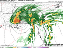
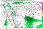
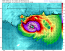
GFS weaker and further west. 1791303000369.png
 
I wonder if the GA/AL game in Tuscaloosa on Sat night (6:30PM CDT start) will be heavily impacted by the Gulf tropical cyclone forecasted to form soon. Any guesses?
 
I wonder if the GA/AL game in Tuscaloosa on Sat night (6:30PM CDT start) will be heavily impacted by the Gulf tropical cyclone forecasted to form soon. Any guesses?
Lots of handwringing about that on my UGA board. The variability in timing in the models makes it hard to know what to expect. Which of course is the nature of tropical systems
 
I wonder if the GA/AL game in Tuscaloosa on Sat night (6:30PM CDT start) will be heavily impacted by the Gulf tropical cyclone forecasted to form soon. Any guesses?
I'd tend to say yes. Although there is a rather large disagreement among models. AI GFS would certainly be a problem.
1791305212432.png
 
12Z UKMET is strongest run yet with a H (65 knots/983 mb) hitting Biloxi followed by a move N into MS:

NEW TROPICAL CYCLONE FORECAST TO DEVELOP AFTER 24 HOURS
FORECAST POSITION AT T+ 24 : 21.6N 93.7W

LEAD CENTRAL MAXIMUM WIND
VERIFYING TIME TIME POSITION PRESSURE (MB) SPEED (KNOTS)
-------------- ---- -------- ------------- -------------
1200UTC 07.10.2026 24 21.6N 93.7W 1005 29
0000UTC 08.10.2026 36 22.0N 93.2W 1003 28
1200UTC 08.10.2026 48 22.6N 92.4W 1000 35
0000UTC 09.10.2026 60 22.7N 90.9W 999 31
1200UTC 09.10.2026 72 24.6N 89.6W 995 41
0000UTC 10.10.2026 84 26.4N 89.2W 992 45
1200UTC 10.10.2026 96 29.2N 88.7W 983 65
0000UTC 11.10.2026 108 32.3N 90.0W 994 26
1200UTC 11.10.2026 120 33.4N 90.4W 1003 27
0000UTC 12.10.2026 132 CEASED TRACKING
 
Lots of handwringing about that on my UGA board. The variability in timing in the models makes it hard to know what to expect. Which of course is the nature of tropical systems

I wish they'd have a contingency plan ex. Atlanta. Falcons play at home the next day but, not until 8:20
 
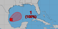
Up to 100%. Maybe a PTC coming at 5pm?

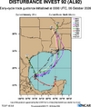
Tropical Weather Outlook
NWS National Hurricane Center Miami FL
200 PM EDT Tue Oct 6 2026

For the North Atlantic...Caribbean Sea and the Gulf of America:

1. Southwestern Gulf of America (AL92):
Satellite images and surface observations indicate that showers and
thunderstorms are becoming better organized while surface pressures
are gradually falling. If these trends continue, advisories will
likely be issued on this system later today or tonight while it
moves slowly eastward. The low pressure area could bring gusty winds
and areas of heavy rain to the western portions of the Yucatan
Peninsula of Mexico in a couple of days.

The disturbance is expected to turn to the north or northeast toward
the northern Gulf Coast by the end of the week. It is still too
early to determine specific impacts to the northern Gulf Coast, but
interests from the Florida Panhandle to Louisiana should closely
monitor the progress of this system. The NOAA Gulfstream jet is en
route to sample the environment over the Gulf this afternoon and Air
Force and NOAA reconnaissance aircraft are scheduled to investigate
the system tomorrow.
* Formation chance through 48 hours...high...near 100 percent.
* Formation chance through 7 days...high...near 100 percent.

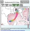
1791308454236.png
 
I wonder if the GA/AL game in Tuscaloosa on Sat night (6:30PM CDT start) will be heavily impacted by the Gulf tropical cyclone forecasted to form soon. Any guesses?
A lot depends on if you are throwing and running with the wind or against it. Unless you have the BR's in which case it's steam roll ahead no matter what the wind is doing. The Falcon's have been making the crowds boo their own teams at home. And it's great outside, cool with a nice breeze. Loving the weather right now.

Edit: And Carolina made the Falcon's fans boo the Falcons at home, so things in the NFC south are heating up. Can't wait for a few division games to take place to see how things shake out. Meanwhile it's 74 with occasional gusts. Prefect prelude for a storm.
 
Last edited:
Back
Top